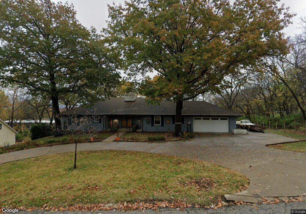
1515 Westwood Dr Leavenworth, KS 66048
Estimated Value: $269,000 - $367,000
3
Beds
2
Baths
1,956
Sq Ft
$153/Sq Ft
Est. Value
About This Home
This home is located at 1515 Westwood Dr, Leavenworth, KS 66048 and is currently estimated at $298,762, approximately $152 per square foot. 1515 Westwood Dr is a home located in Leavenworth County with nearby schools including Henry Leavenworth, Richard Warren Middle School, and Leavenworth Senior High School.
Ownership History
Date
Name
Owned For
Owner Type
Purchase Details
Closed on
Jul 11, 2019
Sold by
Mcleod Barry L and Mcleod Vera L
Bought by
Mcleod Family Living Trust
Current Estimated Value
Purchase Details
Closed on
Aug 1, 1998
Bought by
Mcleod Barry L and Mcleod Vera L
Create a Home Valuation Report for This Property
The Home Valuation Report is an in-depth analysis detailing your home's value as well as a comparison with similar homes in the area
Home Values in the Area
Average Home Value in this Area
Purchase History
| Date | Buyer | Sale Price | Title Company |
|---|---|---|---|
| Mcleod Family Living Trust | -- | None Listed On Document | |
| Mcleod Barry L | $100,000 | -- |
Source: Public Records
Tax History Compared to Growth
Tax History
| Year | Tax Paid | Tax Assessment Tax Assessment Total Assessment is a certain percentage of the fair market value that is determined by local assessors to be the total taxable value of land and additions on the property. | Land | Improvement |
|---|---|---|---|---|
| 2025 | $2,814 | $24,828 | $3,905 | $20,923 |
| 2024 | $2,807 | $24,105 | $3,905 | $20,200 |
| 2023 | $2,807 | $23,402 | $3,905 | $19,497 |
| 2022 | $2,607 | $21,591 | $4,303 | $17,288 |
| 2021 | $2,404 | $18,676 | $4,303 | $14,373 |
| 2020 | $2,356 | $18,170 | $4,303 | $13,867 |
| 2019 | $2,279 | $17,412 | $4,303 | $13,109 |
| 2018 | $2,296 | $17,412 | $4,303 | $13,109 |
| 2017 | $2,279 | $17,412 | $4,303 | $13,109 |
| 2016 | $2,283 | $17,412 | $4,303 | $13,109 |
| 2015 | $2,333 | $17,888 | $4,303 | $13,585 |
| 2014 | $2,323 | $17,888 | $4,303 | $13,585 |
Source: Public Records
Map
Nearby Homes
- 1929 Westwood Dr
- 1715 Klemp St
- 1106 S 14th St
- 1208 Quincy St
- 1605 Ridge Rd
- 1305 Klemp St
- 1116 Quincy St
- 914 Madison St
- 938 S 17th St
- 1509 10th Ave
- 1515 Kenton St
- 1700 Lawrence Ave
- 1158 Randolph St
- 1340 Spruce St
- 1917 Canterbury Ct
- 1166 Kenton St
- 1213 Spruce St
- 1320 Spruce St
- 905 S 17th St
- 1305 Lawrence Ave
- 1511 Westwood Dr
- 1331 Stonleigh Ct
- 1331 Stonleigh Ct
- 1331 Stonleigh Ct
- 1331 Stonleigh Ct
- 1512 Westwood Dr
- 1507 Westwood Dr
- 1602 Westwood Dr
- 1605 Forest Ln
- 1508 Westwood Dr
- 1605 Westwood Dr
- 1503 Westwood Dr
- 1606 Westwood Dr
- 1504 Westwood Dr
- 1702 Forest Ln
- Lots 3-7 Forest Ln
- 1700 Westwood Dr
- 1420 Ohio St
- 1424 Ohio St
- 1432 Ohio St