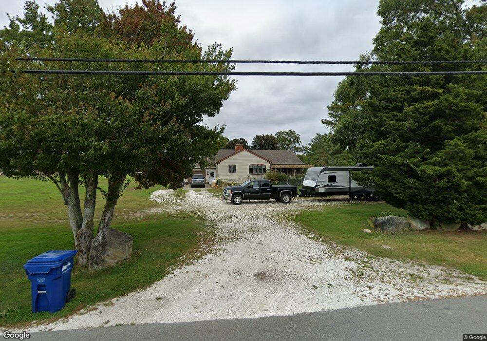
152 Acushnet Rd Mattapoisett, MA 02739
Estimated Value: $554,000 - $614,000
2
Beds
3
Baths
1,320
Sq Ft
$445/Sq Ft
Est. Value
About This Home
This home is located at 152 Acushnet Rd, Mattapoisett, MA 02739 and is currently estimated at $586,754, approximately $444 per square foot. 152 Acushnet Rd is a home located in Plymouth County with nearby schools including Center School, Old Hammondtown Elementary, and Old Rochester Regional High School.
Ownership History
Date
Name
Owned For
Owner Type
Purchase Details
Closed on
Jan 7, 2025
Sold by
Bachand Lee A
Bought by
Lee A Bachand T A and Lee Bachand
Current Estimated Value
Purchase Details
Closed on
Nov 2, 2023
Sold by
Randall & Bachand Rlty Nt and Randall
Bought by
Bachand Lee
Purchase Details
Closed on
Sep 14, 2015
Sold by
Randall Leonard A
Bought by
Randall & Bachand Rt and Randall
Create a Home Valuation Report for This Property
The Home Valuation Report is an in-depth analysis detailing your home's value as well as a comparison with similar homes in the area
Home Values in the Area
Average Home Value in this Area
Purchase History
| Date | Buyer | Sale Price | Title Company |
|---|---|---|---|
| Lee A Bachand T A | -- | None Available | |
| Lee A Bachand T A | -- | None Available | |
| Bachand Lee | -- | None Available | |
| Bachand Lee | -- | None Available | |
| Randall & Bachand Rt | $100,000 | -- | |
| Randall & Bachand Rt | $100,000 | -- |
Source: Public Records
Tax History Compared to Growth
Tax History
| Year | Tax Paid | Tax Assessment Tax Assessment Total Assessment is a certain percentage of the fair market value that is determined by local assessors to be the total taxable value of land and additions on the property. | Land | Improvement |
|---|---|---|---|---|
| 2025 | $5,012 | $465,800 | $190,000 | $275,800 |
| 2024 | $4,913 | $467,500 | $190,000 | $277,500 |
| 2023 | $5,003 | $444,700 | $186,600 | $258,100 |
| 2022 | $4,904 | $395,500 | $157,100 | $238,400 |
| 2021 | $4,701 | $362,700 | $157,100 | $205,600 |
| 2020 | $4,336 | $321,400 | $150,200 | $171,200 |
| 2019 | $4,078 | $308,700 | $142,200 | $166,500 |
| 2018 | $4,146 | $318,400 | $151,100 | $167,300 |
| 2017 | $4,036 | $308,800 | $151,100 | $157,700 |
| 2016 | $3,804 | $288,200 | $136,900 | $151,300 |
| 2015 | $3,518 | $270,600 | $136,900 | $133,700 |
| 2014 | $3,479 | $273,500 | $136,900 | $136,600 |
Source: Public Records
Map
Nearby Homes
- 0 Long Plain Rd
- 225 Mattapoisett Rd
- 8 Abby Ln
- 7 Laura Ln
- 312 New Boston Rd
- 13 Park Place
- 83 Fairhaven Rd
- 47 Fairhaven Rd
- 3 Brandt Island Rd
- 9 Hitching Post Rd
- 421 Huttleston Ave
- 20 Forestview Dr
- 224 North St
- 35 North St
- 7 Pearl St
- 19 High Ridge Dr
- 8 Captains Ln
- 293 Mendall Rd
- 2 Golf Cottage Way
- 4 Golf Cottage Way
- 148 Acushnet Rd
- 155 Acushnet Rd
- 154 Acushnet Rd
- 146 Acushnet Rd
- 157 Acushnet Rd
- 160 Acushnet Rd
- 159 Acushnet Rd
- 156 Acushnet Rd
- 4 Richard Iii Ln
- 161 Acushnet Rd
- 162 Acushnet Rd
- 163 Acushnet Rd
- 164 Acushnet Rd
- 165 Acushnet Rd
- 169 Acushnet Rd
- 15 Hereford Hill Rd
- 174 Acushnet Rd
- 10 Hereford Hill Rd
- 8 Stoney Hill Rd
- 6 Stoney Hill Rd