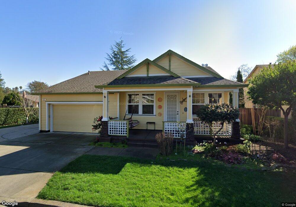
152 Dawson Creek Ln Santa Rosa, CA 95407
Estimated Value: $655,000 - $690,000
3
Beds
2
Baths
1,664
Sq Ft
$403/Sq Ft
Est. Value
About This Home
This home is located at 152 Dawson Creek Ln, Santa Rosa, CA 95407 and is currently estimated at $670,468, approximately $402 per square foot. 152 Dawson Creek Ln is a home located in Sonoma County with nearby schools including Elsie Allen High School, Kid Street Charter School, and St. Michael's Orthodox School.
Ownership History
Date
Name
Owned For
Owner Type
Purchase Details
Closed on
Aug 7, 2020
Sold by
Burns Paul O and Burns Timothy W
Bought by
Burns Paul O and Burns Timothy W
Current Estimated Value
Home Financials for this Owner
Home Financials are based on the most recent Mortgage that was taken out on this home.
Original Mortgage
$349,800
Outstanding Balance
$248,379
Interest Rate
3%
Mortgage Type
New Conventional
Estimated Equity
$422,089
Purchase Details
Closed on
Apr 20, 2018
Sold by
Burns Timothy W
Bought by
Burns Timothy W and The Timothy W Burns Living Tru
Purchase Details
Closed on
Dec 17, 2002
Sold by
Westbrooke Llc
Bought by
Bummer Paul O and Burns Timothy W
Home Financials for this Owner
Home Financials are based on the most recent Mortgage that was taken out on this home.
Original Mortgage
$295,000
Interest Rate
7.37%
Create a Home Valuation Report for This Property
The Home Valuation Report is an in-depth analysis detailing your home's value as well as a comparison with similar homes in the area
Home Values in the Area
Average Home Value in this Area
Purchase History
| Date | Buyer | Sale Price | Title Company |
|---|---|---|---|
| Burns Paul O | -- | Title365 | |
| Burns Paul O | -- | Wfg National Title Insurance | |
| Burns Timothy W | -- | None Available | |
| Burns Paul O | -- | None Available | |
| Bummer Paul O | -- | North American Title Co |
Source: Public Records
Mortgage History
| Date | Status | Borrower | Loan Amount |
|---|---|---|---|
| Open | Burns Paul O | $349,800 | |
| Previous Owner | Bummer Paul O | $295,000 | |
| Closed | Bummer Paul O | $73,750 |
Source: Public Records
Tax History Compared to Growth
Tax History
| Year | Tax Paid | Tax Assessment Tax Assessment Total Assessment is a certain percentage of the fair market value that is determined by local assessors to be the total taxable value of land and additions on the property. | Land | Improvement |
|---|---|---|---|---|
| 2025 | $6,882 | $533,995 | $181,033 | $352,962 |
| 2024 | $6,882 | $523,526 | $177,484 | $346,042 |
| 2023 | $6,882 | $513,261 | $174,004 | $339,257 |
| 2022 | $6,469 | $503,198 | $170,593 | $332,605 |
| 2021 | $6,500 | $493,333 | $167,249 | $326,084 |
| 2020 | $6,483 | $488,276 | $165,535 | $322,741 |
| 2019 | $6,317 | $478,703 | $162,290 | $316,413 |
| 2018 | $6,224 | $469,317 | $159,108 | $310,209 |
| 2017 | $6,070 | $460,116 | $155,989 | $304,127 |
| 2016 | $6,000 | $451,095 | $152,931 | $298,164 |
| 2015 | $5,810 | $444,320 | $150,634 | $293,686 |
| 2014 | $4,898 | $374,000 | $127,000 | $247,000 |
Source: Public Records
Map
Nearby Homes
- 1447 Beachwood Dr
- 1245 Olive St
- 1630 Mathwig Dr
- 1911 Corby Ave
- 0 West Ave Unit 325019616
- 780 Dutton Ave
- 444 Pueblo Bonito Place
- 816 Boyd St Unit 4
- 151 Earle St
- 517 Boyd St
- 433 Blythewood Place
- 101 Colgan Ave Unit 25
- 101 Colgan Ave Unit 24
- 101 Colgan Ave Unit 2
- 2154 Corby Ave
- 1501 La Esplanada Place Unit 326
- 487 Hearn Ave
- 209 Decoe St
- 1215 Rutledge Ave
- 1260 Aloise Ave
- 156 Dawson Creek Ln
- 1365 Funston Dr
- 1339 Funston Dr
- 151 Dawson Creek Ln
- 164 Iron Horse Ln
- 1373 Funston Dr
- 165 Iron Horse Ln
- 139 Cherie Way
- 1366 Funston Dr
- 1378 Funston Dr
- 1350 Hogrefe Way
- 169 Iron Horse Ln
- 1348 Funston Dr
- 1364 Hogrefe Way
- 147 Cherie Way
- 1390 Funston Dr
- 1342 Funston Dr
- 130 Cherie Way
- 1400 Funston Dr