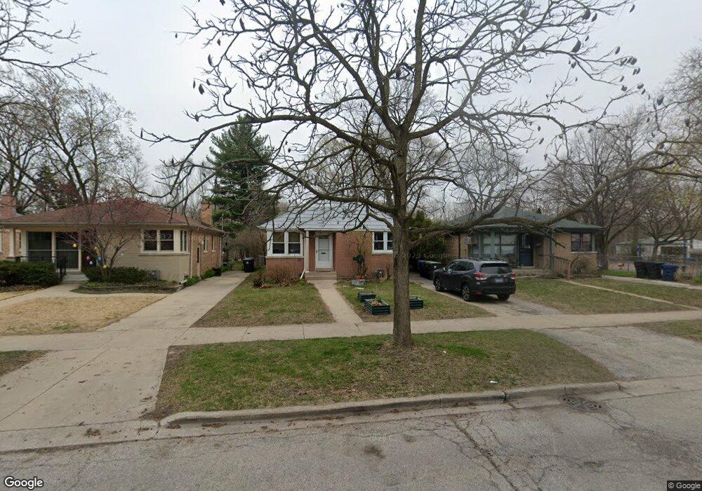
1522 Mulford St Evanston, IL 60202
Estimated Value: $339,000 - $456,000
2
Beds
1
Bath
968
Sq Ft
$412/Sq Ft
Est. Value
About This Home
This home is located at 1522 Mulford St, Evanston, IL 60202 and is currently estimated at $398,461, approximately $411 per square foot. 1522 Mulford St is a home located in Cook County with nearby schools including Dawes Elementary School, Chute Middle School, and Evanston Township High School.
Ownership History
Date
Name
Owned For
Owner Type
Purchase Details
Closed on
Aug 30, 2004
Sold by
Stubbs Larry
Bought by
Hovland Michael R and Kammerer Lisa A
Current Estimated Value
Home Financials for this Owner
Home Financials are based on the most recent Mortgage that was taken out on this home.
Original Mortgage
$258,400
Interest Rate
5.65%
Mortgage Type
Credit Line Revolving
Purchase Details
Closed on
Sep 20, 1994
Sold by
Thebaud Ygor C and Thebaud Christiane
Bought by
Stubbs Larry and Stubbs Cynthia Marlene
Home Financials for this Owner
Home Financials are based on the most recent Mortgage that was taken out on this home.
Original Mortgage
$138,037
Interest Rate
8.6%
Mortgage Type
FHA
Create a Home Valuation Report for This Property
The Home Valuation Report is an in-depth analysis detailing your home's value as well as a comparison with similar homes in the area
Home Values in the Area
Average Home Value in this Area
Purchase History
| Date | Buyer | Sale Price | Title Company |
|---|---|---|---|
| Hovland Michael R | $272,000 | Multiple | |
| Stubbs Larry | $140,500 | Republic Title Company |
Source: Public Records
Mortgage History
| Date | Status | Borrower | Loan Amount |
|---|---|---|---|
| Closed | Hovland Michael R | $258,400 | |
| Previous Owner | Stubbs Larry | $138,037 |
Source: Public Records
Tax History Compared to Growth
Tax History
| Year | Tax Paid | Tax Assessment Tax Assessment Total Assessment is a certain percentage of the fair market value that is determined by local assessors to be the total taxable value of land and additions on the property. | Land | Improvement |
|---|---|---|---|---|
| 2024 | $6,849 | $31,236 | $9,408 | $21,828 |
| 2023 | $6,545 | $31,236 | $9,408 | $21,828 |
| 2022 | $6,545 | $31,236 | $9,408 | $21,828 |
| 2021 | $6,714 | $28,293 | $4,998 | $23,295 |
| 2020 | $6,683 | $28,293 | $4,998 | $23,295 |
| 2019 | $6,681 | $31,578 | $4,998 | $26,580 |
| 2018 | $5,600 | $23,608 | $4,116 | $19,492 |
| 2017 | $5,469 | $23,608 | $4,116 | $19,492 |
| 2016 | $5,411 | $23,608 | $4,116 | $19,492 |
| 2015 | $5,678 | $23,502 | $4,851 | $18,651 |
| 2014 | $5,638 | $23,502 | $4,851 | $18,651 |
| 2013 | $5,492 | $23,502 | $4,851 | $18,651 |
Source: Public Records
Map
Nearby Homes
- 347 Florence Ave
- 419 Florence Ave
- 401 Dewey Ave
- 309 Darrow Ave
- 1406 Brummel St
- 1214 Hull Terrace
- 1217 Hull Terrace Unit 3A
- 325 Dodge Ave
- 1615 W Howard St Unit 303
- 1726 Dobson St
- 215 Brown Ave
- 1200 Dobson St
- 1810 South Blvd
- 2011 Brummel St
- 1408 Seward St
- 340 Ridge Ave Unit 1
- 7546 N Oakley Ave
- 235 Richmond St
- 400 Ridge Ave Unit 16-2
- 356 Ridge Ave Unit 6-2
- 1518 Mulford St
- 1514 Mulford St
- 1512 Mulford St Unit ID1306466P
- 1508 Mulford St
- 1600 Mulford St
- 1521 Mulford St
- 1527 Mulford St
- 1517 Mulford St
- 1506 Mulford St
- 1604 Mulford St
- 1608 Mulford St
- 1502 Mulford St
- 1511 Mulford St
- 311 Florence Ave
- 1617 Mulford St
- 300 Ashland Ave
- 1432 Mulford St
- 1610 Mulford St
- 302 Ashland Ave
- 315 Florence Ave