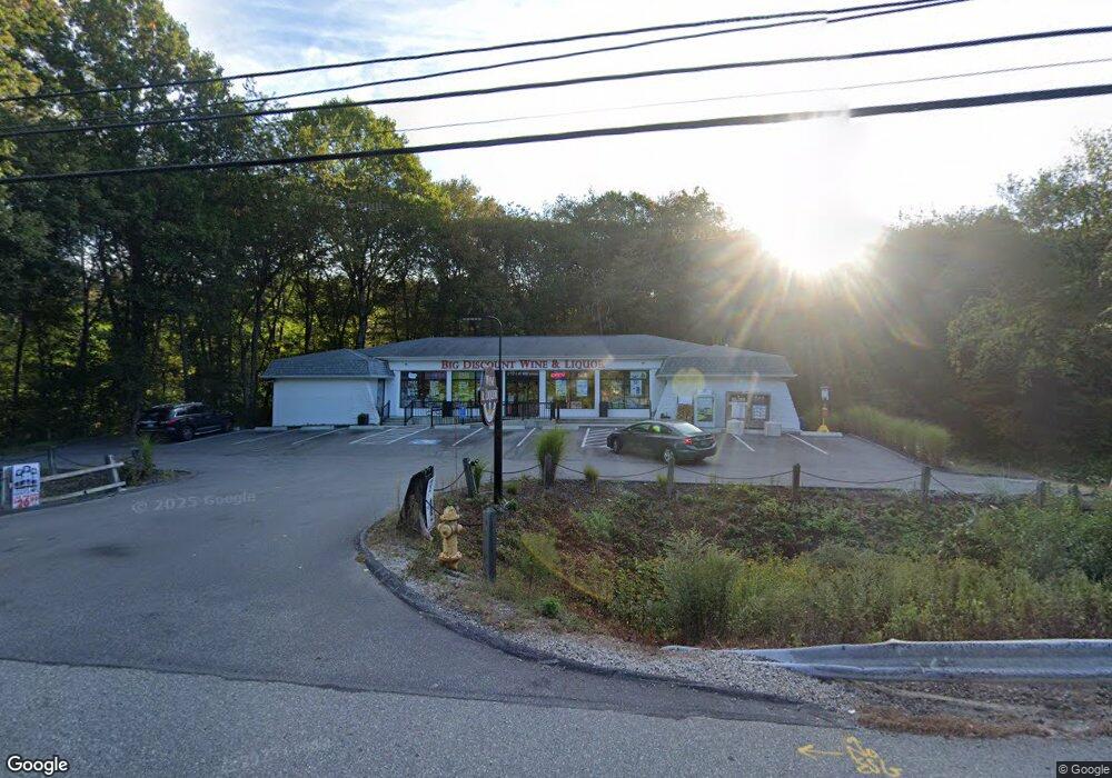
1524 Route 12 Gales Ferry, CT 06335
--
Bed
2
Baths
4,457
Sq Ft
0.7
Acres
About This Home
This home is located at 1524 Route 12, Gales Ferry, CT 06335. 1524 Route 12 is a home located in New London County with nearby schools including Ledyard Middle School, Ledyard High School, and Academy Of St Therese.
Ownership History
Date
Name
Owned For
Owner Type
Purchase Details
Closed on
Oct 8, 2020
Sold by
Morrill Jason R
Bought by
Shrestha Subash
Purchase Details
Closed on
Jan 14, 1998
Sold by
Morrill William E and Morrill Robert W
Bought by
Stone Cynthia H
Home Financials for this Owner
Home Financials are based on the most recent Mortgage that was taken out on this home.
Original Mortgage
$125,000
Interest Rate
7.08%
Mortgage Type
Commercial
Create a Home Valuation Report for This Property
The Home Valuation Report is an in-depth analysis detailing your home's value as well as a comparison with similar homes in the area
Home Values in the Area
Average Home Value in this Area
Purchase History
| Date | Buyer | Sale Price | Title Company |
|---|---|---|---|
| Shrestha Subash | $42,500 | None Available | |
| Shrestha Subash | $127,500 | None Available | |
| Stone Cynthia H | $125,000 | -- |
Source: Public Records
Mortgage History
| Date | Status | Borrower | Loan Amount |
|---|---|---|---|
| Previous Owner | Stone Cynthia H | $125,000 |
Source: Public Records
Tax History Compared to Growth
Tax History
| Year | Tax Paid | Tax Assessment Tax Assessment Total Assessment is a certain percentage of the fair market value that is determined by local assessors to be the total taxable value of land and additions on the property. | Land | Improvement |
|---|---|---|---|---|
| 2025 | $14,418 | $388,220 | $63,210 | $325,010 |
| 2024 | $13,669 | $388,220 | $63,210 | $325,010 |
| 2023 | $7,879 | $227,990 | $63,210 | $164,780 |
| 2022 | $7,711 | $227,990 | $63,210 | $164,780 |
| 2021 | $7,660 | $227,990 | $63,210 | $164,780 |
| 2020 | $9,860 | $281,960 | $92,750 | $189,210 |
| 2019 | $9,886 | $281,960 | $92,750 | $189,210 |
| 2018 | $9,668 | $281,960 | $92,750 | $189,210 |
| 2017 | $9,175 | $281,960 | $92,750 | $189,210 |
| 2016 | $8,995 | $281,960 | $92,750 | $189,210 |
| 2015 | $8,572 | $281,960 | $92,750 | $189,210 |
| 2014 | $8,431 | $281,960 | $92,750 | $189,210 |
Source: Public Records
Map
Nearby Homes
- 1513 Connecticut 12
- 17 Inchcliffe Dr
- 1010 Long Cove Rd
- 932 Long Cove Rd Unit TRLR 4
- 31 Richard Rd
- 14 Woodland Ln
- 1260 Connecticut 12
- 7 Harvard Rd
- 95 Murphys Dr Unit 95
- 47 Norman Dr
- 64 Scotch Cap Rd Unit 102
- 9 West Dr
- 16 Marty's Way
- 11 Marty's Way
- 25 Marty's Way
- 27 Marty's Way
- 205 Old Norwich Rd
- 18 Marty's Way
- 2 Garden Ct
- 176 Old Norwich Rd
- 1528 Route 12
- 1 Inchcliffe Dr
- 12 Inchcliffe Dr
- 1532 Route 12
- 1534 Route 12
- 1529 Route 12
- 1529 Connecticut 12
- 1529 Route 12 Unit 3
- 1533 Route 12
- 972 Long Cove Rd
- 1510 Route 12
- 1538 Connecticut 12 Unit A 3
- 1538 Connecticut 12 Unit A1
- 1510 Connecticut 12
- 1531 Route 12
- 990 Long Cove Rd
- 1538
- 14 Inchcliffe Dr
- 1538 Route 12 Unit C26
- 1538 Route 12 Unit C20