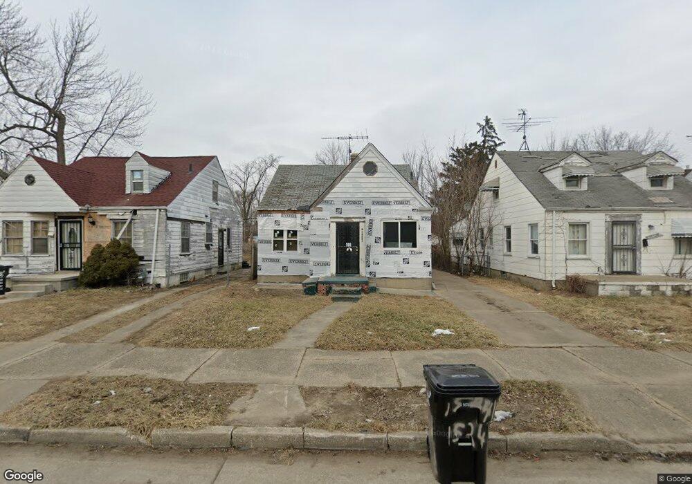
15241 Faircrest St Detroit, MI 48205
Maple Ridge NeighborhoodEstimated Value: $58,000 - $203,809
--
Bed
1
Bath
959
Sq Ft
$103/Sq Ft
Est. Value
About This Home
This home is located at 15241 Faircrest St, Detroit, MI 48205 and is currently estimated at $98,952, approximately $103 per square foot. 15241 Faircrest St is a home located in Wayne County with nearby schools including Edward 'Duke' Ellington Conservatory of Music and Art, Charles L. Spain Elementary-Middle School, and Denby High School.
Ownership History
Date
Name
Owned For
Owner Type
Purchase Details
Closed on
Sep 13, 2021
Sold by
Detroit Land Bank Authority
Bought by
Blackstone Realty & Holdings Llc
Current Estimated Value
Purchase Details
Closed on
Jan 12, 2017
Sold by
Sabree Eric R
Bought by
Detroit Land Bank Authority
Purchase Details
Closed on
Nov 18, 2011
Sold by
Wojtowicz Raymond J
Bought by
The Real Estate Place Llc
Purchase Details
Closed on
Jan 17, 2001
Sold by
Duke Bruce
Bought by
Wells Fargo Home Mtg Inc
Create a Home Valuation Report for This Property
The Home Valuation Report is an in-depth analysis detailing your home's value as well as a comparison with similar homes in the area
Home Values in the Area
Average Home Value in this Area
Purchase History
| Date | Buyer | Sale Price | Title Company |
|---|---|---|---|
| Blackstone Realty & Holdings Llc | $1,500 | None Available | |
| Detroit Land Bank Authority | -- | None Available | |
| The Real Estate Place Llc | $500 | None Available | |
| Wells Fargo Home Mtg Inc | $32,419 | -- |
Source: Public Records
Tax History Compared to Growth
Tax History
| Year | Tax Paid | Tax Assessment Tax Assessment Total Assessment is a certain percentage of the fair market value that is determined by local assessors to be the total taxable value of land and additions on the property. | Land | Improvement |
|---|---|---|---|---|
| 2025 | $1,462 | $22,700 | $0 | $0 |
| 2024 | $1,462 | $21,100 | $0 | $0 |
| 2023 | $1,420 | $17,100 | $0 | $0 |
| 2022 | $1,516 | $14,600 | $0 | $0 |
| 2021 | $2,757 | $0 | $0 | $0 |
| 2020 | $1,100 | $0 | $0 | $0 |
| 2019 | $1,100 | $0 | $0 | $0 |
| 2018 | $0 | $7,200 | $0 | $0 |
| 2017 | $138 | $7,300 | $0 | $0 |
| 2016 | $1,094 | $11,300 | $0 | $0 |
| 2015 | $1,130 | $11,300 | $0 | $0 |
| 2013 | $1,568 | $15,678 | $0 | $0 |
| 2010 | -- | $22,986 | $931 | $22,055 |
Source: Public Records
Map
Nearby Homes
- 15294 Saratoga St
- 15257 Faircrest St
- 15243 Fordham St
- 15480 Saratoga St
- 15227 Linnhurst St
- 18820 Morang Dr
- 18814 Morang Dr
- 15596 Eastwood St
- 15315 Park Grove St
- 15646 Saratoga St
- 14253 Fordham St
- 15666 Eastwood St
- 15649 E 7 Mile Rd
- 15309 Mapleridge St
- 14916 Maddelein St
- 15804 E 7 Mile Rd
- 15611 Mapleridge St
- 15430 Mapleridge St
- 15470 Mapleridge St
- 15816 E 7 Mile Rd
- 15249 Faircrest St
- 15237 Faircrest St
- 15265 Faircrest St
- 15242 Saratoga St
- 15234 Saratoga St
- 15250 Saratoga St
- 15228 Saratoga St
- 15273 Faircrest St
- 15256 Saratoga St
- 15250 Faircrest St
- 15244 Faircrest St
- 15260 Faircrest St
- 15232 Faircrest St
- 15264 Saratoga St
- 18726 Hayes St
- 15226 Faircrest St
- 18700 Hayes St
- 15281 Faircrest St
- 15270 Faircrest St
- 15272 Saratoga St