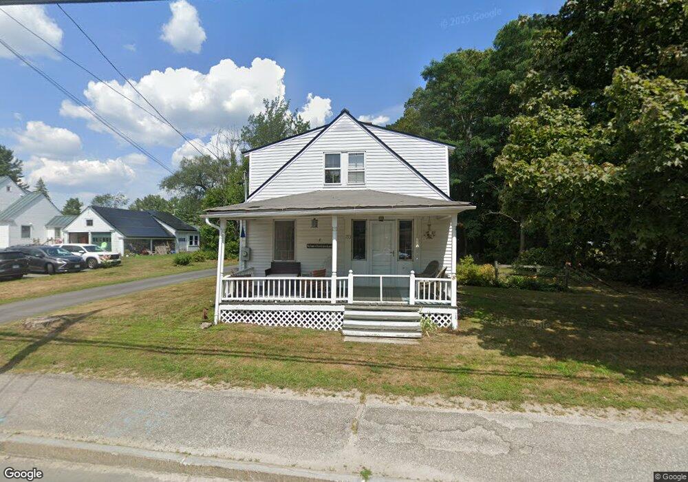
153 Main St New London, NH 03257
Estimated Value: $416,398 - $688,000
4
Beds
1
Bath
1,534
Sq Ft
$357/Sq Ft
Est. Value
About This Home
This home is located at 153 Main St, New London, NH 03257 and is currently estimated at $547,350, approximately $356 per square foot. 153 Main St is a home located in Merrimack County with nearby schools including Kearsarge Elementary School - New London, Kearsarge Regional Middle School, and Kearsarge Regional High School.
Ownership History
Date
Name
Owned For
Owner Type
Purchase Details
Closed on
Dec 2, 2011
Sold by
Henderson David and Henderson Mary F
Bought by
Landry Theodore and Kelly Paula
Current Estimated Value
Home Financials for this Owner
Home Financials are based on the most recent Mortgage that was taken out on this home.
Original Mortgage
$201,435
Outstanding Balance
$138,389
Interest Rate
4.1%
Mortgage Type
Purchase Money Mortgage
Estimated Equity
$408,961
Create a Home Valuation Report for This Property
The Home Valuation Report is an in-depth analysis detailing your home's value as well as a comparison with similar homes in the area
Home Values in the Area
Average Home Value in this Area
Purchase History
| Date | Buyer | Sale Price | Title Company |
|---|---|---|---|
| Landry Theodore | $7,300 | -- |
Source: Public Records
Mortgage History
| Date | Status | Borrower | Loan Amount |
|---|---|---|---|
| Open | Landry Theodore | $201,435 |
Source: Public Records
Tax History Compared to Growth
Tax History
| Year | Tax Paid | Tax Assessment Tax Assessment Total Assessment is a certain percentage of the fair market value that is determined by local assessors to be the total taxable value of land and additions on the property. | Land | Improvement |
|---|---|---|---|---|
| 2024 | $3,822 | $329,200 | $146,800 | $182,400 |
| 2023 | $3,559 | $329,200 | $146,800 | $182,400 |
| 2022 | $2,901 | $182,900 | $59,900 | $123,000 |
| 2021 | $2,815 | $182,900 | $59,900 | $123,000 |
| 2020 | $2,733 | $182,900 | $59,900 | $123,000 |
| 2019 | $2,632 | $178,900 | $59,900 | $119,000 |
| 2018 | $0 | $181,300 | $75,300 | $106,000 |
| 2017 | $0 | $181,300 | $75,300 | $106,000 |
| 2016 | $0 | $181,300 | $75,300 | $106,000 |
| 2015 | $2,801 | $181,300 | $75,300 | $106,000 |
| 2014 | $2,776 | $181,300 | $75,300 | $106,000 |
| 2013 | $2,759 | $183,300 | $75,300 | $108,000 |
Source: Public Records
Map
Nearby Homes
- 27 Pipers Glen
- 0 Newport Rd Unit 10
- 10 Highland Ridge Rd
- 71 Hilltop Place
- 385 Seamans Rd
- 195 Pine Hill Rd
- 106-23 Fieldstone Ln
- 712 Sugarhouse Rd
- 158 Quail Run
- 58 Kearsarge Rd
- 000 Farwell Ln Unit 17
- 273 Forest Acres Rd
- 295 Andover Rd
- 000 Shaker Rd Unit 288
- 0 Little Lake Sunapee Rd Unit 40 4989636
- 0 Summit Rd Unit 431
- 0 Fairway Ln Unit 8
- 617 & 619 Route 103a Map 91 Lot 37 38
- 26 Otterville Rd
- 155 Wilder Ln
- 151 Main St
- 6 Parkside Rd Unit 6
- 152 Main St
- 12 Parkside Rd
- 139 Main St
- 144 Main St
- 2 Parkside Rd Unit 2
- 38 Parkside Rd
- 42 Hillcrest Dr
- 188 Main St Unit . 4
- 188 Main St Unit . 1
- 131 Main St
- 132 Main St
- 24 Sawyer Ln
- 29 Parkside Rd
- 44 Parkside Rd
- 31 Sawyer Ln
- 119 Main St Unit 5
- 119 Main St Unit 4
- 119 Main St Unit 3