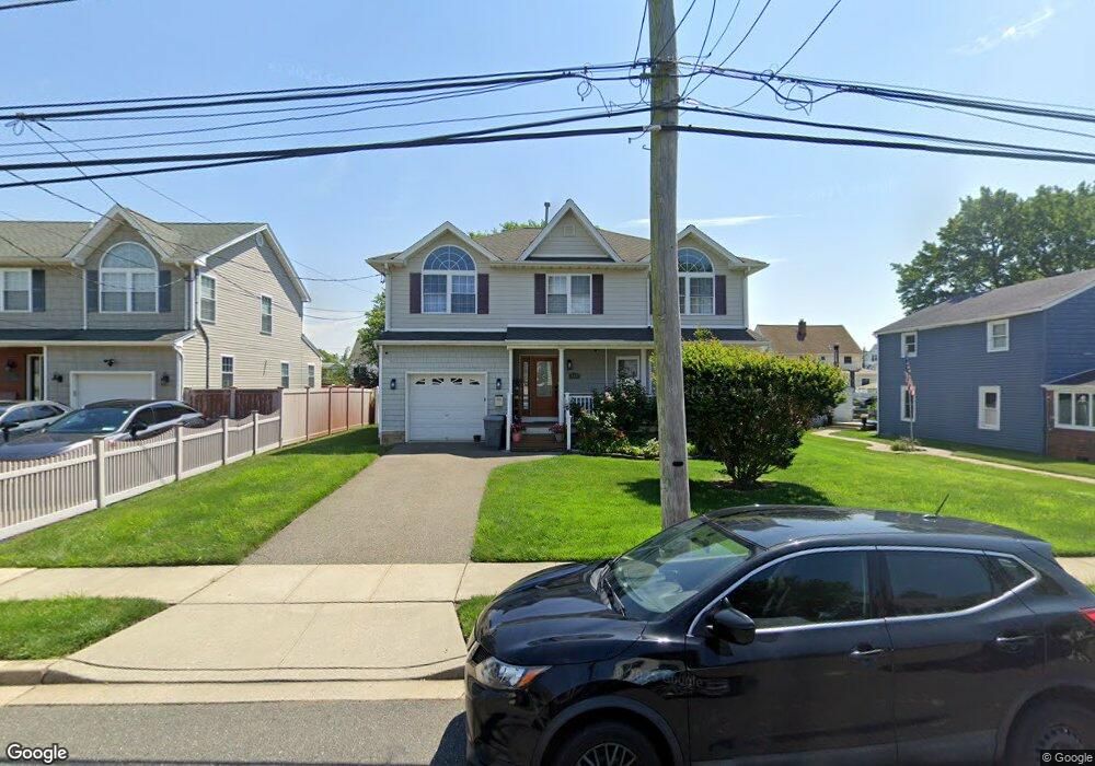
153 S Bay Ave Freeport, NY 11520
Estimated Value: $747,000 - $779,060
4
Beds
3
Baths
2,141
Sq Ft
$356/Sq Ft
Est. Value
About This Home
This home is located at 153 S Bay Ave, Freeport, NY 11520 and is currently estimated at $763,030, approximately $356 per square foot. 153 S Bay Ave is a home located in Nassau County with nearby schools including Columbus Avenue School, Caroline G. Atkinson Intermediate School, and John W Dodd Middle School.
Ownership History
Date
Name
Owned For
Owner Type
Purchase Details
Closed on
Oct 22, 2017
Sold by
Omeragic Alis and Omeragic Adis
Bought by
Omeragic Alis and Omeragic Adis
Current Estimated Value
Purchase Details
Closed on
Feb 10, 2017
Sold by
Omeragic Alis and Omeragic Adis
Bought by
Omeragic Alis and Omeragic Adis
Purchase Details
Closed on
May 7, 2014
Sold by
Omeragic Dzeva and Omeragic Suljejman
Bought by
Omeragic Adis and Omeragic Alis
Purchase Details
Closed on
Apr 18, 2008
Sold by
Trinca Dev Corp
Bought by
Omeiagie Dzeua and Omeiagie Suljejman
Create a Home Valuation Report for This Property
The Home Valuation Report is an in-depth analysis detailing your home's value as well as a comparison with similar homes in the area
Home Values in the Area
Average Home Value in this Area
Purchase History
| Date | Buyer | Sale Price | Title Company |
|---|---|---|---|
| Omeragic Alis | -- | -- | |
| Omeragic Alis | -- | None Available | |
| Omeragic Adis | -- | Island Abstract Inc | |
| Omeiagie Dzeua | $435,000 | Alexander Phillips |
Source: Public Records
Tax History Compared to Growth
Tax History
| Year | Tax Paid | Tax Assessment Tax Assessment Total Assessment is a certain percentage of the fair market value that is determined by local assessors to be the total taxable value of land and additions on the property. | Land | Improvement |
|---|---|---|---|---|
| 2025 | $7,607 | $499 | $180 | $319 |
| 2024 | $623 | $499 | $180 | $319 |
| 2023 | $7,139 | $499 | $180 | $319 |
| 2022 | $7,139 | $499 | $180 | $319 |
| 2021 | $10,469 | $478 | $172 | $306 |
| 2020 | $6,823 | $641 | $473 | $168 |
| 2019 | $568 | $641 | $473 | $168 |
| 2018 | $5,223 | $641 | $0 | $0 |
| 2017 | $4,836 | $641 | $473 | $168 |
| 2016 | $5,405 | $641 | $347 | $294 |
| 2015 | $977 | $676 | $366 | $310 |
| 2014 | $977 | $676 | $366 | $310 |
| 2013 | $1,193 | $874 | $473 | $401 |
Source: Public Records
Map
Nearby Homes
- 173 Cedar St
- 31 Casino St Unit PH
- 119 S Bay Ave
- 171 Westside Ave
- 159 Branch Ave
- 310 Miller Ave
- 322 Miller Ave
- 209 Nassau Ave
- 226 Westside Ave Unit B
- 437 Ray St
- 16 Johnson Place
- 374 Miller Ave
- 494 S Ocean Ave Unit 1H
- 494 S Ocean Ave Unit 3A
- 587 S Bayview Ave
- 232 Nassau Ave
- 536 S Ocean Ave
- 153 Westend Ave
- 570 S Ocean Ave
- 65 Adams St