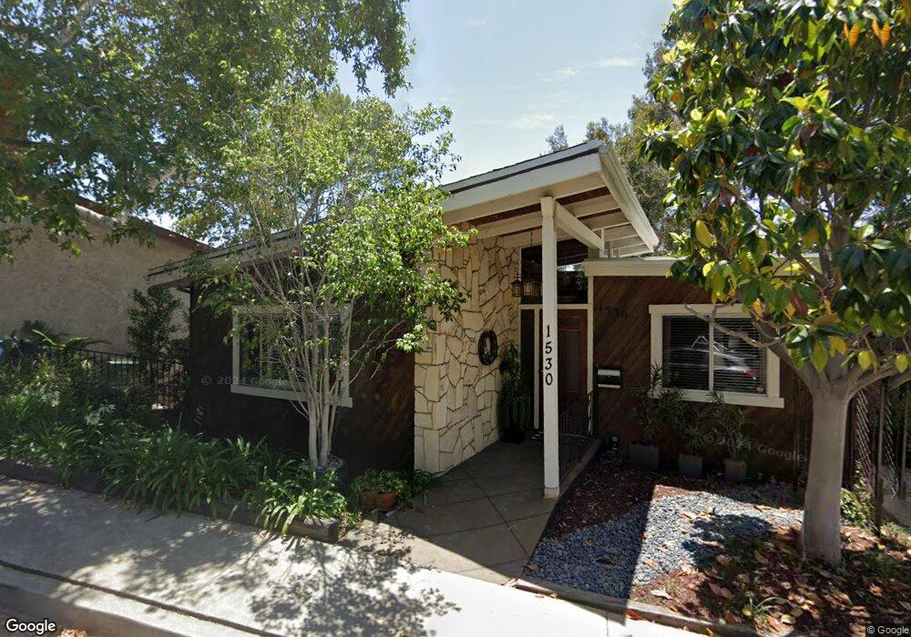
1530 Silverwood Dr Los Angeles, CA 90041
Eagle Rock NeighborhoodEstimated Value: $1,571,001 - $1,876,000
3
Beds
3
Baths
2,648
Sq Ft
$639/Sq Ft
Est. Value
About This Home
This home is located at 1530 Silverwood Dr, Los Angeles, CA 90041 and is currently estimated at $1,691,000, approximately $638 per square foot. 1530 Silverwood Dr is a home located in Los Angeles County with nearby schools including Rockdale Elementary School and Eagle Rock High School.
Ownership History
Date
Name
Owned For
Owner Type
Purchase Details
Closed on
May 19, 2020
Sold by
Manneck Paul A and Manneck Sandra
Bought by
Manneck Paul A and Manneck Sandra
Current Estimated Value
Home Financials for this Owner
Home Financials are based on the most recent Mortgage that was taken out on this home.
Original Mortgage
$300,000
Outstanding Balance
$265,842
Interest Rate
3.3%
Mortgage Type
New Conventional
Estimated Equity
$1,425,158
Purchase Details
Closed on
May 4, 2010
Sold by
Manneck Paul and Manneck Sandra
Bought by
Manneck Paul A and Manneck Sandra
Purchase Details
Closed on
Oct 29, 1997
Sold by
Heyne John M
Bought by
Manneck Paul and Manneck Sandra
Home Financials for this Owner
Home Financials are based on the most recent Mortgage that was taken out on this home.
Original Mortgage
$260,000
Interest Rate
7.19%
Create a Home Valuation Report for This Property
The Home Valuation Report is an in-depth analysis detailing your home's value as well as a comparison with similar homes in the area
Home Values in the Area
Average Home Value in this Area
Purchase History
| Date | Buyer | Sale Price | Title Company |
|---|---|---|---|
| Manneck Paul A | -- | Wfg National Title Co Of Ca | |
| Manneck Paul A | -- | None Available | |
| Manneck Paul | $325,000 | Gateway Title Company |
Source: Public Records
Mortgage History
| Date | Status | Borrower | Loan Amount |
|---|---|---|---|
| Open | Manneck Paul A | $300,000 | |
| Previous Owner | Manneck Paul | $260,000 | |
| Closed | Manneck Paul | $32,500 |
Source: Public Records
Tax History Compared to Growth
Tax History
| Year | Tax Paid | Tax Assessment Tax Assessment Total Assessment is a certain percentage of the fair market value that is determined by local assessors to be the total taxable value of land and additions on the property. | Land | Improvement |
|---|---|---|---|---|
| 2025 | $5,777 | $463,037 | $239,503 | $223,534 |
| 2024 | $5,777 | $453,958 | $234,807 | $219,151 |
| 2023 | $5,669 | $445,057 | $230,203 | $214,854 |
| 2022 | $5,411 | $436,332 | $225,690 | $210,642 |
| 2021 | $5,332 | $427,777 | $221,265 | $206,512 |
| 2019 | $5,175 | $415,091 | $214,703 | $200,388 |
| 2018 | $5,087 | $406,953 | $210,494 | $196,459 |
| 2016 | $4,839 | $391,152 | $202,321 | $188,831 |
| 2015 | $4,769 | $385,277 | $199,282 | $185,995 |
| 2014 | $4,790 | $377,731 | $195,379 | $182,352 |
Source: Public Records
Map
Nearby Homes
- 1333 Wildwood Dr
- 4631 4637 Loleta Place
- 1938 Phillips Way
- 1942 Phillips Way
- 1359 Wildwood Dr
- 1915 N Avenue 52
- 1932 Phillips Way
- 5240 Barker Dr
- 1321 Wildwood Dr
- 1584 Oak Grove Place
- 1902 N Avenue 51
- 1913 Nolden St
- 1632 Oak Grove Dr
- 1813 N Avenue 55
- 1813 N Avenue 53
- 1800 N Avenue 55
- 1567 Fair Park Ave
- 4879 Hartwick St
- 1370 N Avenue 57
- 4890 Floristan Ave
- 1947 Silverwood Ln
- 1984 N Avenue 52
- 1544 Silverwood Dr
- 1531 Silverwood Dr
- 1537 Silverwood Dr
- 1937 Silverwood Ln
- 1964 N Avenue 52
- 1964 North Avenue 52
- 1967 North Avenue 52
- 1541 Silverwood Dr
- 0 Silverwood Dr Unit 12-591975
- 0 Silverwood Dr Unit W504446
- 1958 N Avenue 52
- 1944 Silverwood Ln
- 1958 North Avenue 52
- 1931 Silverwood Ln
- 1554 Silverwood Dr
- 1938 Silverwood Ln
- 1954 N Avenue 52
- 1549 Silverwood Dr