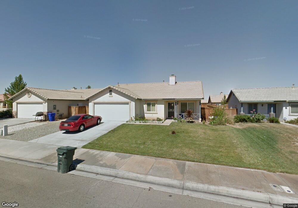
15416 Pearmain St Adelanto, CA 92301
Mesa Linda NeighborhoodEstimated Value: $390,630 - $404,000
4
Beds
2
Baths
1,359
Sq Ft
$292/Sq Ft
Est. Value
About This Home
This home is located at 15416 Pearmain St, Adelanto, CA 92301 and is currently estimated at $396,658, approximately $291 per square foot. 15416 Pearmain St is a home located in San Bernardino County with nearby schools including Victoria Magathan Elementary School, Columbia Middle School, and Adelanto High School.
Ownership History
Date
Name
Owned For
Owner Type
Purchase Details
Closed on
Feb 5, 2003
Sold by
Norris Heller One Llc
Bought by
Ulloa Josephine
Current Estimated Value
Home Financials for this Owner
Home Financials are based on the most recent Mortgage that was taken out on this home.
Original Mortgage
$119,612
Interest Rate
5.89%
Mortgage Type
FHA
Create a Home Valuation Report for This Property
The Home Valuation Report is an in-depth analysis detailing your home's value as well as a comparison with similar homes in the area
Home Values in the Area
Average Home Value in this Area
Purchase History
| Date | Buyer | Sale Price | Title Company |
|---|---|---|---|
| Ulloa Josephine | $121,500 | Orange Coast Title |
Source: Public Records
Mortgage History
| Date | Status | Borrower | Loan Amount |
|---|---|---|---|
| Previous Owner | Ulloa Josephine | $119,612 |
Source: Public Records
Tax History Compared to Growth
Tax History
| Year | Tax Paid | Tax Assessment Tax Assessment Total Assessment is a certain percentage of the fair market value that is determined by local assessors to be the total taxable value of land and additions on the property. | Land | Improvement |
|---|---|---|---|---|
| 2025 | $2,346 | $172,733 | $34,546 | $138,187 |
| 2024 | $2,346 | $169,346 | $33,869 | $135,477 |
| 2023 | $2,377 | $166,026 | $33,205 | $132,821 |
| 2022 | $2,254 | $162,771 | $32,554 | $130,217 |
| 2021 | $2,364 | $159,580 | $31,916 | $127,664 |
| 2020 | $2,306 | $157,944 | $31,589 | $126,355 |
| 2019 | $2,286 | $154,847 | $30,970 | $123,877 |
| 2018 | $2,287 | $151,811 | $30,363 | $121,448 |
| 2017 | $2,215 | $148,835 | $29,768 | $119,067 |
| 2016 | $2,172 | $145,916 | $29,184 | $116,732 |
| 2015 | $2,084 | $143,725 | $28,746 | $114,979 |
| 2014 | $1,615 | $103,100 | $25,800 | $77,300 |
Source: Public Records
Map
Nearby Homes
- 15416 Kearny Dr
- 15386 Fremont Dr
- 11728 Drake Ct
- 11800 Wolcott St
- 15177 Braxton St
- 11613 Autumn St
- 11882 Star St
- 15747 Ox Hill Ct
- 32 Pearmain St
- 0 Pahute - Huerta Unit HD25039461
- 14211 14211
- 14025 Bonanza
- 0 Cajon 0396-154-07 Ave Unit HD24093177
- 0 Civic #1 Dr Unit HD25143721
- 0 Kentwood #1 Blvd Unit HD25143435
- 9 Palmdale
- 0 Civic #4 Dr Unit HD25144089
- 0 Civic #2 Dr Unit HD25144047
- 14321 Amethyst Rd
- 0 Civic #3 Dr Unit HD25144066
- 15428 Pearmain St
- 15404 Pearmain St
- 15409 Kearny Dr
- 15401 Kearny Dr
- 15436 Pearmain St
- 15427 Kearny Dr
- 15444 Pearmain St
- 11899 Sutter Way
- 15435 Kearny Dr
- 11879 Sutter Way
- 11869 Sutter Way
- 15454 Pearmain St
- 15449 Kearny Dr
- 15428 Kearny Dr
- 15404 Kearny Dr
- 15434 Kearny Dr
- 15374 Pearmain St
- 15460 Pearmain St
- 15375 Kearny Dr
- 15446 Kearny Dr