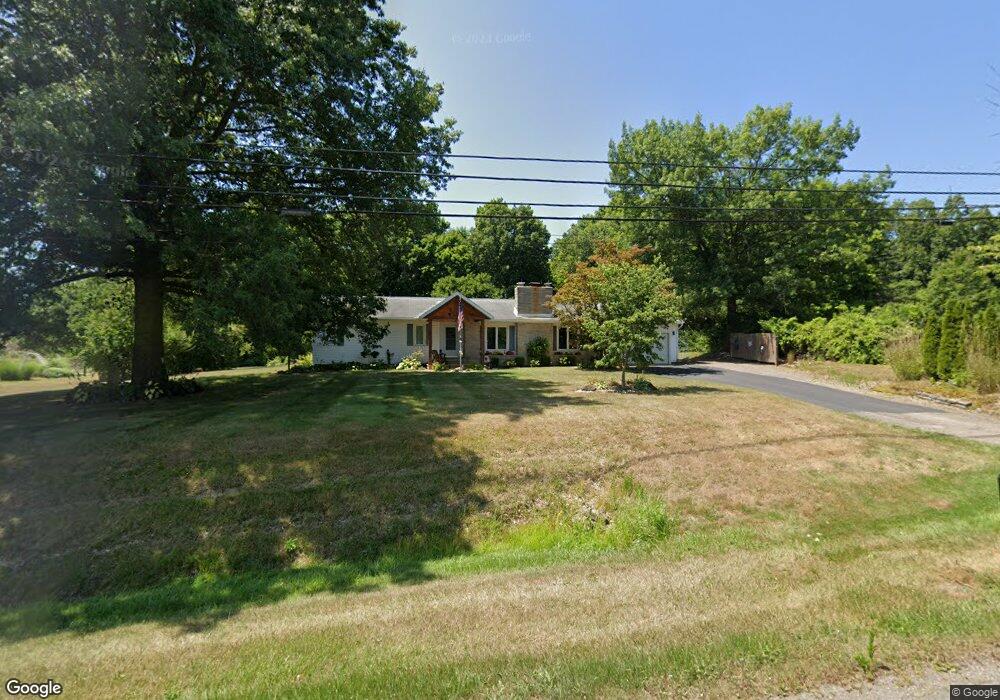
1542 State Route 60 Ashland, OH 44805
Estimated Value: $289,629 - $341,000
3
Beds
2
Baths
1,485
Sq Ft
$214/Sq Ft
Est. Value
About This Home
This home is located at 1542 State Route 60, Ashland, OH 44805 and is currently estimated at $318,157, approximately $214 per square foot. 1542 State Route 60 is a home located in Ashland County with nearby schools including Hillsdale Elementary School, Hillsdale Middle School, and Hillsdale High School.
Ownership History
Date
Name
Owned For
Owner Type
Purchase Details
Closed on
Feb 2, 2007
Sold by
Buskirk Faith L
Bought by
Hunt Michael D
Current Estimated Value
Purchase Details
Closed on
Jul 28, 2004
Sold by
Hipp Heather N
Bought by
Buskirk Faith L
Purchase Details
Closed on
May 29, 2003
Sold by
Finley David
Bought by
Hipp Heather N
Purchase Details
Closed on
Nov 26, 2002
Bought by
Finley David
Purchase Details
Closed on
Dec 30, 1996
Sold by
Calvert Robert C
Purchase Details
Closed on
Oct 17, 1990
Bought by
Calvert Robert C
Create a Home Valuation Report for This Property
The Home Valuation Report is an in-depth analysis detailing your home's value as well as a comparison with similar homes in the area
Home Values in the Area
Average Home Value in this Area
Purchase History
| Date | Buyer | Sale Price | Title Company |
|---|---|---|---|
| Hunt Michael D | $153,000 | -- | |
| Buskirk Faith L | $138,000 | -- | |
| Hipp Heather N | $139,500 | -- | |
| Finley David | $90,000 | -- | |
| -- | $102,500 | -- | |
| Calvert Robert C | $72,500 | -- |
Source: Public Records
Tax History Compared to Growth
Tax History
| Year | Tax Paid | Tax Assessment Tax Assessment Total Assessment is a certain percentage of the fair market value that is determined by local assessors to be the total taxable value of land and additions on the property. | Land | Improvement |
|---|---|---|---|---|
| 2024 | $2,989 | $84,040 | $8,800 | $75,240 |
| 2023 | $2,989 | $84,040 | $8,800 | $75,240 |
| 2022 | $2,699 | $59,250 | $6,280 | $52,970 |
| 2021 | $2,709 | $59,250 | $6,280 | $52,970 |
| 2020 | $2,571 | $59,250 | $6,280 | $52,970 |
| 2019 | $2,435 | $51,880 | $6,520 | $45,360 |
| 2018 | $2,443 | $51,880 | $6,520 | $45,360 |
| 2017 | $2,194 | $51,880 | $6,520 | $45,360 |
| 2016 | $2,194 | $45,920 | $5,770 | $40,150 |
| 2015 | $2,175 | $45,920 | $5,770 | $40,150 |
| 2013 | $2,331 | $48,390 | $5,780 | $42,610 |
Source: Public Records
Map
Nearby Homes
- 1346 Ohio 89
- 1346 State Route 89
- 14 E South St
- 144 Township Road 1650
- 486 Township Road 1275
- 0 Township Road 1275
- 156 U S 250
- 1653 State Route 60
- 1653 Ohio 60
- 1845 County Road 655
- 1446 Township Road 805
- 686 County Road 1302
- 1457 Township Road 853
- 0 Eagle Way
- 1435 Township Road 853
- 1173 Township Road 753
- 150 E Main St
- 2289 N Reedsburg Rd
- 0 Twp Rd 1806 Unit 11591470
- 453 Hillcrest Dr
- 1556 State Route 60
- 1532 State Route 60
- 1512 State Route 89
- 1518 State Route 89
- 1502 State Route 89
- 1531 State Route 89
- 1531 State Route 89
- 1533 State Route 89
- 1529 State Route 89
- 1513 State Route 89
- 1576 State Route 89
- 1509 Ohio 89
- 1509 State Route 89
- 1542 State Route 89
- 1556 State Route 89
- 1572 State Route 89
- 1502 State Route 60
- 437 Twp 1500 Rd
- 437 1500
- 1503 State Route 89