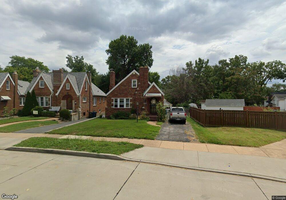
1548 Collins Ave Saint Louis, MO 63117
Estimated Value: $351,000 - $421,375
4
Beds
3
Baths
1,701
Sq Ft
$228/Sq Ft
Est. Value
About This Home
This home is located at 1548 Collins Ave, Saint Louis, MO 63117 and is currently estimated at $388,594, approximately $228 per square foot. 1548 Collins Ave is a home located in St. Louis County with nearby schools including Maplewood Richmond Heights Elementary School, Maplewood Richmond Heights Middle School, and Maplewood-Richmond Heights High School.
Ownership History
Date
Name
Owned For
Owner Type
Purchase Details
Closed on
Dec 23, 2016
Sold by
Loren Marisha
Bought by
Meissa Group Llc
Current Estimated Value
Purchase Details
Closed on
Apr 19, 2005
Sold by
Harris Janice
Bought by
Loren Marisha
Home Financials for this Owner
Home Financials are based on the most recent Mortgage that was taken out on this home.
Original Mortgage
$136,000
Interest Rate
5.6%
Mortgage Type
Fannie Mae Freddie Mac
Create a Home Valuation Report for This Property
The Home Valuation Report is an in-depth analysis detailing your home's value as well as a comparison with similar homes in the area
Home Values in the Area
Average Home Value in this Area
Purchase History
| Date | Buyer | Sale Price | Title Company |
|---|---|---|---|
| Meissa Group Llc | -- | None Available | |
| Loren Marisha | $171,500 | -- |
Source: Public Records
Mortgage History
| Date | Status | Borrower | Loan Amount |
|---|---|---|---|
| Previous Owner | Loren Marisha | $136,000 | |
| Closed | Loren Marisha | $34,300 |
Source: Public Records
Tax History Compared to Growth
Tax History
| Year | Tax Paid | Tax Assessment Tax Assessment Total Assessment is a certain percentage of the fair market value that is determined by local assessors to be the total taxable value of land and additions on the property. | Land | Improvement |
|---|---|---|---|---|
| 2025 | $5,382 | $68,460 | $36,010 | $32,450 |
| 2024 | $5,382 | $70,400 | $22,420 | $47,980 |
| 2023 | $5,335 | $70,400 | $22,420 | $47,980 |
| 2022 | $5,081 | $61,960 | $22,420 | $39,540 |
| 2021 | $4,993 | $61,960 | $22,420 | $39,540 |
| 2020 | $4,455 | $52,370 | $19,210 | $33,160 |
| 2019 | $4,420 | $52,370 | $19,210 | $33,160 |
| 2018 | $3,619 | $38,840 | $11,210 | $27,630 |
| 2017 | $3,594 | $38,840 | $11,210 | $27,630 |
| 2016 | $3,316 | $34,530 | $10,320 | $24,210 |
| 2015 | $3,116 | $34,530 | $10,320 | $24,210 |
| 2014 | $3,608 | $40,110 | $8,610 | $31,500 |
Source: Public Records
Map
Nearby Homes
- 7765 Weston Place
- 7715 Dale Ave
- 7723 Dale Ave
- 1723 Mccready Ave
- 7735 Saint Albans Ave
- 7590 W Bruno Ave
- 7716 Lovella Ave
- 2030 Bland Place
- 1262 Moorlands Dr
- 7555 Alicia Ave
- 7635 Folk Ave
- 7562 Folk Ave
- 1501 Stockard Ave
- 1510 Banneker Ave
- 1174 Claytonia Terrace
- 7638 Weaver Ave
- 7742 Wise Ave
- 7400 Williams Ave
- 1250 Hampton Park Dr
- 1123 Claytonia Terrace
- 1546 Collins Ave
- 1606 Bredell Ave
- 1608 Bredell Ave
- 1542 Collins Ave
- 1604 Bredell Ave
- 1610 Bredell Ave
- 7663 Lindbergh Dr
- 1600 Bredell Ave
- 1612 Bredell Ave
- 1538 Collins Ave
- 1614 Bredell Ave
- 1534 Collins Ave
- 7655 Lindbergh Dr
- 7659 Lindbergh Dr
- 7645 Lindbergh Dr
- 1525 Collins Ave
- 7637 Lindbergh Dr
- 7665 Lindbergh Dr
- 1530 Collins Ave
- 1523 Collins Ave