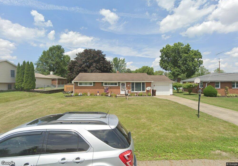
155 Fairview St Louisville, OH 44641
Estimated Value: $197,146 - $225,000
3
Beds
2
Baths
1,144
Sq Ft
$188/Sq Ft
Est. Value
About This Home
This home is located at 155 Fairview St, Louisville, OH 44641 and is currently estimated at $215,537, approximately $188 per square foot. 155 Fairview St is a home located in Stark County with nearby schools including Louisville High School and St. Thomas Aquinas High School & Middle School.
Ownership History
Date
Name
Owned For
Owner Type
Purchase Details
Closed on
Dec 12, 2014
Sold by
George Snyder Victoria A and Geroge Vicotria A
Bought by
Brown Jason O
Current Estimated Value
Home Financials for this Owner
Home Financials are based on the most recent Mortgage that was taken out on this home.
Original Mortgage
$112,789
Outstanding Balance
$86,555
Interest Rate
3.97%
Mortgage Type
FHA
Estimated Equity
$128,982
Purchase Details
Closed on
Apr 23, 2008
Sold by
Huskins Robert J and Huskins Amy L
Bought by
George Snyder Victoria A
Home Financials for this Owner
Home Financials are based on the most recent Mortgage that was taken out on this home.
Original Mortgage
$118,146
Interest Rate
6.17%
Mortgage Type
FHA
Purchase Details
Closed on
Oct 10, 2003
Sold by
Huskins Robert J and Huskins Amy L
Bought by
Huskins Robert J and Huskins Amy L
Home Financials for this Owner
Home Financials are based on the most recent Mortgage that was taken out on this home.
Original Mortgage
$92,500
Interest Rate
6.49%
Mortgage Type
Purchase Money Mortgage
Purchase Details
Closed on
Jan 26, 2001
Sold by
Morgan Michelle R and Morgan Michael L
Bought by
Huskins Robert J and Huskins Amy L
Purchase Details
Closed on
Nov 18, 1998
Sold by
Morgan Michael L and Morgan Michelle R
Bought by
Morgan Michelle R
Home Financials for this Owner
Home Financials are based on the most recent Mortgage that was taken out on this home.
Original Mortgage
$95,100
Interest Rate
6.88%
Mortgage Type
VA
Purchase Details
Closed on
Oct 22, 1998
Sold by
Deem Danny A and Deem Marcia A
Bought by
Morgan Michael L and Morgan Michelle R
Home Financials for this Owner
Home Financials are based on the most recent Mortgage that was taken out on this home.
Original Mortgage
$95,100
Interest Rate
6.88%
Mortgage Type
VA
Purchase Details
Closed on
Dec 15, 1992
Purchase Details
Closed on
Dec 10, 1992
Create a Home Valuation Report for This Property
The Home Valuation Report is an in-depth analysis detailing your home's value as well as a comparison with similar homes in the area
Home Values in the Area
Average Home Value in this Area
Purchase History
| Date | Buyer | Sale Price | Title Company |
|---|---|---|---|
| Brown Jason O | $114,900 | None Available | |
| George Snyder Victoria A | $119,500 | Quest Title Agency Inc | |
| Huskins Robert J | -- | -- | |
| Huskins Robert J | $103,000 | -- | |
| Morgan Michelle R | -- | -- | |
| Morgan Michael L | $93,300 | -- | |
| -- | $60,000 | -- | |
| -- | -- | -- |
Source: Public Records
Mortgage History
| Date | Status | Borrower | Loan Amount |
|---|---|---|---|
| Open | Brown Jason O | $112,789 | |
| Previous Owner | George Snyder Victoria A | $118,146 | |
| Previous Owner | Huskins Robert J | $92,500 | |
| Previous Owner | Morgan Michael L | $95,100 |
Source: Public Records
Tax History Compared to Growth
Tax History
| Year | Tax Paid | Tax Assessment Tax Assessment Total Assessment is a certain percentage of the fair market value that is determined by local assessors to be the total taxable value of land and additions on the property. | Land | Improvement |
|---|---|---|---|---|
| 2025 | -- | $54,780 | $16,000 | $38,780 |
| 2024 | -- | $54,780 | $16,000 | $38,780 |
| 2023 | $1,896 | $44,100 | $13,230 | $30,870 |
| 2022 | $1,901 | $44,100 | $13,230 | $30,870 |
| 2021 | $1,906 | $44,100 | $13,230 | $30,870 |
| 2020 | $1,562 | $39,240 | $11,940 | $27,300 |
| 2019 | $1,569 | $39,240 | $11,940 | $27,300 |
| 2018 | $1,563 | $39,240 | $11,940 | $27,300 |
| 2017 | $1,423 | $34,480 | $9,980 | $24,500 |
| 2016 | $1,453 | $34,480 | $9,980 | $24,500 |
| 2015 | $1,457 | $34,480 | $9,980 | $24,500 |
| 2014 | $1,398 | $30,770 | $8,860 | $21,910 |
| 2013 | $703 | $30,770 | $8,860 | $21,910 |
Source: Public Records
Map
Nearby Homes
- 524 Glenbar St
- 614 Reno Dr
- 428 Honeycrisp Dr NE
- 3047 Mcintosh Dr NE
- 432 Honeycrisp Dr NE
- 2962 Mcintosh Dr NE
- 2963 Mcintosh Dr NE
- 430 Honeycrisp Dr NE
- 2957 Mcintosh Dr NE
- 5474 Ravenna Ave
- 316 E Reno Dr
- 0 Glenbar St
- 300 Kennedy St
- 0 Brookridge Ave
- 3580 Brookridge Ave Lot 15
- 910 Crosswyck Cir
- 1170 Winding Ridge Ave
- 1175 Sturbridge Dr
- 1149 Sturbridge Dr
- 325 Lincoln Ave