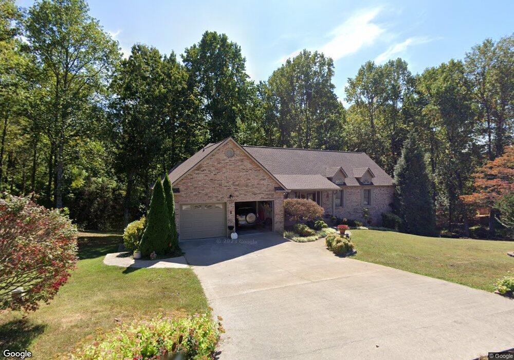
156 Apple Tree Dr Clinton, TN 37716
South Clinton NeighborhoodEstimated Value: $366,000 - $640,000
--
Bed
3
Baths
2,187
Sq Ft
$226/Sq Ft
Est. Value
About This Home
This home is located at 156 Apple Tree Dr, Clinton, TN 37716 and is currently estimated at $494,650, approximately $226 per square foot. 156 Apple Tree Dr is a home located in Anderson County.
Ownership History
Date
Name
Owned For
Owner Type
Purchase Details
Closed on
Jul 25, 2001
Sold by
Bates Robert D and Bates Christine
Bought by
Butler George R
Current Estimated Value
Home Financials for this Owner
Home Financials are based on the most recent Mortgage that was taken out on this home.
Original Mortgage
$150,500
Interest Rate
7.09%
Purchase Details
Closed on
Dec 27, 1988
Bought by
Higdon Charles P and Higdon Wife Nancy Lawson
Create a Home Valuation Report for This Property
The Home Valuation Report is an in-depth analysis detailing your home's value as well as a comparison with similar homes in the area
Home Values in the Area
Average Home Value in this Area
Purchase History
| Date | Buyer | Sale Price | Title Company |
|---|---|---|---|
| Butler George R | $210,500 | -- | |
| Higdon Charles P | $40,000 | -- |
Source: Public Records
Mortgage History
| Date | Status | Borrower | Loan Amount |
|---|---|---|---|
| Closed | Higdon Charles P | $150,500 |
Source: Public Records
Tax History Compared to Growth
Tax History
| Year | Tax Paid | Tax Assessment Tax Assessment Total Assessment is a certain percentage of the fair market value that is determined by local assessors to be the total taxable value of land and additions on the property. | Land | Improvement |
|---|---|---|---|---|
| 2024 | $1,837 | $69,875 | $10,075 | $59,800 |
| 2023 | $1,837 | $69,875 | $0 | $0 |
| 2022 | $1,837 | $69,875 | $10,075 | $59,800 |
| 2021 | $1,837 | $69,875 | $10,075 | $59,800 |
| 2020 | $1,775 | $69,875 | $10,075 | $59,800 |
| 2019 | $1,838 | $63,600 | $10,075 | $53,525 |
| 2018 | $1,775 | $63,600 | $10,075 | $53,525 |
| 2017 | $1,775 | $63,600 | $10,075 | $53,525 |
| 2016 | $1,775 | $63,600 | $10,075 | $53,525 |
| 2015 | -- | $63,600 | $10,075 | $53,525 |
| 2014 | -- | $63,600 | $10,075 | $53,525 |
| 2013 | -- | $77,650 | $0 | $0 |
Source: Public Records
Map
Nearby Homes
- 0 Saint James Ln Unit 1313852
- 0 St James Ln Unit 1303175
- Lot 6 St James Ln
- Lot 5 St James Ln
- 101 Blossom Ln
- 39 Apple Tree Dr
- 3341 W Wolf Valley Rd
- 372 Walnut Valley Rd
- 3275 W Wolf Valley Rd
- 120 Crest Ln
- 3225 W Wolf Valley Rd
- 110 Courtland Ln
- 45 Riverside Dr
- 780 Old Emory Rd
- 120 West Ln
- 17 Raintree Place
- 329 Centennial Bluff Blvd
- 135 Edgewood Heights Ln
- 0 Rivers Run Blvd
- 75 Rolling Links Blvd
- 152 Apple Tree Dr
- 0 Apple Tree Dr
- 157 Apple Tree Dr
- 161 Apple Tree Dr
- 148 Apple Tree Dr
- 153 Apple Tree Dr
- Lot 5 St
- 0 Saint James Ln Unit 1268955
- 0 Saint James Ln Unit 1143680
- 0 Saint James Ln Unit 1171990
- 0 Saint James Ln
- 164 Apple Tree Dr
- 8 Lots St James Ln
- Lot 08 St James Ln
- 0 Lot 8 St James Unit 1186738
- 0 Lot 8 St James Unit 1175359
- 0 St James Ln Unit RTC2998398
- 0 St James Ln Unit RTC2998397
- 0 St James Ln Unit 1293775
- 0 St James Ln Unit 1293774