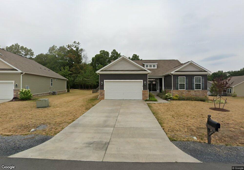
156 Flagstick Ct Front Royal, VA 22630
Estimated Value: $551,387 - $651,000
3
Beds
3
Baths
2,404
Sq Ft
$246/Sq Ft
Est. Value
About This Home
This home is located at 156 Flagstick Ct, Front Royal, VA 22630 and is currently estimated at $591,097, approximately $245 per square foot. 156 Flagstick Ct is a home located in Warren County with nearby schools including Leslie Fox Keyser Elementary School and Warren County High School.
Ownership History
Date
Name
Owned For
Owner Type
Purchase Details
Closed on
Aug 17, 2018
Sold by
D R Horton Inc
Bought by
Kersjes Scott R
Current Estimated Value
Home Financials for this Owner
Home Financials are based on the most recent Mortgage that was taken out on this home.
Original Mortgage
$377,000
Outstanding Balance
$327,409
Interest Rate
4.5%
Mortgage Type
VA
Estimated Equity
$263,688
Create a Home Valuation Report for This Property
The Home Valuation Report is an in-depth analysis detailing your home's value as well as a comparison with similar homes in the area
Home Values in the Area
Average Home Value in this Area
Purchase History
| Date | Buyer | Sale Price | Title Company |
|---|---|---|---|
| Kersjes Scott R | $377,000 | Premier Title Inc |
Source: Public Records
Mortgage History
| Date | Status | Borrower | Loan Amount |
|---|---|---|---|
| Open | Kersjes Scott R | $377,000 |
Source: Public Records
Tax History Compared to Growth
Tax History
| Year | Tax Paid | Tax Assessment Tax Assessment Total Assessment is a certain percentage of the fair market value that is determined by local assessors to be the total taxable value of land and additions on the property. | Land | Improvement |
|---|---|---|---|---|
| 2025 | $2,742 | $572,500 | $74,700 | $497,800 |
| 2024 | $2,833 | $534,500 | $86,300 | $448,200 |
| 2023 | $2,619 | $534,500 | $86,300 | $448,200 |
| 2022 | $2,650 | $404,600 | $75,000 | $329,600 |
| 2021 | $2,650 | $404,600 | $75,000 | $329,600 |
| 2020 | $2,650 | $404,600 | $75,000 | $329,600 |
| 2019 | $2,615 | $399,200 | $75,000 | $324,200 |
| 2018 | $330 | $50,000 | $50,000 | $0 |
| 2017 | $325 | $50,000 | $50,000 | $0 |
| 2016 | $310 | $50,000 | $50,000 | $0 |
| 2015 | -- | $50,000 | $50,000 | $0 |
| 2014 | -- | $45,000 | $45,000 | $0 |
Source: Public Records
Map
Nearby Homes
- 8+/- Acres Winchester Rd
- Lot 3 Springwood Ln
- 167 Cedar Park Ct
- 43 Little Sorrel Dr
- 76 Katie Ln
- 386 Ashby Station Rd
- 2479 Rockland Rd
- 836 Bennys Beach Rd
- 2137 Reliance Rd
- 89 Pin Oak Rd
- 0 Pin Oak Rd Unit VAWR2006146
- 515 River Ridge Dr
- 0 River Ridge Dr Unit VAWR2012826
- 0 River Ridge Dr Unit VAWR2011208
- 0 Cherrywood Rd
- 167 Beckwith Dr
- 225 Sugar Maple Rd
- 1408 Winchester Pike
- 45 W Duck St
- 43 W Duck St
- 168 Flagstick Ct
- 140 Flag Stick Ct
- 140 Flagstick Ct
- 165 Flagstick Ct
- 41 Hickory Shaft Ct
- 137 Flagstick Ct
- 184 Flagstick Ct
- 110 Flagstick Ct
- 105 Flagstick Ct
- 181 Flagstick Ct
- 47 Hickory Shaft Ct
- 40 Hickory Shaft Ct
- 188 Flagstick Ct
- 81 Flagstick Ct
- 190 Flagstick Ct
- 187 Flagstick Ct
- 90 Flagstick Ct
- 49 Hickory Shaft Ct
- 48 Hickory Shaft Ct
- 46 Hickory Shaft Ct