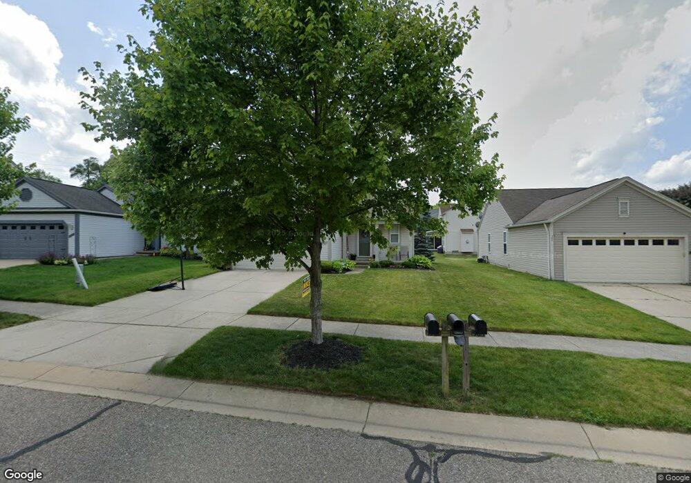
1561 Meadow Ridge Dr Pontiac, MI 48340
Estimated Value: $262,419 - $344,000
3
Beds
3
Baths
1,491
Sq Ft
$197/Sq Ft
Est. Value
About This Home
This home is located at 1561 Meadow Ridge Dr, Pontiac, MI 48340 and is currently estimated at $293,355, approximately $196 per square foot. 1561 Meadow Ridge Dr is a home located in Oakland County with nearby schools including Alcott School, Pontiac Middle School, and Pontiac High School.
Ownership History
Date
Name
Owned For
Owner Type
Purchase Details
Closed on
Sep 3, 2008
Sold by
Flagstar Bank Fsb
Bought by
Federal National Mortgage Association
Current Estimated Value
Purchase Details
Closed on
Sep 2, 2008
Sold by
Stark Guy C
Bought by
Flagstar Bank Fsb
Purchase Details
Closed on
Apr 8, 2002
Sold by
Hinds Jason
Bought by
Stark Guy C
Home Financials for this Owner
Home Financials are based on the most recent Mortgage that was taken out on this home.
Original Mortgage
$135,100
Interest Rate
6.93%
Purchase Details
Closed on
May 28, 1999
Sold by
Pulte Land Dev Corp
Bought by
Hinds Jason
Create a Home Valuation Report for This Property
The Home Valuation Report is an in-depth analysis detailing your home's value as well as a comparison with similar homes in the area
Home Values in the Area
Average Home Value in this Area
Purchase History
| Date | Buyer | Sale Price | Title Company |
|---|---|---|---|
| Federal National Mortgage Association | -- | None Available | |
| Flagstar Bank Fsb | $133,662 | None Available | |
| Stark Guy C | $168,900 | -- | |
| Hinds Jason | $40,000 | -- |
Source: Public Records
Mortgage History
| Date | Status | Borrower | Loan Amount |
|---|---|---|---|
| Previous Owner | Stark Guy C | $135,100 |
Source: Public Records
Tax History Compared to Growth
Tax History
| Year | Tax Paid | Tax Assessment Tax Assessment Total Assessment is a certain percentage of the fair market value that is determined by local assessors to be the total taxable value of land and additions on the property. | Land | Improvement |
|---|---|---|---|---|
| 2024 | $1,562 | $107,810 | $0 | $0 |
| 2023 | $1,489 | $95,540 | $0 | $0 |
| 2022 | $1,509 | $88,860 | $0 | $0 |
| 2021 | $1,464 | $80,310 | $0 | $0 |
| 2020 | $1,353 | $75,600 | $0 | $0 |
| 2019 | $1,434 | $66,620 | $0 | $0 |
| 2018 | $1,389 | $58,760 | $0 | $0 |
| 2017 | $1,315 | $55,910 | $0 | $0 |
| 2016 | $1,337 | $51,460 | $0 | $0 |
| 2015 | -- | $41,030 | $0 | $0 |
| 2014 | -- | $34,780 | $0 | $0 |
| 2011 | -- | $41,540 | $0 | $0 |
Source: Public Records
Map
Nearby Homes
- 2854 Beacham Dr
- 2927 Huntington Park Dr
- 2831 Silverstone Ln
- 940 Lake Angelus Shores Rd
- 405 W Walton Blvd
- 2361 Montroyal Ave
- 2550 W Walton Blvd
- 310 W Princeton Ave
- 228 W Walton Blvd
- 161 W Brooklyn Ave
- 3411 Wormer Dr
- 2830 Dixie Hwy
- 108 W Brooklyn Ave
- 104 W Brooklyn Ave
- 1123 Cherrylawn Dr
- 1153 Stanley Ave
- 64 W Colgate Ave
- 37 W Brooklyn Ave
- 240 W Fairmount Ave
- 1017 Cherrylawn Dr
- 1559 Meadow Ridge Dr
- 1563 Meadow Ridge Dr
- 1572 Marshbank Dr
- 1566 Marshbank Dr
- 1557 Meadow Ridge Dr
- 1558 Meadow Ridge Dr
- 1555 Meadow Ridge Dr
- 1560 Meadow Ridge Dr
- 1560 Marshbank Dr
- 1577 Marshbank Dr
- 1575 Marshbank Dr
- 1573 Marshbank Ct
- 1579 Marshbank Dr
- 1556 Meadow Ridge Dr
- 1558 Marshbank Dr
- 1581 Marshbank Dr
- 1553 Meadow Ridge Dr
- 1554 Meadow Ridge Dr
- 1554 Marshbank Dr
- 1583 Marshbank Dr