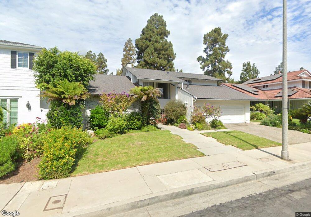
1561 Roxbury Dr Los Angeles, CA 90035
Beverlywood NeighborhoodEstimated Value: $2,865,000 - $3,793,000
4
Beds
3
Baths
2,866
Sq Ft
$1,150/Sq Ft
Est. Value
About This Home
This home is located at 1561 Roxbury Dr, Los Angeles, CA 90035 and is currently estimated at $3,295,893, approximately $1,149 per square foot. 1561 Roxbury Dr is a home located in Los Angeles County with nearby schools including Canfield Avenue Elementary, Palms Middle School, and Alexander Hamilton Senior High School.
Ownership History
Date
Name
Owned For
Owner Type
Purchase Details
Closed on
Jul 28, 2005
Sold by
Feinstein Charles I and Feinstein Alice
Bought by
Feinstein Charles I
Current Estimated Value
Home Financials for this Owner
Home Financials are based on the most recent Mortgage that was taken out on this home.
Original Mortgage
$650,000
Outstanding Balance
$340,575
Interest Rate
5.62%
Mortgage Type
Purchase Money Mortgage
Estimated Equity
$2,955,318
Purchase Details
Closed on
Oct 18, 2002
Sold by
Feinstein Charles and Feinstein Alice
Bought by
Feinstein Charles I
Purchase Details
Closed on
Sep 22, 1993
Sold by
Richter Weston E and Richter Denise
Bought by
Feinstein Charles
Home Financials for this Owner
Home Financials are based on the most recent Mortgage that was taken out on this home.
Original Mortgage
$553,200
Interest Rate
6.95%
Create a Home Valuation Report for This Property
The Home Valuation Report is an in-depth analysis detailing your home's value as well as a comparison with similar homes in the area
Home Values in the Area
Average Home Value in this Area
Purchase History
| Date | Buyer | Sale Price | Title Company |
|---|---|---|---|
| Feinstein Charles I | -- | Gateway Title Company | |
| Feinstein Charles I | -- | Gateway Title Company | |
| Feinstein Charles I | -- | -- | |
| Feinstein Charles | $691,500 | North American Title Company |
Source: Public Records
Mortgage History
| Date | Status | Borrower | Loan Amount |
|---|---|---|---|
| Open | Feinstein Charles I | $650,000 | |
| Closed | Feinstein Charles | $553,200 |
Source: Public Records
Tax History Compared to Growth
Tax History
| Year | Tax Paid | Tax Assessment Tax Assessment Total Assessment is a certain percentage of the fair market value that is determined by local assessors to be the total taxable value of land and additions on the property. | Land | Improvement |
|---|---|---|---|---|
| 2025 | $14,171 | $1,175,319 | $505,986 | $669,333 |
| 2024 | $14,171 | $1,152,274 | $496,065 | $656,209 |
| 2023 | $13,900 | $1,129,682 | $486,339 | $643,343 |
| 2022 | $13,259 | $1,107,532 | $476,803 | $630,729 |
| 2021 | $13,086 | $1,085,816 | $467,454 | $618,362 |
| 2019 | $12,694 | $1,053,612 | $453,590 | $600,022 |
| 2018 | $12,587 | $1,032,954 | $444,697 | $588,257 |
| 2016 | $12,024 | $992,845 | $427,430 | $565,415 |
| 2015 | $11,847 | $977,932 | $421,010 | $556,922 |
| 2014 | $11,886 | $958,776 | $412,763 | $546,013 |
Source: Public Records
Map
Nearby Homes
- 9730 Cresta Dr
- 1601 S Beverly Dr
- 1515 S Beverly Dr Unit 201
- 1318 S Roxbury Dr Unit 118
- 1625 Rexford Dr
- 1201 Roxbury Dr Unit 106
- 1450 S Beverly Dr Unit 105
- 2222 Avenue of The Stars Unit 2503
- 2220 Avenue of The Stars Unit 2304-2305
- 2220 Avenue of The Stars Unit 702
- 2220 Avenue of The Stars Unit 2004W
- 2222 Avenue of The Stars Unit 1404
- 2220 Avenue of The Stars Unit 1803
- 2220 Avenue of The Stars Unit 2203
- 2220 Avenue of The Stars Unit 205
- 2222 Avenue of The Stars Unit 1203
- 2220 Avenue of The Stars Unit 803
- 10128 Empyrean Way Unit 102
- 10106 Empyrean Way Unit 302
- 10106 Empyrean Way Unit 301
- 1565 Roxbury Dr
- 1555 Roxbury Dr
- 1553 Roxbury Dr
- 1569 Roxbury Dr
- 1566 Roxbury Dr
- 1601 Roxbury Dr
- 1573 Roxbury Dr
- 1551 Roxbury Dr
- 1574 Roxbury Dr
- 9754 Castello Place
- 9752 Castello Place
- 1577 Roxbury Dr
- 9756 Castello Place
- 9750 Castello Place
- 1578 Roxbury Dr
- 9761 Castello Place
- 1581 Roxbury Dr
- 9734 Holcomb St
- 9751 Castello Place
- 9758 Castello Place