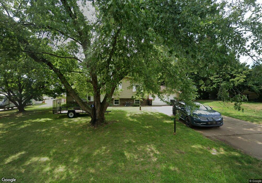
1566 Plateau St NE Uniontown, OH 44685
Estimated Value: $244,000 - $285,000
3
Beds
1
Bath
1,144
Sq Ft
$228/Sq Ft
Est. Value
About This Home
This home is located at 1566 Plateau St NE, Uniontown, OH 44685 and is currently estimated at $260,398, approximately $227 per square foot. 1566 Plateau St NE is a home located in Stark County with nearby schools including Lake Middle/High School and Lake Center Christian School.
Ownership History
Date
Name
Owned For
Owner Type
Purchase Details
Closed on
Apr 17, 2020
Sold by
Hensley Kristin M and Bush Kristin M
Bought by
Hensley Joseph L
Current Estimated Value
Home Financials for this Owner
Home Financials are based on the most recent Mortgage that was taken out on this home.
Original Mortgage
$132,990
Outstanding Balance
$117,363
Interest Rate
3.2%
Mortgage Type
VA
Estimated Equity
$143,035
Purchase Details
Closed on
Feb 8, 2007
Sold by
Yacub Luqman and Yacub Julie A
Bought by
Hensley Kristin M
Home Financials for this Owner
Home Financials are based on the most recent Mortgage that was taken out on this home.
Original Mortgage
$126,000
Interest Rate
6.22%
Mortgage Type
Purchase Money Mortgage
Purchase Details
Closed on
Jun 4, 1993
Create a Home Valuation Report for This Property
The Home Valuation Report is an in-depth analysis detailing your home's value as well as a comparison with similar homes in the area
Home Values in the Area
Average Home Value in this Area
Purchase History
| Date | Buyer | Sale Price | Title Company |
|---|---|---|---|
| Hensley Joseph L | $130,000 | None Available | |
| Hensley Kristin M | $126,000 | Title One | |
| -- | $81,500 | -- |
Source: Public Records
Mortgage History
| Date | Status | Borrower | Loan Amount |
|---|---|---|---|
| Open | Hensley Joseph L | $132,990 | |
| Previous Owner | Hensley Kristin M | $126,000 |
Source: Public Records
Tax History Compared to Growth
Tax History
| Year | Tax Paid | Tax Assessment Tax Assessment Total Assessment is a certain percentage of the fair market value that is determined by local assessors to be the total taxable value of land and additions on the property. | Land | Improvement |
|---|---|---|---|---|
| 2025 | -- | $68,040 | $21,210 | $46,830 |
| 2024 | -- | $68,040 | $21,210 | $46,830 |
| 2023 | $2,709 | $55,300 | $13,230 | $42,070 |
| 2022 | $2,589 | $55,300 | $13,230 | $42,070 |
| 2021 | $2,618 | $55,300 | $13,230 | $42,070 |
| 2020 | $2,617 | $49,560 | $11,410 | $38,150 |
| 2019 | $2,593 | $49,560 | $11,410 | $38,150 |
| 2018 | $2,594 | $49,560 | $11,410 | $38,150 |
| 2017 | $2,388 | $42,390 | $11,410 | $30,980 |
| 2016 | $2,392 | $42,390 | $11,410 | $30,980 |
| 2015 | $2,391 | $42,390 | $11,410 | $30,980 |
| 2014 | $58 | $37,980 | $10,220 | $27,760 |
| 2013 | $1,029 | $37,980 | $10,220 | $27,760 |
Source: Public Records
Map
Nearby Homes
- 11121 Geib Ave NE
- 2084 Hazel St NE
- 1975 Eloise Cir NE
- 1037 Canyon St NE
- 1180 Tessa Trail Unit 1180
- 425 Tonawanda Trail SW
- 747 Grandview Cir
- 11900 Geib Ave NE
- 225 Seneca Trail SW
- 778 Fair Vista Cir SW
- 550 Woodlands Glen Ave
- 786 Fair Vista Cir SW
- 531 Gentlebrook Blvd SW
- 525 Gentlebrook Blvd SW
- 510 Meadow Cir SW Unit 11
- Unit 9 Meadow Trail SW Unit 9
- 9790 Smithdale Ave NE
- 9766 Smithdale Ave NE
- 330 Belle Ave SW
- 316 S Prospect Ave
- 1550 Plateau St NE
- 1586 Plateau St NE
- 1530 Plateau St NE
- 1600 Plateau St NE
- 1593 Plateau St NE
- 1510 Plateau St NE
- 1624 Plateau St NE
- 11015 Oasis Ave NE
- 11056 Oasis Ave NE
- 1490 Plateau St NE
- 11017 Sagebrush Ave NE
- 1648 Plateau St NE
- 11025 Sagebrush Ave NE
- 11037 Oasis Ave NE
- 1663 Smith Kramer St NE
- 1463 Plateau St NE
- 11031 Sagebrush Ave NE
- 11061 Oasis Ave NE
- 1478 Plateau St NE
- 11035 Sagebrush Ave NE