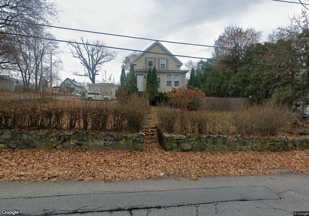
157 Sladen St Dracut, MA 01826
Estimated Value: $546,000 - $665,000
3
Beds
1
Bath
1,827
Sq Ft
$319/Sq Ft
Est. Value
About This Home
This home is located at 157 Sladen St, Dracut, MA 01826 and is currently estimated at $582,195, approximately $318 per square foot. 157 Sladen St is a home located in Middlesex County with nearby schools including George H. Englesby Elementary School, Richardson Middle School, and Dracut Senior High School.
Ownership History
Date
Name
Owned For
Owner Type
Purchase Details
Closed on
May 20, 2010
Sold by
Milt Peter
Bought by
Milt Peter and Milt Lorianne M
Current Estimated Value
Home Financials for this Owner
Home Financials are based on the most recent Mortgage that was taken out on this home.
Original Mortgage
$227,625
Outstanding Balance
$153,907
Interest Rate
5.23%
Estimated Equity
$428,288
Purchase Details
Closed on
Feb 25, 2005
Sold by
Bean Marc W and Bean Patricia M
Bought by
Walsh Lorianne M and Milt Peter A
Home Financials for this Owner
Home Financials are based on the most recent Mortgage that was taken out on this home.
Original Mortgage
$240,000
Interest Rate
5.73%
Mortgage Type
Purchase Money Mortgage
Purchase Details
Closed on
Sep 1, 1998
Sold by
Crawson Robbie L
Bought by
Bean Marc W and Bean Patricia A
Purchase Details
Closed on
Sep 7, 1995
Sold by
Horan Stephen L and Horan Gail F
Bought by
Crawson Robbie L
Create a Home Valuation Report for This Property
The Home Valuation Report is an in-depth analysis detailing your home's value as well as a comparison with similar homes in the area
Home Values in the Area
Average Home Value in this Area
Purchase History
| Date | Buyer | Sale Price | Title Company |
|---|---|---|---|
| Milt Peter | -- | -- | |
| Walsh Lorianne M | $300,000 | -- | |
| Bean Marc W | $132,000 | -- | |
| Crawson Robbie L | $110,000 | -- |
Source: Public Records
Mortgage History
| Date | Status | Borrower | Loan Amount |
|---|---|---|---|
| Open | Milt Peter | $227,625 | |
| Previous Owner | Walsh Lorianne M | $240,000 | |
| Previous Owner | Crawson Robbie L | $20,000 | |
| Previous Owner | Crawson Robbie L | $143,000 |
Source: Public Records
Tax History Compared to Growth
Tax History
| Year | Tax Paid | Tax Assessment Tax Assessment Total Assessment is a certain percentage of the fair market value that is determined by local assessors to be the total taxable value of land and additions on the property. | Land | Improvement |
|---|---|---|---|---|
| 2025 | $4,745 | $468,900 | $197,100 | $271,800 |
| 2024 | $4,727 | $452,300 | $187,700 | $264,600 |
| 2023 | $4,519 | $390,200 | $163,200 | $227,000 |
| 2022 | $4,534 | $368,900 | $148,300 | $220,600 |
| 2021 | $4,370 | $335,900 | $134,800 | $201,100 |
| 2020 | $21,033 | $328,100 | $130,900 | $197,200 |
| 2019 | $4,015 | $292,000 | $124,600 | $167,400 |
| 2018 | $19,219 | $279,000 | $124,600 | $154,400 |
| 2017 | $3,727 | $279,000 | $124,600 | $154,400 |
| 2016 | $3,608 | $243,100 | $119,800 | $123,300 |
| 2015 | $3,456 | $231,500 | $119,800 | $111,700 |
| 2014 | $3,241 | $223,700 | $119,800 | $103,900 |
Source: Public Records
Map
Nearby Homes
- 100 Cass Ave Unit A13
- 20 Dean Ave
- 14 Louis Farm Rd Unit 14
- 37 Beaudry St
- 94 Hampson St
- 157 Old Rd
- 174 Old Rd
- 363 Hildreth St Unit 11
- 49 Sparks St
- 349 Hildreth St Unit 16
- 345 Hildreth St Unit 14
- 190 Old Rd
- 15 Louis Farm Rd Unit 15
- 81 Spring Park Ave
- 108 Billings St
- 195 Ludlam St
- 18 Stone St
- 2 Sutherland St
- 3 Hamel Place
- 101 Donohue Rd Unit 19