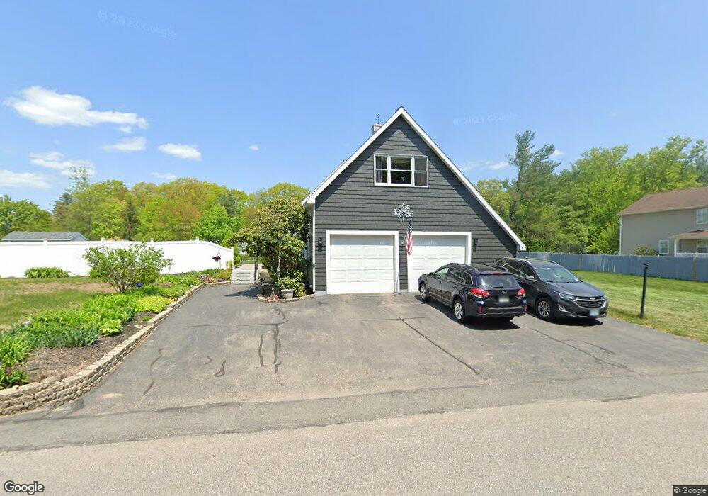
16 Anderson Ln Rochester, NH 03867
Estimated Value: $549,000 - $634,508
4
Beds
2
Baths
2,503
Sq Ft
$239/Sq Ft
Est. Value
About This Home
This home is located at 16 Anderson Ln, Rochester, NH 03867 and is currently estimated at $599,377, approximately $239 per square foot. 16 Anderson Ln is a home located in Strafford County with nearby schools including Chamberlain Street School, Rochester Middle School, and Spaulding High School.
Ownership History
Date
Name
Owned For
Owner Type
Purchase Details
Closed on
Feb 15, 2024
Sold by
Dyer Jeanne M
Bought by
Jeanne M Dyer Lt and Dyer
Current Estimated Value
Purchase Details
Closed on
Apr 6, 2007
Sold by
Chamberlain Invest Pro
Bought by
Perry Marshall B and Perry Jeanne M
Home Financials for this Owner
Home Financials are based on the most recent Mortgage that was taken out on this home.
Original Mortgage
$263,000
Interest Rate
6.25%
Mortgage Type
Purchase Money Mortgage
Create a Home Valuation Report for This Property
The Home Valuation Report is an in-depth analysis detailing your home's value as well as a comparison with similar homes in the area
Home Values in the Area
Average Home Value in this Area
Purchase History
| Date | Buyer | Sale Price | Title Company |
|---|---|---|---|
| Jeanne M Dyer Lt | -- | None Available | |
| Perry Marshall B | $281,700 | -- |
Source: Public Records
Mortgage History
| Date | Status | Borrower | Loan Amount |
|---|---|---|---|
| Previous Owner | Perry Marshall B | $255,000 | |
| Previous Owner | Perry Marshall B | $263,000 |
Source: Public Records
Tax History Compared to Growth
Tax History
| Year | Tax Paid | Tax Assessment Tax Assessment Total Assessment is a certain percentage of the fair market value that is determined by local assessors to be the total taxable value of land and additions on the property. | Land | Improvement |
|---|---|---|---|---|
| 2024 | $8,733 | $588,100 | $131,200 | $456,900 |
| 2023 | $8,221 | $319,400 | $42,000 | $277,400 |
| 2022 | $8,074 | $319,400 | $42,000 | $277,400 |
| 2021 | $7,873 | $319,400 | $42,000 | $277,400 |
| 2020 | $7,506 | $305,000 | $42,000 | $263,000 |
| 2019 | $7,595 | $305,000 | $42,000 | $263,000 |
| 2018 | $6,283 | $228,300 | $44,000 | $184,300 |
| 2017 | $6,011 | $228,300 | $44,000 | $184,300 |
| 2016 | $6,048 | $214,000 | $44,000 | $170,000 |
| 2015 | $6,024 | $214,000 | $44,000 | $170,000 |
| 2014 | $5,879 | $214,000 | $44,000 | $170,000 |
| 2013 | $5,770 | $218,900 | $63,500 | $155,400 |
| 2012 | $5,621 | $218,900 | $63,500 | $155,400 |
Source: Public Records
Map
Nearby Homes
- 68 Moose Ln
- 518 & 532 Portland St
- 22 Corson St
- 35 Franklin Heights
- 56 Chamberlain St
- 0 Franklin St Unit 55 4959653
- 616 Portland St Unit 75
- 32 Adams Ave
- 38 Western Ave
- 17 Maplewood Ave
- 3 Freedom Dr Unit 17
- 2 Freedom Dr
- 10 Lady Slipper Ct
- 19 Vernon Ave
- 10 Sarah Ct
- 524 Salmon Falls Rd
- 67 Winter St
- 859 Salmon Falls Rd
- 871 Salmon Falls Rd
- 10 Smoke St
- 0 Anderson Ln
- 20 Anderson Ln
- 121 Franklin St
- 123 Franklin St
- 100-29 Anderson Ln
- 119 Franklin St
- 24 Anderson Ln
- 00 Anderson Ln
- 113 Franklin St
- 23 Anderson Ln
- 111 Franklin St
- 125 Franklin St
- 120 Franklin St
- 30 Anderson Ln
- 16 Wentworth Ave
- 116 Franklin St
- 127 Franklin St
- 109 Franklin St
- 31 Anderson Ln
- 112 Franklin St