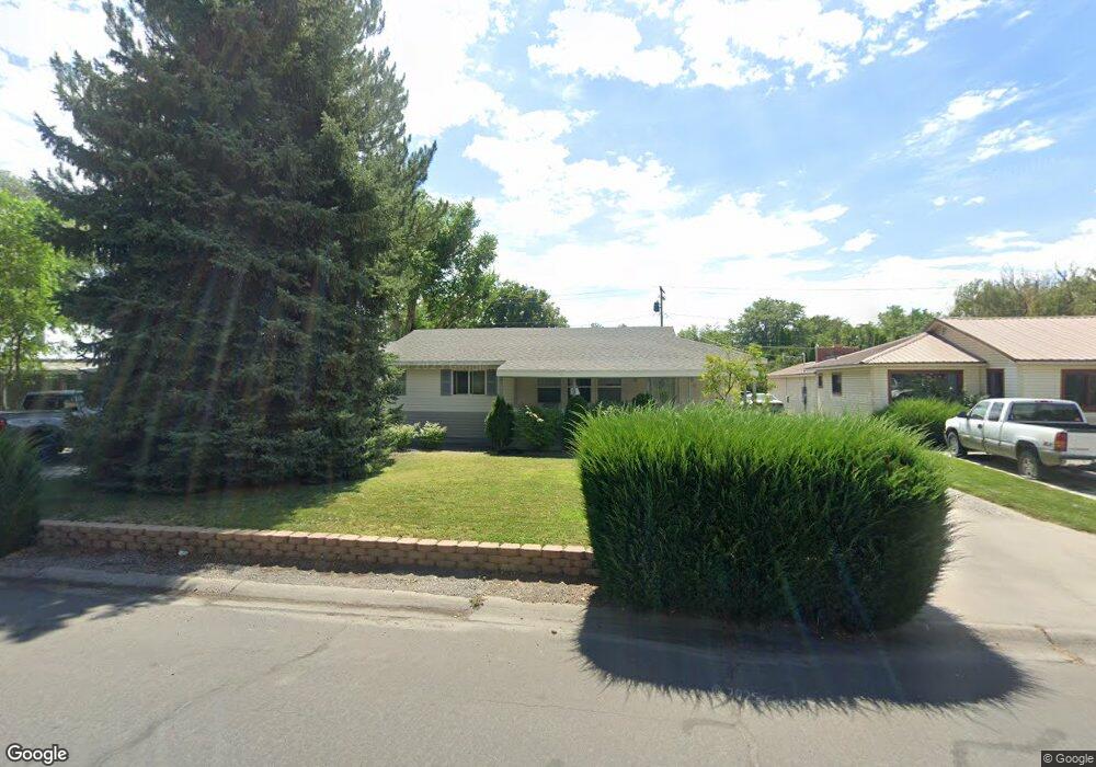
16 Columbia Way Montrose, CO 81401
Estimated Value: $338,000 - $359,000
3
Beds
1
Bath
1,660
Sq Ft
$211/Sq Ft
Est. Value
About This Home
This home is located at 16 Columbia Way, Montrose, CO 81401 and is currently estimated at $350,678, approximately $211 per square foot. 16 Columbia Way is a home located in Montrose County with nearby schools including Pomona Elementary School, Columbine Middle School, and Montrose High School.
Ownership History
Date
Name
Owned For
Owner Type
Purchase Details
Closed on
Mar 25, 1998
Sold by
Svaldi John and Svaldi Doris L
Bought by
Richmond Kenneth and Richmond Darla
Current Estimated Value
Purchase Details
Closed on
Oct 8, 1991
Sold by
Whisnant Jean D and Whisnant Vivian B
Bought by
Svaldi John and Svaldi Doris L
Purchase Details
Closed on
Nov 23, 1987
Sold by
West Charles E
Bought by
Whisnant Jean D and Whisnant Vivian B
Purchase Details
Closed on
May 25, 1978
Sold by
Ford Lee E and Ford Shirley G
Bought by
West Charles E and West Phebe K
Create a Home Valuation Report for This Property
The Home Valuation Report is an in-depth analysis detailing your home's value as well as a comparison with similar homes in the area
Home Values in the Area
Average Home Value in this Area
Purchase History
| Date | Buyer | Sale Price | Title Company |
|---|---|---|---|
| Richmond Kenneth | $98,000 | -- | |
| Svaldi John | $54,500 | -- | |
| Whisnant Jean D | $48,500 | -- | |
| West Charles E | $46,000 | -- |
Source: Public Records
Tax History Compared to Growth
Tax History
| Year | Tax Paid | Tax Assessment Tax Assessment Total Assessment is a certain percentage of the fair market value that is determined by local assessors to be the total taxable value of land and additions on the property. | Land | Improvement |
|---|---|---|---|---|
| 2024 | $1,530 | $21,490 | $3,150 | $18,340 |
| 2023 | $1,530 | $26,110 | $3,820 | $22,290 |
| 2022 | $1,224 | $17,790 | $2,780 | $15,010 |
| 2021 | $1,262 | $18,300 | $2,860 | $15,440 |
| 2020 | $1,031 | $15,370 | $2,470 | $12,900 |
| 2019 | $1,038 | $15,370 | $2,470 | $12,900 |
| 2018 | $848 | $12,250 | $1,990 | $10,260 |
| 2017 | $841 | $12,250 | $1,990 | $10,260 |
| 2016 | $789 | $11,680 | $2,010 | $9,670 |
| 2015 | $775 | $11,680 | $2,010 | $9,670 |
| 2014 | $671 | $10,820 | $2,010 | $8,810 |
Source: Public Records
Map
Nearby Homes
- 119 Akard Ave
- 103 Duncan Place
- 122 Spruce Dr
- TBD Montrose Dr Site C
- 535 S 11th St Unit 5
- 902 S Mesa Ave
- 1413 Chatam Dr
- 23 S 5th St
- 612 & 616 S 6th
- 909 S 10th St
- Lot 5 TBD E Oak Grove Rd
- TBD Lot 1 E Oak Grove Rd
- 0 E Oak Grove Rd
- Tract A & 3 E Oak Grove Rd
- Tract 3 E Oak Grove Rd
- Tract A, 3 Lot2 E Oak Grove Rd
- Tract A E Oak Grove Rd
- Lot 2 E Oak Grove Rd
- 814 S 7th St
- TBD S 4th St