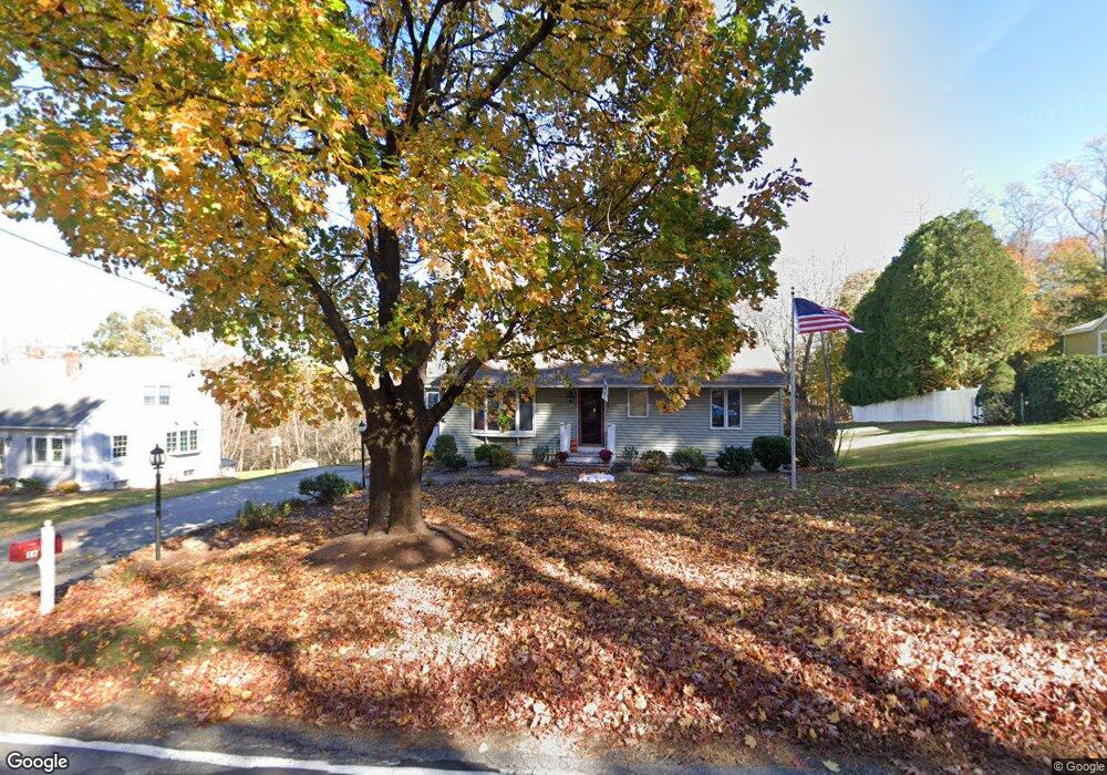
16 Kimball Rd Amesbury, MA 01913
Estimated Value: $530,000 - $568,000
1
Bed
1
Bath
1,280
Sq Ft
$430/Sq Ft
Est. Value
About This Home
This home is located at 16 Kimball Rd, Amesbury, MA 01913 and is currently estimated at $550,226, approximately $429 per square foot. 16 Kimball Rd is a home located in Essex County with nearby schools including Amesbury High School and Amesbury Seventh-Day Adventist School.
Ownership History
Date
Name
Owned For
Owner Type
Purchase Details
Closed on
Sep 30, 2014
Sold by
Morrill Ft
Bought by
Morrill-Faucher J M and Faucher Jeremy P
Current Estimated Value
Home Financials for this Owner
Home Financials are based on the most recent Mortgage that was taken out on this home.
Original Mortgage
$224,000
Outstanding Balance
$171,360
Interest Rate
4.12%
Mortgage Type
New Conventional
Estimated Equity
$378,866
Purchase Details
Closed on
Jun 7, 2010
Sold by
Morrill Sarah G
Bought by
Morrill Ft
Create a Home Valuation Report for This Property
The Home Valuation Report is an in-depth analysis detailing your home's value as well as a comparison with similar homes in the area
Home Values in the Area
Average Home Value in this Area
Purchase History
| Date | Buyer | Sale Price | Title Company |
|---|---|---|---|
| Morrill-Faucher J M | $280,000 | -- | |
| Morrill Ft | -- | -- |
Source: Public Records
Mortgage History
| Date | Status | Borrower | Loan Amount |
|---|---|---|---|
| Open | Morrill-Faucher J M | $224,000 | |
| Previous Owner | Morrill Ft | $88,236 |
Source: Public Records
Tax History Compared to Growth
Tax History
| Year | Tax Paid | Tax Assessment Tax Assessment Total Assessment is a certain percentage of the fair market value that is determined by local assessors to be the total taxable value of land and additions on the property. | Land | Improvement |
|---|---|---|---|---|
| 2025 | $7,445 | $486,600 | $265,900 | $220,700 |
| 2024 | $7,051 | $450,800 | $250,900 | $199,900 |
| 2023 | $6,833 | $418,200 | $218,300 | $199,900 |
| 2022 | $6,590 | $372,500 | $189,800 | $182,700 |
| 2021 | $6,114 | $335,000 | $146,600 | $188,400 |
| 2020 | $5,449 | $317,200 | $141,000 | $176,200 |
| 2019 | $5,426 | $295,400 | $141,000 | $154,400 |
| 2018 | $5,553 | $292,400 | $134,300 | $158,100 |
| 2017 | $5,253 | $263,300 | $134,300 | $129,000 |
| 2016 | $5,121 | $252,500 | $134,300 | $118,200 |
| 2015 | $4,987 | $242,800 | $134,300 | $108,500 |
| 2014 | $4,609 | $219,800 | $134,300 | $85,500 |
Source: Public Records
Map
Nearby Homes
- 1 Acadia Kimball Rd Unit 1
- 4 Acadia Kimball Rd
- 5 Moncrief St Unit 5
- 188 Lions Mouth Rd
- 20 Hillside Ct
- 31 Whitter Meadows Dr Unit 31
- 160 Haverhill Rd
- 49 W Greenwood St
- 1 Bisson Ln
- 4 Larnard Ct
- 10 Sharon Cir
- 13 Bailey Pond Ln Unit 13
- 93 Friend St
- 47 Cutter Ln Unit 47
- 4 Greenwood St
- 19 Cutter Ln Unit 19
- 8 Riverview Heights
- 3 B St
- 6 B St
- 16 Glen Devin St