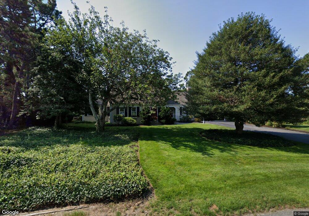
16 Lookout Rd Yarmouth Port, MA 02675
Yarmouth Port NeighborhoodEstimated Value: $1,019,000 - $1,110,000
4
Beds
4
Baths
2,442
Sq Ft
$437/Sq Ft
Est. Value
About This Home
This home is located at 16 Lookout Rd, Yarmouth Port, MA 02675 and is currently estimated at $1,066,453, approximately $436 per square foot. 16 Lookout Rd is a home located in Barnstable County with nearby schools including Dennis-Yarmouth Regional High School.
Ownership History
Date
Name
Owned For
Owner Type
Purchase Details
Closed on
Feb 4, 2016
Sold by
Ekholm Robert V and Ekholm Margaret A
Bought by
Ekholm Ft and Ekholm Robert V
Current Estimated Value
Purchase Details
Closed on
Sep 19, 2007
Sold by
Anne D Livermore Rt and Livermore Anne D
Bought by
Ekholm Margaret A and Ekholm Robert
Home Financials for this Owner
Home Financials are based on the most recent Mortgage that was taken out on this home.
Original Mortgage
$200,000
Interest Rate
6.63%
Mortgage Type
Purchase Money Mortgage
Purchase Details
Closed on
Jun 8, 2001
Sold by
Cronin James A and Cronin Bernice P
Bought by
Ann D Livermore Ret and Livermore Ann D
Purchase Details
Closed on
Nov 16, 1998
Sold by
Boyden Evelyn B
Bought by
Cronin James A and Cronin Bernice F
Home Financials for this Owner
Home Financials are based on the most recent Mortgage that was taken out on this home.
Original Mortgage
$85,000
Interest Rate
6.65%
Mortgage Type
Purchase Money Mortgage
Create a Home Valuation Report for This Property
The Home Valuation Report is an in-depth analysis detailing your home's value as well as a comparison with similar homes in the area
Home Values in the Area
Average Home Value in this Area
Purchase History
| Date | Buyer | Sale Price | Title Company |
|---|---|---|---|
| Ekholm Ft | -- | -- | |
| Ekholm Margaret A | $610,000 | -- | |
| Ann D Livermore Ret | $435,000 | -- | |
| Cronin James A | $275,000 | -- |
Source: Public Records
Mortgage History
| Date | Status | Borrower | Loan Amount |
|---|---|---|---|
| Previous Owner | Cronin James A | $100,000 | |
| Previous Owner | Cronin James A | $200,001 | |
| Previous Owner | Ekholm Margaret A | $200,000 | |
| Previous Owner | Cronin James A | $25,000 | |
| Previous Owner | Cronin James A | $85,000 |
Source: Public Records
Tax History Compared to Growth
Tax History
| Year | Tax Paid | Tax Assessment Tax Assessment Total Assessment is a certain percentage of the fair market value that is determined by local assessors to be the total taxable value of land and additions on the property. | Land | Improvement |
|---|---|---|---|---|
| 2025 | $6,498 | $917,800 | $238,600 | $679,200 |
| 2024 | $6,034 | $817,600 | $207,600 | $610,000 |
| 2023 | $6,100 | $752,100 | $195,600 | $556,500 |
| 2022 | $5,911 | $643,900 | $222,300 | $421,600 |
| 2021 | $5,724 | $598,700 | $212,100 | $386,600 |
| 2020 | $5,524 | $552,400 | $211,700 | $340,700 |
| 2019 | $5,170 | $511,900 | $211,700 | $300,200 |
| 2018 | $5,171 | $502,500 | $202,300 | $300,200 |
| 2017 | $5,035 | $502,500 | $202,300 | $300,200 |
| 2016 | $5,015 | $502,500 | $202,300 | $300,200 |
| 2015 | $5,280 | $525,900 | $202,300 | $323,600 |
Source: Public Records
Map
Nearby Homes
- 23 Dauphine Dr
- 2 Pine Grove
- 24 Minnetuxet Way
- 30 W Woods Cir Unit 30
- 30 W Woods
- 7 Forest Gate Unit 7
- 25 Oak Glen
- 25 Oak Glen Village Unit 25
- 371 Route 6a
- 17 Kates Path Unit A
- 228 Kates Path
- 43 Canterbury Rd
- 34 Kates Path
- 34 Kates Path Unit 34
- 50 John Hall Cartway
- 50 John Hall Cartway Unit 50
- 1 Barnacle Rd
- 42 John Hall Cartway Unit 42
- 64 Kates Path
- 933-935 W Yarmouth Rd
- 22 Lookout Rd
- 10 Lookout Rd
- 1 Dartmoor Way
- 5 Lookout Rd
- 28 Lookout Rd
- 26 Homers Dock Rd
- 29 Lookout Rd
- 26 Forewind Rd
- 9 Dartmoor Way
- 34 Lookout Rd
- 36 Homers Dock Rd
- 22 Homers Dock Rd
- 14 Forewind Rd
- 9 Thorwald Place
- 15 Forewind Rd
- 15A Thorwald Place
- 45 Lookout Rd
- 20 Mattis Dr
- 15 Thorwald Place Unit NA
- 10 Dartmoor Way