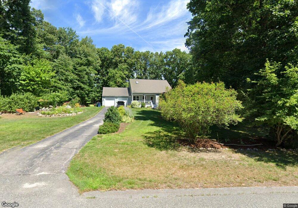
16 Stanley Rd Unit 1 Medway, MA 02053
Estimated Value: $752,411 - $827,000
4
Beds
2
Baths
2,020
Sq Ft
$389/Sq Ft
Est. Value
About This Home
This home is located at 16 Stanley Rd Unit 1, Medway, MA 02053 and is currently estimated at $786,603, approximately $389 per square foot. 16 Stanley Rd Unit 1 is a home located in Norfolk County with nearby schools including John D. McGovern Elementary School, Burke-Memorial Elementary, and Medway Middle School.
Ownership History
Date
Name
Owned For
Owner Type
Purchase Details
Closed on
May 17, 2017
Sold by
Segur Michael and Segur Judith A
Bought by
Segur Ret
Current Estimated Value
Purchase Details
Closed on
Nov 9, 2016
Sold by
Billings Sara and Billings Richard
Bought by
Segur Michael and Segur Judith A
Purchase Details
Closed on
Jun 15, 2016
Sold by
Usa Va
Bought by
Billings Sara
Purchase Details
Closed on
Apr 19, 2016
Sold by
Mcelveen 2Nd Aden J
Bought by
Usa Va
Purchase Details
Closed on
Jul 30, 2007
Sold by
Vouriotis June
Bought by
Mcelveen Aden J and Mcelveen Erin L
Home Financials for this Owner
Home Financials are based on the most recent Mortgage that was taken out on this home.
Original Mortgage
$380,828
Interest Rate
6.78%
Mortgage Type
VA
Create a Home Valuation Report for This Property
The Home Valuation Report is an in-depth analysis detailing your home's value as well as a comparison with similar homes in the area
Home Values in the Area
Average Home Value in this Area
Purchase History
| Date | Buyer | Sale Price | Title Company |
|---|---|---|---|
| Segur Ret | -- | -- | |
| Segur Michael | $444,000 | -- | |
| Billings Sara | $272,130 | -- | |
| Usa Va | -- | -- | |
| Mcelveen Aden J | $395,000 | -- |
Source: Public Records
Mortgage History
| Date | Status | Borrower | Loan Amount |
|---|---|---|---|
| Previous Owner | Mcelveen Aden J | $380,828 |
Source: Public Records
Tax History Compared to Growth
Tax History
| Year | Tax Paid | Tax Assessment Tax Assessment Total Assessment is a certain percentage of the fair market value that is determined by local assessors to be the total taxable value of land and additions on the property. | Land | Improvement |
|---|---|---|---|---|
| 2025 | $8,784 | $616,400 | $305,100 | $311,300 |
| 2024 | $8,876 | $616,400 | $305,100 | $311,300 |
| 2023 | $8,475 | $531,700 | $252,800 | $278,900 |
| 2022 | $8,485 | $501,200 | $224,500 | $276,700 |
| 2021 | $8,030 | $459,900 | $207,100 | $252,800 |
| 2020 | $7,705 | $440,300 | $191,900 | $248,400 |
| 2019 | $7,472 | $440,300 | $191,900 | $248,400 |
| 2018 | $7,583 | $429,400 | $183,200 | $246,200 |
| 2017 | $6,801 | $379,500 | $176,600 | $202,900 |
| 2016 | $6,755 | $373,000 | $170,100 | $202,900 |
| 2015 | $6,499 | $356,300 | $157,000 | $199,300 |
| 2014 | $6,396 | $339,500 | $157,100 | $182,400 |
Source: Public Records
Map
Nearby Homes
- 15 Broad Acres Farm Rd
- 12 Longmeadow Ln
- 78 Fisher St
- 4 Deerfield Rd
- 85 Fisher St
- 6 Freedom Trail
- 6 Rainbow Dr
- 116 Winthrop St
- 56 Paul Rd
- 5 Fales St
- 176 Main St Unit 3
- 220 Main St Unit 220
- 19 Sycamore Way Unit L40
- 39 West St
- 14 Heritage Dr
- 7 Hill St
- 28 Wellington St
- 36 Lovering St
- 22 Granite St
- 9 Tulip Way