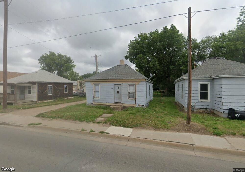
160 N Broadway Blvd Salina, KS 67401
Estimated Value: $67,120 - $126,000
2
Beds
1
Bath
858
Sq Ft
$106/Sq Ft
Est. Value
About This Home
This home is located at 160 N Broadway Blvd, Salina, KS 67401 and is currently estimated at $90,707, approximately $105 per square foot. 160 N Broadway Blvd is a home located in Saline County with nearby schools including Cottonwood Elementary School, Lakewood Middle School, and Salina High School Central.
Ownership History
Date
Name
Owned For
Owner Type
Purchase Details
Closed on
May 14, 2025
Sold by
Larry And Linda Mattison Trust and Mattison Larry D
Bought by
Mattison Joshua D and Mattison Carlie D
Current Estimated Value
Home Financials for this Owner
Home Financials are based on the most recent Mortgage that was taken out on this home.
Original Mortgage
$10,000
Outstanding Balance
$9,965
Interest Rate
6.64%
Mortgage Type
New Conventional
Estimated Equity
$80,742
Purchase Details
Closed on
Sep 22, 2009
Sold by
Farless Janice E and Farless Delbert
Bought by
Mattison Roger and Mattison Maureen
Create a Home Valuation Report for This Property
The Home Valuation Report is an in-depth analysis detailing your home's value as well as a comparison with similar homes in the area
Home Values in the Area
Average Home Value in this Area
Purchase History
| Date | Buyer | Sale Price | Title Company |
|---|---|---|---|
| Mattison Joshua D | -- | Land Title | |
| Mattison Roger | -- | -- |
Source: Public Records
Mortgage History
| Date | Status | Borrower | Loan Amount |
|---|---|---|---|
| Open | Mattison Joshua D | $10,000 |
Source: Public Records
Tax History Compared to Growth
Tax History
| Year | Tax Paid | Tax Assessment Tax Assessment Total Assessment is a certain percentage of the fair market value that is determined by local assessors to be the total taxable value of land and additions on the property. | Land | Improvement |
|---|---|---|---|---|
| 2025 | $234 | $1,658 | $845 | $813 |
| 2024 | $234 | $1,967 | $788 | $1,179 |
| 2023 | $234 | $2,186 | $912 | $1,274 |
| 2022 | $152 | $1,311 | $1,148 | $163 |
| 2021 | $198 | $1,672 | $826 | $846 |
| 2020 | $212 | $1,759 | $767 | $992 |
| 2019 | $187 | $2,024 | $407 | $1,617 |
| 2018 | $200 | $1,690 | $407 | $1,283 |
| 2017 | $0 | $1,276 | $407 | $869 |
| 2016 | $0 | $1,325 | $407 | $918 |
| 2015 | -- | $1,138 | $407 | $731 |
| 2013 | -- | $0 | $0 | $0 |
Source: Public Records
Map
Nearby Homes
- 118 S Chicago St
- 141 S Chicago St
- 110 N College Ave
- 214 S Clark St
- 610 State St
- B1 L2 Cedar Point Place
- B1 L4 Cedar Point Place
- B1 L13 Cedar Point Place
- B1 L1 Cedar Point Place
- B1 L12 Cedar Point Place
- B1 L3 Cedar Point Place
- 301 S Clark St
- 705 W Walnut St
- 604 W Walnut St
- 507 Park St
- 600 W Walnut St
- 152 S 10th St
- 158 S 10th St
- 335 Baker St
- 408 W Walnut St
- 158 N Broadway Blvd
- 162 N Broadway Blvd
- 156 N Broadway Blvd
- 1216 State St
- 154 N Broadway Blvd
- 166 N Broadway Blvd
- 152 N Broadway Blvd
- 1212 State St
- 168 N Broadway Blvd
- 1211 W Ash St
- 1210 State St
- 153 N Broadway Blvd
- 170 N Broadway Blvd
- 1207 W Ash St
- 1204 State St
- 127 N Chicago St
- 1305 W Ash St
- 1205 W Ash St
- 145 N Chicago St
- 1202 State St