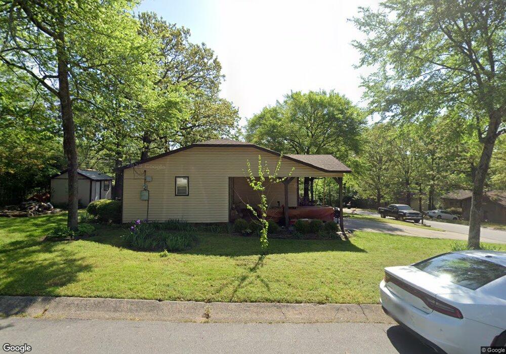
1601 Club Ln E Sherwood, AR 72120
Estimated Value: $133,022 - $165,000
--
Bed
3
Baths
1,311
Sq Ft
$117/Sq Ft
Est. Value
About This Home
This home is located at 1601 Club Ln E, Sherwood, AR 72120 and is currently estimated at $152,756, approximately $116 per square foot. 1601 Club Ln E is a home located in Pulaski County with nearby schools including Sherwood Elementary School, Sylvan Hills Middle School, and Sylvan Hills High School.
Ownership History
Date
Name
Owned For
Owner Type
Purchase Details
Closed on
Jan 13, 1999
Sold by
Fitzjerrell Robert D and Fitzjerrell Betty S
Bought by
Thomas Kevin W and Russell Sheri
Current Estimated Value
Home Financials for this Owner
Home Financials are based on the most recent Mortgage that was taken out on this home.
Original Mortgage
$64,966
Outstanding Balance
$14,939
Interest Rate
6.66%
Mortgage Type
FHA
Estimated Equity
$137,817
Create a Home Valuation Report for This Property
The Home Valuation Report is an in-depth analysis detailing your home's value as well as a comparison with similar homes in the area
Home Values in the Area
Average Home Value in this Area
Purchase History
| Date | Buyer | Sale Price | Title Company |
|---|---|---|---|
| Thomas Kevin W | $65,000 | -- |
Source: Public Records
Mortgage History
| Date | Status | Borrower | Loan Amount |
|---|---|---|---|
| Open | Thomas Kevin W | $64,966 |
Source: Public Records
Tax History Compared to Growth
Tax History
| Year | Tax Paid | Tax Assessment Tax Assessment Total Assessment is a certain percentage of the fair market value that is determined by local assessors to be the total taxable value of land and additions on the property. | Land | Improvement |
|---|---|---|---|---|
| 2025 | $1,086 | $23,285 | $2,800 | $20,485 |
| 2024 | $996 | $23,285 | $2,800 | $20,485 |
| 2023 | $996 | $23,285 | $2,800 | $20,485 |
| 2022 | $1,085 | $23,285 | $2,800 | $20,485 |
| 2021 | $999 | $17,370 | $3,700 | $13,670 |
| 2020 | $619 | $17,370 | $3,700 | $13,670 |
| 2019 | $619 | $17,370 | $3,700 | $13,670 |
| 2018 | $644 | $17,370 | $3,700 | $13,670 |
| 2017 | $598 | $17,370 | $3,700 | $13,670 |
| 2016 | $556 | $15,940 | $4,000 | $11,940 |
| 2015 | $810 | $15,940 | $4,000 | $11,940 |
| 2014 | $810 | $15,940 | $4,000 | $11,940 |
Source: Public Records
Map
Nearby Homes
- +/- 8.16 Acres Windchime Ave
- 1301 Stafford Rd
- 1300 Stafford Rd
- 11 Daniel Dr
- 619 Newcastle Dr
- 1800 Palomino Dr
- 609 Newcastle Dr
- 626 Newcastle Dr
- 622 Newcastle Dr
- 618 & 620 Newcastle Dr
- 1415 Stafford Rd
- 610 Newcastle Dr
- 1419 Stafford Rd
- 615 & 617 Brierly Dr
- 615 Brierly Dr
- 1423 Stafford Rd
- 1501 Stafford Rd
- 8000 Pinto Trail
- +/- 21.56 Acres Stafford Rd
- 4636 Brandywine Cove
- 1605 Club Ln E
- 1600 Windchime Ave
- 7615 Club Ln
- 7611 Club Ln
- 1609 Club Ln E
- 1600 Club Ln E
- 1604 Windchime Ave
- 1604 Club Ln E
- 7619 Club Ln
- 7607 Club Ln
- 1608 Windchime Ave
- 1613 Club Ln E
- 1608 Club Ln E
- 7623 Club Ln
- 7603 Club Ln
- 7524 Club Ln
- 1612 Windchime Ave
- 7701 Club Ln
- 1601 Windchime Ave
- 7523 Club Ln