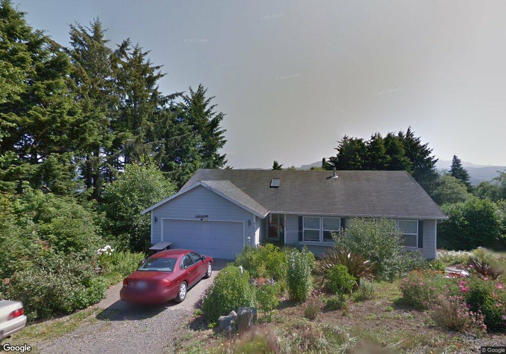
1602 SE Port Dr Lincoln City, OR 97367
Estimated Value: $474,000 - $573,720
2
Beds
2
Baths
1,380
Sq Ft
$385/Sq Ft
Est. Value
About This Home
This home is located at 1602 SE Port Dr, Lincoln City, OR 97367 and is currently estimated at $531,573, approximately $385 per square foot. 1602 SE Port Dr is a home located in Lincoln County with nearby schools including Taft Elementary School, Oceanlake Elementary School, and Taft High School.
Ownership History
Date
Name
Owned For
Owner Type
Purchase Details
Closed on
Nov 13, 2009
Sold by
Shirley Mary Elizabeth and Shirley Melvin V
Bought by
Shirley Mary Elizabeth and Shirley Melvin
Current Estimated Value
Home Financials for this Owner
Home Financials are based on the most recent Mortgage that was taken out on this home.
Original Mortgage
$226,393
Interest Rate
4.83%
Mortgage Type
FHA
Purchase Details
Closed on
Jul 14, 2005
Sold by
Shirley Mary Elizabeth and Dehkordi Mary Elizabeth
Bought by
Shirley Mary Elizabeth and Shirley Melvin
Create a Home Valuation Report for This Property
The Home Valuation Report is an in-depth analysis detailing your home's value as well as a comparison with similar homes in the area
Home Values in the Area
Average Home Value in this Area
Purchase History
| Date | Buyer | Sale Price | Title Company |
|---|---|---|---|
| Shirley Mary Elizabeth | -- | First American | |
| Shirley Mary Elizabeth | -- | -- |
Source: Public Records
Mortgage History
| Date | Status | Borrower | Loan Amount |
|---|---|---|---|
| Closed | Shirley Mary Elizabeth | $226,393 |
Source: Public Records
Tax History Compared to Growth
Tax History
| Year | Tax Paid | Tax Assessment Tax Assessment Total Assessment is a certain percentage of the fair market value that is determined by local assessors to be the total taxable value of land and additions on the property. | Land | Improvement |
|---|---|---|---|---|
| 2024 | $4,221 | $245,830 | -- | -- |
| 2023 | $4,105 | $238,670 | $0 | $0 |
| 2022 | $3,990 | $231,720 | $0 | $0 |
| 2021 | $3,802 | $224,980 | $0 | $0 |
| 2020 | $3,714 | $218,430 | $0 | $0 |
| 2019 | $3,588 | $212,070 | $0 | $0 |
| 2018 | $3,507 | $205,900 | $0 | $0 |
| 2017 | $3,357 | $199,910 | $0 | $0 |
| 2016 | $3,142 | $194,090 | $0 | $0 |
| 2015 | $3,078 | $188,440 | $0 | $0 |
| 2014 | $2,973 | $182,960 | $0 | $0 |
| 2013 | -- | $177,640 | $0 | $0 |
Source: Public Records
Map
Nearby Homes
- 0 SE Quay Ave Unit 777055144
- TL 6300 SE Quay Place
- 6300 SE Quay Place
- 3400 SE Port Dr
- 1800 BLk SE Oar Dr Unit TL 4100
- 1851 SE Oar Dr
- 1219 SE Oar Ave
- T/L 500 SE 14th St
- Lot 6 SE Marine Ave
- 1496 SE Marine Ave
- 1453 SE Marine Ave
- 1502 SE Marine Ave
- 1455 SE Marine Ave
- 2016 SE 8th St
- TL1508 + NE East Devils Lake Rd
- 720 SE Quay Ave
- 1218 SW 16th St
- 541 SE Oar Ave
- 520 SE Quay Ave
- 1423 SE 23rd Dr
- 1602 SE Port Dr
- TL 6100 SE Quay Place
- 1642 SE Port Dr
- T/L 4500 SE Port Ave
- 1505 SE Quay Place
- 1500 Blk Quay Place
- 0 SE Quay Ave Unit 4-3328
- 0 SE Quay Ave Unit 728601
- 0 SE Quay Ave Unit 6100 19692000
- 0 SE Quay Ave Unit 22 19363453
- 0 SE Quay Ave
- 1660 SE Port Dr
- 0 Lot Se Port Dr Unit 20586649
- 1554 SE Port Dr
- 1720 SE Oar Dr
- 1540 SE Oar Ave
- 1710 SE Port Dr
- 1636 SE Oar Dr
- 1626 SE Oar Dr
- 0 SE Quay Place Unit 331397