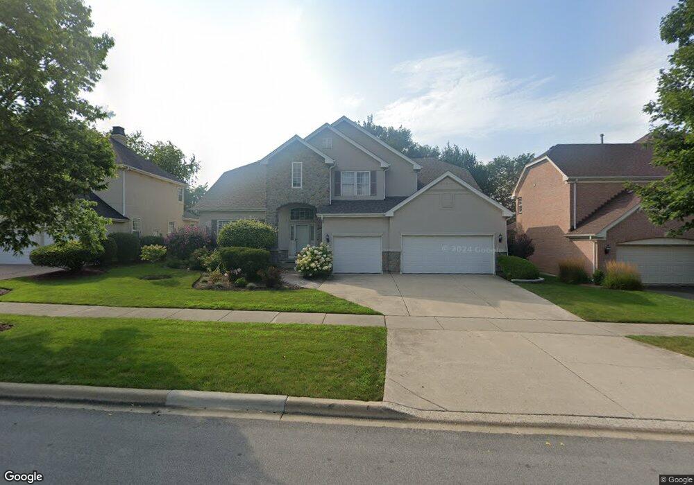
1604 Saint Andrew Dr Vernon Hills, IL 60061
Gregg's Landing NeighborhoodEstimated Value: $789,000 - $857,000
--
Bed
4
Baths
2,896
Sq Ft
$286/Sq Ft
Est. Value
About This Home
This home is located at 1604 Saint Andrew Dr, Vernon Hills, IL 60061 and is currently estimated at $827,974, approximately $285 per square foot. 1604 Saint Andrew Dr is a home located in Lake County with nearby schools including Hawthorn Elementary School North, Hawthorn School Of Dual Language, and Hawthorn Middle School North.
Ownership History
Date
Name
Owned For
Owner Type
Purchase Details
Closed on
Jul 2, 2001
Sold by
Centex Homes
Bought by
Kurup Parvathy D and Kurup Govinda N
Current Estimated Value
Home Financials for this Owner
Home Financials are based on the most recent Mortgage that was taken out on this home.
Original Mortgage
$487,500
Interest Rate
7.03%
Mortgage Type
Stand Alone First
Purchase Details
Closed on
Jun 30, 1998
Sold by
Rembrandt Homes Inc
Bought by
National Model Homes Inc
Home Financials for this Owner
Home Financials are based on the most recent Mortgage that was taken out on this home.
Original Mortgage
$867,000
Interest Rate
8.15%
Create a Home Valuation Report for This Property
The Home Valuation Report is an in-depth analysis detailing your home's value as well as a comparison with similar homes in the area
Home Values in the Area
Average Home Value in this Area
Purchase History
| Date | Buyer | Sale Price | Title Company |
|---|---|---|---|
| Kurup Parvathy D | $520,000 | -- | |
| National Model Homes Inc | $867,000 | Ticor Title |
Source: Public Records
Mortgage History
| Date | Status | Borrower | Loan Amount |
|---|---|---|---|
| Previous Owner | Kurup Parvathy D | $487,500 | |
| Previous Owner | National Model Homes Inc | $867,000 |
Source: Public Records
Tax History Compared to Growth
Tax History
| Year | Tax Paid | Tax Assessment Tax Assessment Total Assessment is a certain percentage of the fair market value that is determined by local assessors to be the total taxable value of land and additions on the property. | Land | Improvement |
|---|---|---|---|---|
| 2024 | $17,299 | $209,749 | $60,450 | $149,299 |
| 2023 | $16,647 | $193,459 | $55,755 | $137,704 |
| 2022 | $16,647 | $189,340 | $53,590 | $135,750 |
| 2021 | $15,927 | $185,264 | $52,436 | $132,828 |
| 2020 | $15,346 | $182,149 | $51,554 | $130,595 |
| 2019 | $14,959 | $180,417 | $51,064 | $129,353 |
| 2018 | $16,976 | $206,711 | $59,189 | $147,522 |
| 2017 | $16,712 | $200,185 | $57,320 | $142,865 |
| 2016 | $16,024 | $189,803 | $54,347 | $135,456 |
| 2015 | $15,775 | $177,402 | $50,796 | $126,606 |
| 2014 | $15,681 | $172,443 | $50,113 | $122,330 |
| 2012 | $15,162 | $173,939 | $50,548 | $123,391 |
Source: Public Records
Map
Nearby Homes
- 1688 Saint Andrew Dr
- 1290 Butterfield Rd
- 1726 Shoal Creek Terrace
- 900 S Butterfield Rd
- 1654 Pebble Beach Way
- 608 Sycamore St
- 1255 Huntington Dr
- 20 Echo Ct Unit 3
- 11 Echo Ct Unit 12
- 15 Echo Ct Unit 8
- 4 Parkside Ct Unit 12
- 31 Washington Blvd Unit 108
- 1028 Cumberland Ct
- 640 Allanson Rd
- 1969 Royal Birkdale Dr
- 422 Shadow Creek Dr
- 15 Crestview Ln Unit 4
- 1620 Nicklaus Ct
- 1939 Lake Charles Dr
- 240 Southwick Ct Unit 52
- 1594 Saint Andrew Dr
- 1624 Saint Andrew Dr
- 1634 Saint Andrew Dr
- 1644 Saint Andrew Dr
- 1652 Saint Andrew Dr
- 1656 Saint Andrew Dr
- 1660 Saint Andrew Dr
- 1660 Saint Andrew Dr
- 1666 Saint Andrew Dr
- 1655 Stanwich Rd
- 426 Camargo Ct
- 1674 Saint Andrew Dr
- 414 Camargo Ct
- 1680 Saint Andrew Dr
- 425 Camargo Ct
- 1654 Stanwich Rd
- 1661 Stanwich Rd
- 1686 Saint Andrew Dr
- 402 Camargo Ct
- 1659 Saint Andrew Dr