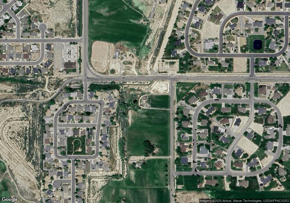
16055 6700 Rd Montrose, CO 81401
Estimated Value: $552,000 - $698,246
4
Beds
2
Baths
3,111
Sq Ft
$205/Sq Ft
Est. Value
About This Home
This home is located at 16055 6700 Rd, Montrose, CO 81401 and is currently estimated at $638,812, approximately $205 per square foot. 16055 6700 Rd is a home located in Montrose County with nearby schools including Cottonwood Elementary School, Centennial Middle School, and Montrose High School.
Ownership History
Date
Name
Owned For
Owner Type
Purchase Details
Closed on
Nov 20, 2009
Sold by
Deutsch Bank Trust
Bought by
Sanders Benjamin C
Current Estimated Value
Home Financials for this Owner
Home Financials are based on the most recent Mortgage that was taken out on this home.
Original Mortgage
$201,286
Outstanding Balance
$130,285
Interest Rate
4.83%
Estimated Equity
$508,527
Purchase Details
Closed on
Sep 9, 2009
Sold by
Kirby Stephen E and Kirby Diana S
Bought by
National City Bank
Purchase Details
Closed on
Jan 28, 1992
Sold by
Brown Gale N and Brown Wanda S
Bought by
Kirby Stephen E and Kirby Diana S
Create a Home Valuation Report for This Property
The Home Valuation Report is an in-depth analysis detailing your home's value as well as a comparison with similar homes in the area
Home Values in the Area
Average Home Value in this Area
Purchase History
| Date | Buyer | Sale Price | Title Company |
|---|---|---|---|
| Sanders Benjamin C | $205,000 | None Available | |
| National City Bank | $100,000 | None Available | |
| Kirby Stephen E | -- | -- |
Source: Public Records
Mortgage History
| Date | Status | Borrower | Loan Amount |
|---|---|---|---|
| Open | Sanders Benjamin C | $201,286 |
Source: Public Records
Tax History Compared to Growth
Tax History
| Year | Tax Paid | Tax Assessment Tax Assessment Total Assessment is a certain percentage of the fair market value that is determined by local assessors to be the total taxable value of land and additions on the property. | Land | Improvement |
|---|---|---|---|---|
| 2024 | $2,540 | $35,240 | $7,520 | $27,720 |
| 2023 | $2,540 | $40,330 | $8,480 | $31,850 |
| 2022 | $1,941 | $27,810 | $6,270 | $21,540 |
| 2021 | $2,006 | $28,710 | $6,530 | $22,180 |
| 2020 | $1,613 | $23,730 | $5,930 | $17,800 |
| 2019 | $1,624 | $23,730 | $5,930 | $17,800 |
| 2018 | $1,451 | $20,670 | $4,880 | $15,790 |
| 2017 | $1,440 | $20,670 | $4,880 | $15,790 |
| 2016 | $1,357 | $19,810 | $4,630 | $15,180 |
| 2015 | $1,333 | $19,810 | $4,630 | $15,180 |
| 2014 | $1,151 | $18,280 | $4,440 | $13,840 |
Source: Public Records
Map
Nearby Homes
- TBD Lot 3 E Oak Grove Rd
- TBD Lot 2 E Oak Grove Rd
- Lot 23 Glen Eagle Dr
- 2700 Peyton Dr
- 2709 Glen Mor Dr
- 2648 Virginia Ln
- 3004 Silver Fox Dr
- 2941 Lost Creek Rd N
- 1997 Sara E Ln
- 2710 Cirque Way
- 1987 Sara E Ln
- 3161 Silver Fox Dr
- 2536 Bridges Cir
- 2796 Matie Ln
- 2837 Outlook Rd
- Lot 10 Bridges Dr
- 2691 Red Cliff Cir
- 2132 Patriot Ct
- 2869 Cimarron St
- 3011 Fortress Cir
- TBD Lot 4 E Oak Grove Rd
- TBD LOT 7 E Oak Grove Rd
- 2401 Glenhaven Dr
- 2417 Glenhaven Dr
- 2425 Glenhaven Dr
- 2300 Glenview Dr
- 2433 Glenhaven Dr
- 3240 Monte Vista Cir
- 3240 Monte Vista Cir Unit Monte Vista Subdivis
- 3232 Monte Vista Cir
- 3248 Monte Vista Cir
- 3256 Monte Vista Cir
- 2308 Glenview Dr
- 2501 Glenhaven Dr
- 2412 Glenhaven Dr
- 2509 Glenhaven Dr
- 0 Glen Oak Dr Unit 755988
- 0 Glen Oak Dr Unit 749119
- 0 Glen Oak Dr Unit 598154
- 0 Glen Oak Dr Unit 606149
