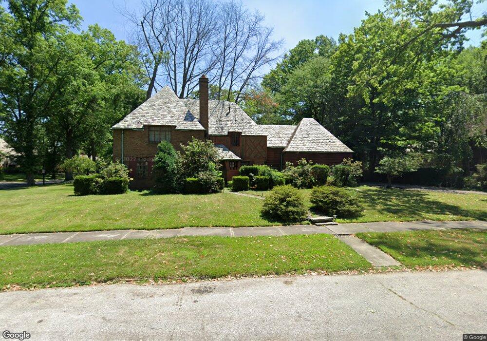
16070 Henley Rd Cleveland, OH 44112
Estimated Value: $232,000 - $257,184
3
Beds
3
Baths
2,257
Sq Ft
$111/Sq Ft
Est. Value
About This Home
This home is located at 16070 Henley Rd, Cleveland, OH 44112 and is currently estimated at $250,046, approximately $110 per square foot. 16070 Henley Rd is a home located in Cuyahoga County with nearby schools including Shaw High School, Apex Academy, and Lutheran High School East.
Ownership History
Date
Name
Owned For
Owner Type
Purchase Details
Closed on
Sep 25, 2015
Sold by
Wiggins Fred L
Bought by
East Cleveland Land Reutilization Progra
Current Estimated Value
Purchase Details
Closed on
May 31, 1984
Sold by
Mcmichael Carol
Bought by
Wiggins Fred
Purchase Details
Closed on
Sep 7, 1983
Bought by
Mcmichael Carol
Purchase Details
Closed on
Aug 10, 1982
Bought by
Adm Veterans Affairs
Purchase Details
Closed on
Jul 27, 1979
Sold by
Gabrovsek Frank V
Bought by
Flannary Joseph R
Purchase Details
Closed on
Mar 26, 1979
Sold by
Gabrovsek Frank V and Gabrovsek J
Bought by
Gabrovsek Frank
Purchase Details
Closed on
Jan 1, 1975
Bought by
Gabrovsek Frank and Gabrovsek J
Create a Home Valuation Report for This Property
The Home Valuation Report is an in-depth analysis detailing your home's value as well as a comparison with similar homes in the area
Home Values in the Area
Average Home Value in this Area
Purchase History
| Date | Buyer | Sale Price | Title Company |
|---|---|---|---|
| East Cleveland Land Reutilization Progra | $22,198 | Commonwealth Land Title Ins | |
| Wiggins Fred | $92,500 | -- | |
| Mcmichael Carol | -- | -- | |
| Adm Veterans Affairs | -- | -- | |
| Cardinal Fed S& L Assoc | -- | -- | |
| Flannary Joseph R | $83,500 | -- | |
| Gabrovsek Frank | -- | -- | |
| Gabrovsek Frank | -- | -- |
Source: Public Records
Tax History Compared to Growth
Tax History
| Year | Tax Paid | Tax Assessment Tax Assessment Total Assessment is a certain percentage of the fair market value that is determined by local assessors to be the total taxable value of land and additions on the property. | Land | Improvement |
|---|---|---|---|---|
| 2024 | $4,421 | $79,940 | $12,215 | $67,725 |
| 2023 | $3,642 | $49,080 | $9,630 | $39,450 |
| 2022 | $3,666 | $49,070 | $9,630 | $39,450 |
| 2021 | $3,635 | $49,070 | $9,630 | $39,450 |
| 2020 | $3,557 | $45,010 | $8,820 | $36,190 |
| 2019 | $3,719 | $128,600 | $25,200 | $103,400 |
| 2018 | $3,702 | $45,010 | $8,820 | $36,190 |
| 2017 | $3,436 | $44,600 | $5,080 | $39,520 |
| 2016 | $3,410 | $44,600 | $5,080 | $39,520 |
| 2015 | $8,554 | $44,600 | $5,080 | $39,520 |
| 2014 | $8,554 | $52,470 | $5,990 | $46,480 |
Source: Public Records
Map
Nearby Homes
- 2067 Mount Vernon Blvd
- 15959 Glynn Rd
- 2186 Mount Vernon Blvd
- 0 Wyatt Rd
- 16252 Oakhill Rd
- 15724 Wyatt Rd
- 16263 Oakhill Rd
- 15908 Hazel Rd
- 2188 N Taylor Rd
- 2256 N Taylor Rd
- 2090 Newbury Dr
- 2195 N Taylor Rd
- 1148 Rutherford Rd
- 1073 Hereford Rd
- 15703 Hazel Rd
- 2257 N Taylor Rd
- 2145 N Taylor Rd
- 2137 N Taylor Rd
- 3153 Eastwick Dr
- 1159 Brandon Rd
- 16200 Brewster Rd
- 16058 Henley Rd
- 16224 Brewster Rd
- 16088 Brewster Rd
- 16050 Henley Rd
- 16217 Cleviden Rd
- 16165 Brewster Rd
- 16233 Cleviden Rd
- 16049 Henley Rd
- 16141 Brewster Rd
- 16201 Brewster Rd
- 16064 Brewster Rd
- 16201 Cleviden Rd
- 16117 Brewster Rd
- 16038 Henley Rd
- 16225 Brewster Rd
- 16185 Cleviden Rd
- 16035 Henley Rd
- 16089 Brewster Rd
- 16249 Brewster Rd