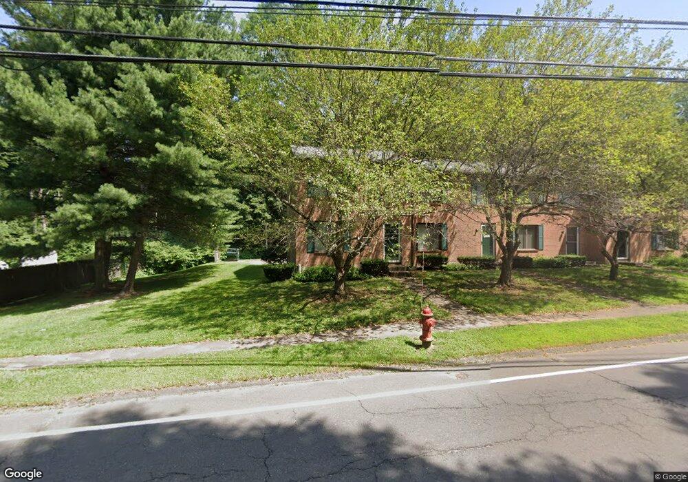
161 New Britain Ave Unionville, CT 06085
Estimated Value: $216,000 - $272,000
2
Beds
1
Bath
960
Sq Ft
$247/Sq Ft
Est. Value
About This Home
This home is located at 161 New Britain Ave, Unionville, CT 06085 and is currently estimated at $236,906, approximately $246 per square foot. 161 New Britain Ave is a home located in Hartford County with nearby schools including Union School, West Woods Upper Elementary School, and Irving A. Robbins Middle School.
Ownership History
Date
Name
Owned For
Owner Type
Purchase Details
Closed on
May 21, 2018
Sold by
Batista Carlos M
Bought by
Couto Elisa M and Lopes-Docouto Carlos
Current Estimated Value
Purchase Details
Closed on
Jun 25, 1997
Sold by
Degroff Adriance I
Bought by
Ohare Mark C
Home Financials for this Owner
Home Financials are based on the most recent Mortgage that was taken out on this home.
Original Mortgage
$40,000
Interest Rate
7.81%
Mortgage Type
Unknown
Create a Home Valuation Report for This Property
The Home Valuation Report is an in-depth analysis detailing your home's value as well as a comparison with similar homes in the area
Home Values in the Area
Average Home Value in this Area
Purchase History
| Date | Buyer | Sale Price | Title Company |
|---|---|---|---|
| Couto Elisa M | $180,000 | -- | |
| Ohare Mark C | $56,000 | -- |
Source: Public Records
Mortgage History
| Date | Status | Borrower | Loan Amount |
|---|---|---|---|
| Previous Owner | Ohare Mark C | $40,000 |
Source: Public Records
Tax History Compared to Growth
Tax History
| Year | Tax Paid | Tax Assessment Tax Assessment Total Assessment is a certain percentage of the fair market value that is determined by local assessors to be the total taxable value of land and additions on the property. | Land | Improvement |
|---|---|---|---|---|
| 2025 | $2,339 | $87,850 | $0 | $87,850 |
| 2024 | $2,236 | $87,850 | $0 | $87,850 |
| 2023 | $2,127 | $87,850 | $0 | $87,850 |
| 2022 | $2,204 | $75,170 | $0 | $75,170 |
| 2021 | $2,166 | $75,170 | $0 | $75,170 |
| 2020 | $2,103 | $75,170 | $0 | $75,170 |
| 2019 | $2,103 | $75,170 | $0 | $75,170 |
| 2018 | $2,043 | $75,170 | $0 | $75,170 |
| 2017 | $2,088 | $78,260 | $0 | $78,260 |
| 2016 | $2,018 | $78,260 | $0 | $78,260 |
| 2015 | $1,957 | $78,260 | $0 | $78,260 |
| 2014 | $1,913 | $78,260 | $0 | $78,260 |
Source: Public Records
Map
Nearby Homes
- 243 New Britain Ave Unit 243
- 267 New Britain Ave
- 55 Depot Place
- 1622 Farmington Ave Unit 4
- 31 Railroad Ave
- 54 Westview Terrace
- 27 Westview Terrace
- 115 W Avon Rd
- 6 Burlington Rd
- 94 Sanford Ave
- 20 Briarwood Rd
- 3 Heritage Dr
- 94 Perry St
- 148 River Rd
- 27 Sherman Ave
- 22 Heritage Dr Unit 22
- 54 Pinewood Dr
- 2 Muirfield Ln
- 14 Springwood Rd
- 49 Northwoods Rd
- 163 New Britain Ave
- 163 New Britain Ave Unit 163
- 169 New Britain Ave
- 167 New Britain Ave
- 167 New Britain Ave Unit 167
- 165 New Britain Ave
- 181 New Britain Ave
- 183 New Britain Ave
- 179 New Britain Ave
- 177 New Britain Ave
- 175 New Britain Ave
- 179 New Britain Ave Unit 179
- 175 New Britain Ave Unit 175
- 155 New Britain Ave
- 153 New Britain Ave(155)
- 153 New Britain Ave
- 144 New Britain Ave
- 189 New Britain Ave
- 147 New Britain Ave Unit 149
- 143 New Britain Ave