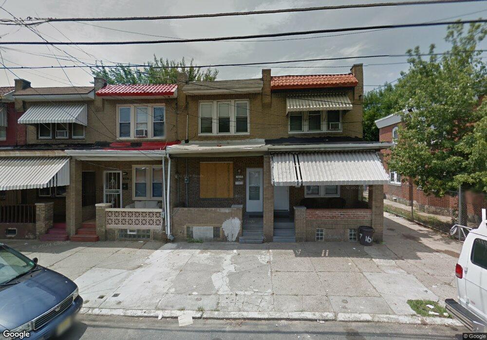
1619 Norris St Camden, NJ 08104
Whitman Park NeighborhoodEstimated Value: $102,000 - $129,000
3
Beds
1
Bath
1,120
Sq Ft
$102/Sq Ft
Est. Value
About This Home
This home is located at 1619 Norris St, Camden, NJ 08104 and is currently estimated at $114,000, approximately $101 per square foot. 1619 Norris St is a home located in Camden County with nearby schools including Camden High School and Freedom Prep Charter School.
Ownership History
Date
Name
Owned For
Owner Type
Purchase Details
Closed on
Sep 29, 2022
Sold by
S & G Investment Partners Llc
Bought by
S & G 2 Investment Partners Llc
Current Estimated Value
Purchase Details
Closed on
Aug 11, 2021
Sold by
Barzak Llc
Bought by
S & G Investment Partners Llc
Home Financials for this Owner
Home Financials are based on the most recent Mortgage that was taken out on this home.
Original Mortgage
$354,000
Interest Rate
3.11%
Mortgage Type
New Conventional
Purchase Details
Closed on
Nov 3, 2015
Sold by
Wooley Robert
Bought by
Barzak Llc
Purchase Details
Closed on
Apr 20, 2009
Sold by
Wooley Theodore
Bought by
Wooley Robert
Purchase Details
Closed on
Aug 20, 2008
Sold by
Demarco Thomas J
Bought by
Wooley Theodore
Purchase Details
Closed on
Mar 28, 2002
Sold by
Secr Housing And Urban Dev
Bought by
Demarco Thomas
Create a Home Valuation Report for This Property
The Home Valuation Report is an in-depth analysis detailing your home's value as well as a comparison with similar homes in the area
Home Values in the Area
Average Home Value in this Area
Purchase History
| Date | Buyer | Sale Price | Title Company |
|---|---|---|---|
| S & G 2 Investment Partners Llc | -- | -- | |
| S & G Investment Partners Llc | $385,000 | None Listed On Document | |
| Barzak Llc | $11,406 | Foundation Title Llc | |
| Wooley Robert | $27,600 | -- | |
| Wooley Theodore | $26,500 | -- | |
| Demarco Thomas | $11,402 | -- |
Source: Public Records
Mortgage History
| Date | Status | Borrower | Loan Amount |
|---|---|---|---|
| Previous Owner | S & G Investment Partners Llc | $354,000 |
Source: Public Records
Tax History Compared to Growth
Tax History
| Year | Tax Paid | Tax Assessment Tax Assessment Total Assessment is a certain percentage of the fair market value that is determined by local assessors to be the total taxable value of land and additions on the property. | Land | Improvement |
|---|---|---|---|---|
| 2025 | $1,013 | $28,600 | $5,200 | $23,400 |
| 2024 | $980 | $28,600 | $5,200 | $23,400 |
| 2023 | $980 | $28,600 | $5,200 | $23,400 |
| 2022 | $961 | $28,600 | $5,200 | $23,400 |
| 2021 | $955 | $28,600 | $5,200 | $23,400 |
| 2020 | $909 | $28,600 | $5,200 | $23,400 |
| 2019 | $871 | $28,600 | $5,200 | $23,400 |
| 2018 | $866 | $28,600 | $5,200 | $23,400 |
| 2017 | $845 | $28,600 | $5,200 | $23,400 |
| 2016 | $818 | $28,600 | $5,200 | $23,400 |
| 2015 | $788 | $28,600 | $5,200 | $23,400 |
| 2014 | $769 | $28,600 | $5,200 | $23,400 |
Source: Public Records
Map
Nearby Homes
- 1270 Jackson St
- 1281 Jackson St
- 1239 Jackson St
- 1240 Chase St
- 1257 Chase St
- 1613 Louis St
- 1218 Morton St
- 1216 Morton St
- 1575 Louis St
- 1606 Pershing St
- 1352 Carl Miller Blvd
- 1183 Chase St
- 1165 Chase St
- 1574 Mount Ephraim Ave
- 1165 Morton St
- 1275 Everett St
- 1139 Lowell St
- 1097 Morton St
- 1327 Lansdowne Ave
- 1476 Mount Ephraim Ave Unit 3
- 1621 Norris St
- 1617 Norris St
- 1623 Norris St
- 1625 Norris St
- 1611 Norris St
- 1281 Sheridan St
- 1627 Norris St
- 1609 Norris St
- 1279 Sheridan St
- 1607 Norris St
- 1275 Sheridan St
- 0 Sheridan & Warsaw Streets
- 1605 Norris St
- 1284 Jackson St
- 1282 Jackson St
- 1603 Norris St
- 1273 Sheridan St
- 1278 Jackson St
- 1271 Sheridan St
- 1303 Sheridan St