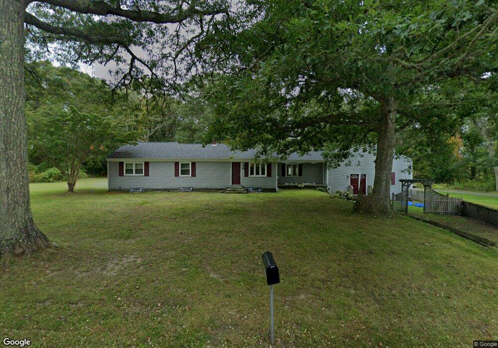
162 Colebrook Rd Little Compton, RI 02837
Estimated Value: $732,000 - $1,033,000
3
Beds
3
Baths
2,493
Sq Ft
$343/Sq Ft
Est. Value
About This Home
This home is located at 162 Colebrook Rd, Little Compton, RI 02837 and is currently estimated at $854,542, approximately $342 per square foot. 162 Colebrook Rd is a home located in Newport County with nearby schools including Wilbur & McMahon School.
Ownership History
Date
Name
Owned For
Owner Type
Purchase Details
Closed on
Jun 30, 2017
Sold by
Marion Deobrah A
Bought by
Executive Holdings Llc
Current Estimated Value
Home Financials for this Owner
Home Financials are based on the most recent Mortgage that was taken out on this home.
Original Mortgage
$150,000
Outstanding Balance
$124,469
Interest Rate
4.02%
Mortgage Type
Purchase Money Mortgage
Estimated Equity
$730,073
Create a Home Valuation Report for This Property
The Home Valuation Report is an in-depth analysis detailing your home's value as well as a comparison with similar homes in the area
Home Values in the Area
Average Home Value in this Area
Purchase History
| Date | Buyer | Sale Price | Title Company |
|---|---|---|---|
| Executive Holdings Llc | $180,000 | -- |
Source: Public Records
Mortgage History
| Date | Status | Borrower | Loan Amount |
|---|---|---|---|
| Open | Executive Holdings Llc | $40,000 | |
| Open | Executive Holdings Llc | $150,000 | |
| Previous Owner | Executive Holdings Llc | $105,000 | |
| Previous Owner | Executive Holdings Llc | $105,000 |
Source: Public Records
Tax History Compared to Growth
Tax History
| Year | Tax Paid | Tax Assessment Tax Assessment Total Assessment is a certain percentage of the fair market value that is determined by local assessors to be the total taxable value of land and additions on the property. | Land | Improvement |
|---|---|---|---|---|
| 2025 | $3,473 | $725,100 | $237,600 | $487,500 |
| 2024 | $2,688 | $529,200 | $159,400 | $369,800 |
| 2023 | $2,625 | $529,200 | $159,400 | $369,800 |
| 2022 | $2,471 | $504,200 | $159,400 | $344,800 |
| 2021 | $2,259 | $374,000 | $114,300 | $259,700 |
| 2020 | $2,240 | $374,000 | $114,300 | $259,700 |
| 2019 | $2,218 | $374,000 | $114,300 | $259,700 |
| 2018 | $2,339 | $392,500 | $122,500 | $270,000 |
| 2016 | $2,104 | $371,000 | $122,500 | $248,500 |
| 2015 | $2,112 | $367,300 | $118,800 | $248,500 |
| 2014 | $2,072 | $367,300 | $118,800 | $248,500 |
Source: Public Records
Map
Nearby Homes
- 116 Amy Hart Path
- 83 Long Hwy
- 245 John Dyer Rd
- 90 Two Rod Rd
- 505 Long Hwy
- 17 Quail Trail
- 184 Field Stone Ln
- 255 John Dyer Rd
- 0 Willow Ave
- 0 S Lake Rd Unit 73361665
- 0 S Lake Rd Unit 1382842
- 0 S Lake Rd Unit 1400795
- 19 Seabury Ln
- 24 Peaceful Way
- 312 W Main Rd
- 60 Edmond Ln
- 180 W Main Rd
- 55 W Main Rd
- 6 June Way
- 155 W Main Rd
- 160 Colebrook Rd
- 156 Coldbrook Rd
- 159 Colebrook Rd
- 153 Colebrook Rd
- 156 Colebrook Rd
- 154 Colebrook Rd
- 180 Colebrook Rd
- 184 Colebrook Rd
- 140L Long Hwy
- 142-C Coldbrook Rd
- 142-B Coldbrook Rd
- 142-A Coldbrook Rd
- 142C Coldbrook Rd
- 142B Coldbrook Rd
- 142A Coldbrook Rd
- 190 Colebrook Rd
- 140H Long Hwy
- 139 Colebrook Rd
- 187 Colebrook Rd
- 163 Colebrook Rd