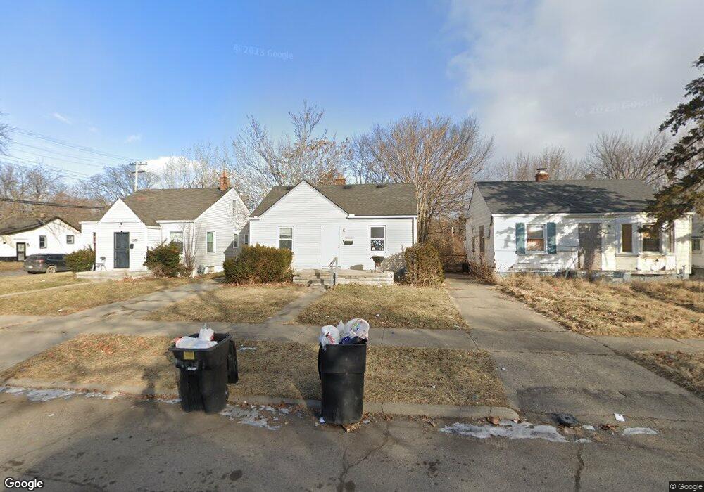
16211 Liberal St Detroit, MI 48205
Regent Park NeighborhoodEstimated Value: $51,000 - $102,770
2
Beds
1
Bath
672
Sq Ft
$113/Sq Ft
Est. Value
About This Home
This home is located at 16211 Liberal St, Detroit, MI 48205 and is currently estimated at $76,193, approximately $113 per square foot. 16211 Liberal St is a home located in Wayne County with nearby schools including Edward 'Duke' Ellington Conservatory of Music and Art, Charles L. Spain Elementary-Middle School, and Denby High School.
Ownership History
Date
Name
Owned For
Owner Type
Purchase Details
Closed on
Jun 5, 2024
Sold by
Life Hacks Investing Llc
Bought by
Bienstock Llc
Current Estimated Value
Purchase Details
Closed on
Oct 11, 2018
Sold by
Sabree Eric R
Bought by
Life Hacks Invetings Llc
Purchase Details
Closed on
Apr 29, 2015
Sold by
Midas Development Corp
Bought by
Liberal 16211 Llc
Create a Home Valuation Report for This Property
The Home Valuation Report is an in-depth analysis detailing your home's value as well as a comparison with similar homes in the area
Home Values in the Area
Average Home Value in this Area
Purchase History
| Date | Buyer | Sale Price | Title Company |
|---|---|---|---|
| Bienstock Llc | $10,000 | None Listed On Document | |
| Life Hacks Invetings Llc | $12,000 | None Available | |
| Liberal 16211 Llc | $46,000 | None Available |
Source: Public Records
Tax History Compared to Growth
Tax History
| Year | Tax Paid | Tax Assessment Tax Assessment Total Assessment is a certain percentage of the fair market value that is determined by local assessors to be the total taxable value of land and additions on the property. | Land | Improvement |
|---|---|---|---|---|
| 2025 | $768 | $18,900 | $0 | $0 |
| 2024 | $768 | $15,200 | $0 | $0 |
| 2023 | $745 | $12,400 | $0 | $0 |
| 2022 | $786 | $11,400 | $0 | $0 |
| 2021 | $768 | $6,630 | $0 | $0 |
| 2020 | $767 | $6,700 | $0 | $0 |
| 2019 | $758 | $5,850 | $0 | $0 |
| 2018 | $679 | $5,700 | $0 | $0 |
| 2017 | $109 | $6,300 | $0 | $0 |
| 2016 | $747 | $6,700 | $0 | $0 |
| 2015 | $670 | $6,700 | $0 | $0 |
| 2013 | $747 | $7,473 | $0 | $0 |
| 2010 | -- | $21,914 | $1,058 | $20,856 |
Source: Public Records
Map
Nearby Homes
- 16221 Liberal St
- 16232 Manning St
- 16236 Liberal St
- 16274 Liberal St
- 16100 Liberal St
- 16121 Manning St
- 16077 Liberal St
- 16235 Tacoma St
- 16419 Novara St
- 16209 Tacoma St
- 16410 Novara St
- 16052 Tacoma St
- 16073 Tacoma St
- 16216 E State Fair St
- 19401 Kelly Rd
- 19605 Kelly Rd
- 16011 Tacoma St
- 19649 Kelly Rd
- 16446 E State Fair St
- 19249 Kelly Rd
- 16201 Liberal St
- 16229 Liberal St
- 16237 Liberal St
- 16117 Liberal St
- 16214 Manning St
- 16204 Manning St
- 16224 Manning St
- 16245 Liberal St
- 16111 Liberal St
- 16220 Liberal St
- 16200 Liberal St
- 16118 Manning St
- 16253 Liberal St
- 16240 Manning St
- 16101 Liberal St
- 16210 Liberal St
- 16110 Manning St
- 16118 Liberal St
- 16248 Manning St
- 16261 Liberal St