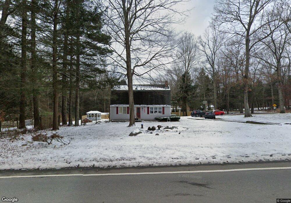
1635 Route 171 Woodstock Valley, CT 06282
Estimated Value: $398,000 - $472,000
3
Beds
3
Baths
1,728
Sq Ft
$249/Sq Ft
Est. Value
About This Home
This home is located at 1635 Route 171, Woodstock Valley, CT 06282 and is currently estimated at $430,126, approximately $248 per square foot. 1635 Route 171 is a home located in Windham County with nearby schools including Woodstock Elementary School and Woodstock Middle School.
Ownership History
Date
Name
Owned For
Owner Type
Purchase Details
Closed on
Oct 31, 2013
Sold by
Zimmerman-Smith Elizabeth
Bought by
Suitum Alissa R
Current Estimated Value
Home Financials for this Owner
Home Financials are based on the most recent Mortgage that was taken out on this home.
Original Mortgage
$213,303
Outstanding Balance
$160,405
Interest Rate
4.52%
Mortgage Type
New Conventional
Estimated Equity
$269,721
Purchase Details
Closed on
Aug 10, 2005
Sold by
Dzubin Matthew D and Dzubin Heather E
Bought by
Zimmerman Elizabeth A and Zimmerman Douglas C
Purchase Details
Closed on
Mar 1, 2004
Sold by
Fontaine Gary D and Fontaine Leona M
Bought by
Dzubin Matthew D and Couture Heather E
Create a Home Valuation Report for This Property
The Home Valuation Report is an in-depth analysis detailing your home's value as well as a comparison with similar homes in the area
Home Values in the Area
Average Home Value in this Area
Purchase History
| Date | Buyer | Sale Price | Title Company |
|---|---|---|---|
| Suitum Alissa R | $219,900 | -- | |
| Suitum Alissa R | $219,900 | -- | |
| Zimmerman Elizabeth A | $230,000 | -- | |
| Dzubin Matthew D | $180,100 | -- |
Source: Public Records
Mortgage History
| Date | Status | Borrower | Loan Amount |
|---|---|---|---|
| Open | Suitum Alissa R | $213,303 | |
| Closed | Dzubin Matthew D | $213,303 | |
| Previous Owner | Dzubin Matthew D | $150,000 |
Source: Public Records
Tax History Compared to Growth
Tax History
| Year | Tax Paid | Tax Assessment Tax Assessment Total Assessment is a certain percentage of the fair market value that is determined by local assessors to be the total taxable value of land and additions on the property. | Land | Improvement |
|---|---|---|---|---|
| 2025 | $4,306 | $161,700 | $22,300 | $139,400 |
| 2024 | $3,726 | $161,700 | $22,300 | $139,400 |
| 2023 | $3,624 | $161,700 | $22,300 | $139,400 |
| 2022 | $3,371 | $161,700 | $22,300 | $139,400 |
| 2021 | $3,950 | $154,900 | $23,500 | $131,400 |
| 2020 | $3,097 | $126,400 | $24,100 | $102,300 |
| 2019 | $3,097 | $126,400 | $24,100 | $102,300 |
| 2018 | $3,097 | $126,400 | $24,100 | $102,300 |
| 2017 | $3,072 | $126,400 | $24,100 | $102,300 |
| 2016 | $2,743 | $114,100 | $30,000 | $84,100 |
| 2015 | $2,665 | $114,100 | $30,000 | $84,100 |
| 2014 | $2,636 | $114,100 | $30,000 | $84,100 |
Source: Public Records
Map
Nearby Homes
- 60 Indian Spring Rd
- 23 Little Bungee Hill Rd
- 0 Hemlock Dr
- 30 Lyon Rd
- 29 Crooked Trail Extension
- 19 Hiawatha Heights
- 70 Laurel Hill Dr
- 80 Bungay Hill Rd
- 56 Laurel Hill Dr
- 381 Bungay Hill Rd
- 145 Perrin Rd
- 10 Laurel Hill Dr
- 4 Perrin Rd
- 402 Perrin Rd
- 00 Route 171 Unit Lot 1
- 0 Aplin Hill Ln
- 8 Nahaco Hill Ln
- 86A County Rd
- Lot 4A Weeks Rd
- 5 Nahaco Hill Ln
- 0 Indian Spring Rd Unit 170036831
- 0 Indian Spring Rd Unit G637908
- 00 Indian Spring Rd
- 0 Indian Spring Rd Unit G10177237
- 01 Indian Spring Rd
- 1641 Route 171
- 1629 Route 171
- 0 Crooked Trail
- 3 Crooked Trail
- 16 Indian Spring Rd
- 1623 Route 171
- 1636 Route 171
- 1619 Route 171
- 21 Indian Spring Rd
- 20 Indian Spring Rd
- 15 Crooked Trail
- 20 Crooked Trail
- 1615 Route 171
- 3 Shaw Rd
- 23 Crooked Trail