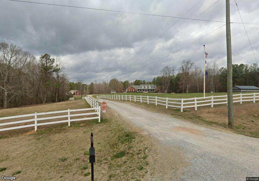
1638 Liberty Church Rd Bremen, GA 30110
Estimated Value: $356,000 - $520,322
3
Beds
2
Baths
2,462
Sq Ft
$178/Sq Ft
Est. Value
About This Home
This home is located at 1638 Liberty Church Rd, Bremen, GA 30110 and is currently estimated at $438,331, approximately $178 per square foot. 1638 Liberty Church Rd is a home located in Haralson County with nearby schools including Haralson County High School.
Ownership History
Date
Name
Owned For
Owner Type
Purchase Details
Closed on
May 29, 2024
Sold by
Jones Charles T
Bought by
Jones Charles T and Jones Melissa F
Current Estimated Value
Purchase Details
Closed on
Nov 15, 2007
Sold by
Not Provided
Bought by
Jones Charles T and Jones Melissa F
Purchase Details
Closed on
Aug 26, 2002
Sold by
Maulding Garry and Maulding Charles D
Bought by
Jones Charles T and Jones Melissa F
Purchase Details
Closed on
Mar 20, 2002
Bought by
Maulding Garry and Maulding Charles D
Create a Home Valuation Report for This Property
The Home Valuation Report is an in-depth analysis detailing your home's value as well as a comparison with similar homes in the area
Home Values in the Area
Average Home Value in this Area
Purchase History
| Date | Buyer | Sale Price | Title Company |
|---|---|---|---|
| Jones Charles T | -- | -- | |
| Jones Charles T | -- | -- | |
| Jones Charles T | -- | -- | |
| Jones Charles T | $59,200 | -- | |
| Maulding Garry | $260,900 | -- |
Source: Public Records
Tax History Compared to Growth
Tax History
| Year | Tax Paid | Tax Assessment Tax Assessment Total Assessment is a certain percentage of the fair market value that is determined by local assessors to be the total taxable value of land and additions on the property. | Land | Improvement |
|---|---|---|---|---|
| 2024 | $4,872 | $189,922 | $21,816 | $168,106 |
| 2023 | $4,768 | $179,820 | $14,544 | $165,276 |
| 2022 | $4,065 | $153,611 | $14,544 | $139,067 |
| 2021 | $4,105 | $148,943 | $14,544 | $134,399 |
| 2020 | $3,344 | $121,180 | $14,544 | $106,636 |
| 2019 | $3,274 | $114,368 | $14,544 | $99,824 |
| 2018 | $3,321 | $114,368 | $14,544 | $99,824 |
| 2017 | $3,207 | $100,616 | $14,544 | $86,072 |
| 2016 | $2,760 | $92,089 | $14,544 | $77,545 |
| 2015 | $3,011 | $100,212 | $23,634 | $76,578 |
| 2014 | $2,992 | $101,143 | $23,634 | $77,509 |
Source: Public Records
Map
Nearby Homes
- 26 Liberty Station Dr
- 38 Liberty Station Dr
- 1109 Liberty Church Rd
- 395 Pollard Rd
- 972 Seventh Court Ground Rd
- 90 Defnall Rd
- 242 Brookshire Dr
- 128 Pollard Rd
- 89 Autumn Dr
- 0 Pollard Rd Unit 10533145
- 0 Pollard Rd Unit 10533156
- 0 Helton Rd Unit 10648273
- 0 Helton Rd Unit 7685463
- 9385 U S 78
- 212 Webster Lake Dr
- 24 Mcclure Rd
- 248 Webster Lake Dr
- 426 Amy Blvd
- 1732 Liberty Church Rd
- 1418 Liberty Church Rd
- 1631 Liberty Church Rd
- 201 Zion Hill Church Rd
- 1639 Liberty Church Rd
- 1398 Liberty Church Rd
- 1651 Liberty Church Rd
- 441 Henry Lewis Rd
- 0 Henry Lewis Rd
- 0 Henry Lewis Rd Unit 20095991
- 0 Henry Lewis Rd Unit 7428194
- 0 Henry Lewis Rd Unit 7371970
- 0 Henry Lewis Rd Unit 8537397
- 0 Henry Lewis Rd Unit 7060864
- 0 Henry Lewis Rd Unit 3138347
- 0 Henry Lewis Rd Unit 8794797
- 0 Henry Lewis Rd Unit 8942899
- 369 Henry Lewis Rd
- 385 Henry Lewis Rd
- 365 Henry Lewis Rd