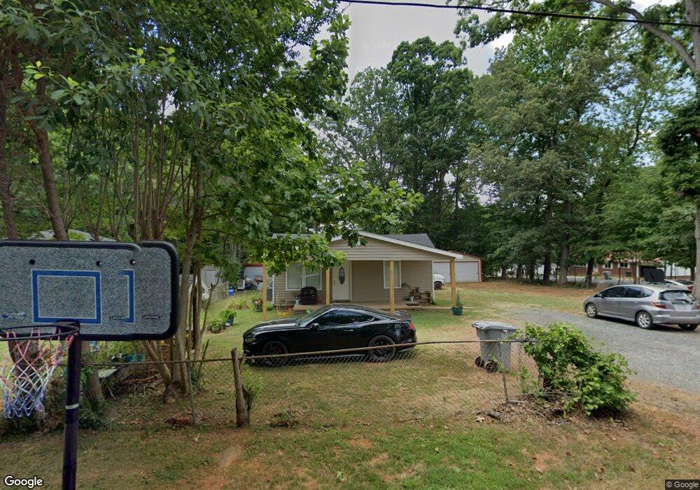
1643 Thornsdale Dr Asheboro, NC 27203
Estimated Value: $110,090 - $168,000
--
Bed
1
Bath
826
Sq Ft
$174/Sq Ft
Est. Value
About This Home
This home is located at 1643 Thornsdale Dr, Asheboro, NC 27203 and is currently estimated at $143,773, approximately $174 per square foot. 1643 Thornsdale Dr is a home located in Randolph County with nearby schools including Balfour Elementary School, North Asheboro Middle School, and Asheboro High School.
Ownership History
Date
Name
Owned For
Owner Type
Purchase Details
Closed on
Jan 5, 2022
Sold by
Robbins Properties Of Asheboro Inc
Bought by
Charles Eleazer Rodriguez
Current Estimated Value
Home Financials for this Owner
Home Financials are based on the most recent Mortgage that was taken out on this home.
Original Mortgage
$44,000
Outstanding Balance
$40,474
Interest Rate
3.12%
Mortgage Type
New Conventional
Estimated Equity
$103,299
Create a Home Valuation Report for This Property
The Home Valuation Report is an in-depth analysis detailing your home's value as well as a comparison with similar homes in the area
Home Values in the Area
Average Home Value in this Area
Purchase History
| Date | Buyer | Sale Price | Title Company |
|---|---|---|---|
| Charles Eleazer Rodriguez | $55,000 | Law Office Of Ben C Morgan |
Source: Public Records
Mortgage History
| Date | Status | Borrower | Loan Amount |
|---|---|---|---|
| Open | Charles Eleazer Rodriguez | $44,000 |
Source: Public Records
Tax History Compared to Growth
Tax History
| Year | Tax Paid | Tax Assessment Tax Assessment Total Assessment is a certain percentage of the fair market value that is determined by local assessors to be the total taxable value of land and additions on the property. | Land | Improvement |
|---|---|---|---|---|
| 2025 | $1,321 | $99,680 | $26,840 | $72,840 |
| 2024 | $1,174 | $87,810 | $26,840 | $60,970 |
| 2023 | $918 | $69,260 | $26,840 | $42,420 |
| 2022 | $721 | $50,010 | $20,890 | $29,120 |
| 2021 | $721 | $50,010 | $20,890 | $29,120 |
| 2020 | $721 | $50,010 | $20,890 | $29,120 |
| 2019 | $721 | $50,010 | $20,890 | $29,120 |
| 2018 | $572 | $38,960 | $20,890 | $18,070 |
| 2016 | $572 | $38,960 | $20,890 | $18,070 |
| 2015 | $573 | $38,960 | $20,890 | $18,070 |
| 2014 | -- | $42,023 | $24,670 | $17,353 |
Source: Public Records
Map
Nearby Homes
- 0 English St
- 223 Mclaurin Dr
- 222 Cracklin Dr
- 405 Saunders Dr
- 1537 Humble St
- 1847 Saddlewood Ct
- 410 Millikan Dr
- 1807 Newell St
- 1822 Newell St
- 1684 Pen Oak Dr
- 728 Central Falls Rd
- 734 Central Falls Rd
- 738 Oak Bend Dr
- 1249 Eton Ave
- 1907 Levance St
- 1913 Levance St
- 1319 E Allred St
- 911 Old Liberty Rd
- 503 Sunrise Ave
- 1821 Back Creek Ct
- 1637 Thornsdale Dr
- 1635 Thornsdale Dr
- 111 W Bailey St
- 200 W Bailey St
- 118 W Bailey St
- 1633 Thornsdale Dr
- 205 W Bailey St
- 202 W Bailey St
- 1641 N Fayetteville St
- 1637 N Fayetteville St
- 211 W Bailey St
- 1631 Thornsdale Dr
- 217 W Bailey St
- 1705 N Fayetteville St
- 1625 Thornsdale Dr
- 0 N Fayetteville St Unit 1019976
- 0 N Fayetteville St Unit 1083499
- 0 N Fayetteville St Unit 952689
- 0 N Fayetteville St
- 1707 N Fayetteville St