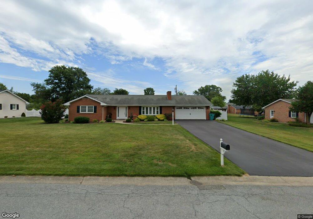
16616 Mosby Dr Williamsport, MD 21795
Estimated Value: $364,162 - $397,000
--
Bed
2
Baths
1,535
Sq Ft
$252/Sq Ft
Est. Value
About This Home
This home is located at 16616 Mosby Dr, Williamsport, MD 21795 and is currently estimated at $387,541, approximately $252 per square foot. 16616 Mosby Dr is a home located in Washington County with nearby schools including Williamsport Elementary School, Springfield Middle School, and Williamsport High School.
Ownership History
Date
Name
Owned For
Owner Type
Purchase Details
Closed on
Jun 21, 2019
Sold by
Martin Larry L and Martin Roberta A
Bought by
Saufley Eugene S and Saufley Amy L
Current Estimated Value
Home Financials for this Owner
Home Financials are based on the most recent Mortgage that was taken out on this home.
Original Mortgage
$196,000
Outstanding Balance
$171,983
Interest Rate
4%
Mortgage Type
New Conventional
Estimated Equity
$215,558
Purchase Details
Closed on
May 14, 2013
Sold by
Forsyth Investment Llc
Bought by
Martin Larry
Purchase Details
Closed on
Feb 15, 1983
Sold by
Raney Bruce C
Bought by
Martin Larry L
Home Financials for this Owner
Home Financials are based on the most recent Mortgage that was taken out on this home.
Original Mortgage
$25,000
Interest Rate
13.06%
Create a Home Valuation Report for This Property
The Home Valuation Report is an in-depth analysis detailing your home's value as well as a comparison with similar homes in the area
Home Values in the Area
Average Home Value in this Area
Purchase History
| Date | Buyer | Sale Price | Title Company |
|---|---|---|---|
| Saufley Eugene S | $285,000 | Passport Title Services Llc | |
| Martin Larry | $100,000 | None Available | |
| Martin Larry L | $73,000 | -- |
Source: Public Records
Mortgage History
| Date | Status | Borrower | Loan Amount |
|---|---|---|---|
| Open | Saufley Eugene S | $196,000 | |
| Previous Owner | Martin Larry L | $25,000 |
Source: Public Records
Tax History Compared to Growth
Tax History
| Year | Tax Paid | Tax Assessment Tax Assessment Total Assessment is a certain percentage of the fair market value that is determined by local assessors to be the total taxable value of land and additions on the property. | Land | Improvement |
|---|---|---|---|---|
| 2025 | $3,115 | $322,900 | $58,700 | $264,200 |
| 2024 | $3,115 | $300,900 | $0 | $0 |
| 2023 | $2,888 | $278,900 | $0 | $0 |
| 2022 | $2,660 | $256,900 | $58,700 | $198,200 |
| 2021 | $2,464 | $233,500 | $0 | $0 |
| 2020 | $2,217 | $210,100 | $0 | $0 |
| 2019 | $1,979 | $186,700 | $58,700 | $128,000 |
| 2018 | $2,108 | $180,333 | $0 | $0 |
| 2017 | $1,777 | $173,967 | $0 | $0 |
| 2016 | -- | $167,600 | $0 | $0 |
| 2015 | -- | $167,600 | $0 | $0 |
| 2014 | $2,095 | $167,600 | $0 | $0 |
Source: Public Records
Map
Nearby Homes
- 10642 Hershey Dr
- 10608 Hershey Dr
- 10730 Hershey Dr
- 10701 Bratton Ct
- 10808 Archer Ln
- 10813 Wilcox Dr
- 16722 Custer Ct
- 10818 Anderson Dr
- 11015 Donelson Dr
- 10744 Apple Tree Ln
- 16040 Cloverton Ln
- 16804 Longfellow Ct Unit 652
- 10616 Peachtree Ln
- 10706 Honeyfield Rd
- 17125 Miner Ave
- 16810 Alcott Rd
- 10510 Honeyfield Rd
- 0 Greencastle Pike
- 11307 Hawthorne Ct
- 16847 Longfellow Ct
- 16610 Mosby Dr
- 16620 Mosby Dr
- 16611 Buford Dr
- 16607 Buford Dr
- 16615 Buford Dr
- 16617 Mosby Dr
- 16621 Mosby Dr
- 16606 Mosby Dr
- 16626 Mosby Dr
- 16617 Buford Dr
- 16611 Mosby Dr
- 16625 Mosby Dr
- 16621 Buford Dr
- 16602 Mosby Dr
- 16608 Buford Dr
- 16630 Mosby Dr
- 16601 Buford Dr
- 16534 Edward Doub Rd
- 16532 Edward Doub Rd
- 16612 Buford Dr