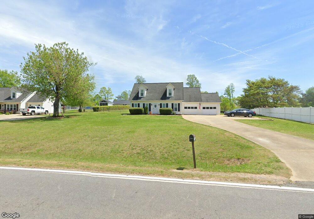
1667 Poors Ford Rd Rutherfordton, NC 28139
Estimated Value: $214,000 - $274,000
3
Beds
2
Baths
1,377
Sq Ft
$176/Sq Ft
Est. Value
About This Home
This home is located at 1667 Poors Ford Rd, Rutherfordton, NC 28139 and is currently estimated at $241,790, approximately $175 per square foot. 1667 Poors Ford Rd is a home located in Rutherford County with nearby schools including Harris Elementary School, Chase Middle School, and Chase High School.
Ownership History
Date
Name
Owned For
Owner Type
Purchase Details
Closed on
Feb 7, 2005
Sold by
Federal National Mortgage Association
Bought by
Arrowood Rick D
Current Estimated Value
Home Financials for this Owner
Home Financials are based on the most recent Mortgage that was taken out on this home.
Original Mortgage
$89,610
Outstanding Balance
$49,580
Interest Rate
7.12%
Mortgage Type
Adjustable Rate Mortgage/ARM
Estimated Equity
$192,210
Create a Home Valuation Report for This Property
The Home Valuation Report is an in-depth analysis detailing your home's value as well as a comparison with similar homes in the area
Home Values in the Area
Average Home Value in this Area
Purchase History
| Date | Buyer | Sale Price | Title Company |
|---|---|---|---|
| Arrowood Rick D | -- | V |
Source: Public Records
Mortgage History
| Date | Status | Borrower | Loan Amount |
|---|---|---|---|
| Open | Arrowood Rick D | $89,610 |
Source: Public Records
Tax History Compared to Growth
Tax History
| Year | Tax Paid | Tax Assessment Tax Assessment Total Assessment is a certain percentage of the fair market value that is determined by local assessors to be the total taxable value of land and additions on the property. | Land | Improvement |
|---|---|---|---|---|
| 2025 | $1,056 | $210,000 | $22,400 | $187,600 |
| 2024 | $289 | $210,000 | $22,400 | $187,600 |
| 2023 | $1,108 | $210,000 | $22,400 | $187,600 |
| 2022 | $1,108 | $140,800 | $19,600 | $121,200 |
| 2021 | $1,089 | $140,800 | $19,600 | $121,200 |
| 2020 | $1,075 | $140,800 | $19,600 | $121,200 |
| 2019 | $1,067 | $140,800 | $19,600 | $121,200 |
| 2018 | $936 | $120,900 | $10,400 | $110,500 |
| 2016 | $814 | $120,900 | $10,400 | $110,500 |
| 2013 | -- | $120,900 | $10,400 | $110,500 |
Source: Public Records
Map
Nearby Homes
- 2311 Poors Ford Rd
- 1349 Us 221 Hwy S
- 732 Crowe Dairy Rd
- Lot #69 Cleghorn Mill Rd
- Lot 2 Cleghorn Mill Rd
- Lot 7 Cleghorn Mill Rd
- Lot 3 Cleghorn Mill Rd
- Lot 1 Cleghorn Mill Rd
- Lot #6 Cleghorn Mill Rd
- 1260 US 221 Hwy S
- 139 Holly Forest Dr
- 847 Crowe Dairy Rd
- 0 Holly Forest Dr
- 000 Moss Dr
- 0 Moss Dr Unit CAR4221345
- Lot #38 Moss Dr
- Lot #49 Moss Dr
- 0 Moss Dr Unit 39 CAR3724319
- Lot # 27 Moss Dr
- Lot #9 Moss Dr
- 1675 Poors Ford Rd
- 1655 Poors Ford Rd
- 1685 Poors Ford Rd
- 1674 Poors Ford Rd
- 105 Big Island Rd
- 121 Big Island Rd
- 126 Big Island Rd
- 1589 Poors Ford Rd
- 159 Big Island Rd
- 1753 Poors Ford Rd
- 154 Big Island Rd
- 1573 Poors Ford Rd
- 840 Shiloh Rd Unit 844
- 166 Big Island Rd Unit 168
- 1559 Poors Ford Rd
- 151 Belt Ct
- 1764 Poors Ford Rd
- 178 Big Island Rd
- 178 Big Island Rd
- 178 Big Island Rd Unit A1