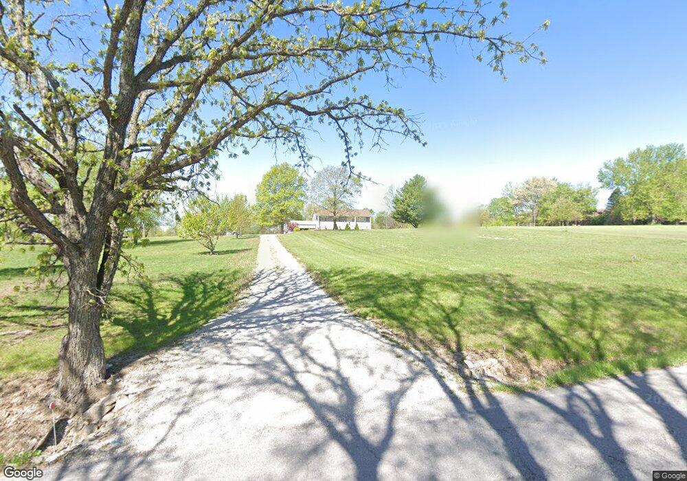
16706 Ragsdale Rd Kearney, MO 64060
Estimated Value: $247,000 - $474,000
3
Beds
3
Baths
1,248
Sq Ft
$312/Sq Ft
Est. Value
About This Home
This home is located at 16706 Ragsdale Rd, Kearney, MO 64060 and is currently estimated at $389,337, approximately $311 per square foot. 16706 Ragsdale Rd is a home located in Clay County with nearby schools including Kearney Junior High School and Kearney High School.
Ownership History
Date
Name
Owned For
Owner Type
Purchase Details
Closed on
Nov 17, 2020
Sold by
Johnson Robert and Johnson Janet
Bought by
Mckwon Scott
Current Estimated Value
Purchase Details
Closed on
Oct 10, 2003
Sold by
Kremlacek Kent K and Kremlacek Tamie J
Bought by
Johnson Robert and Johnson Janet
Home Financials for this Owner
Home Financials are based on the most recent Mortgage that was taken out on this home.
Original Mortgage
$160,000
Interest Rate
6.42%
Mortgage Type
Credit Line Revolving
Purchase Details
Closed on
Feb 26, 2002
Sold by
Ryan Pa Beverly Sue and Nelson Margaret M
Bought by
Kremlacek Kent and Kremlacek Kent K
Purchase Details
Closed on
Oct 31, 1997
Sold by
Deese Gayle Ann
Bought by
Kremlacek Kent K
Create a Home Valuation Report for This Property
The Home Valuation Report is an in-depth analysis detailing your home's value as well as a comparison with similar homes in the area
Home Values in the Area
Average Home Value in this Area
Purchase History
| Date | Buyer | Sale Price | Title Company |
|---|---|---|---|
| Mckwon Scott | -- | None Available | |
| Johnson Robert | -- | Thomson Title Corporation | |
| Kremlacek Kent | $60,000 | -- | |
| Kremlacek Kent K | $2,000 | -- |
Source: Public Records
Mortgage History
| Date | Status | Borrower | Loan Amount |
|---|---|---|---|
| Previous Owner | Johnson Robert | $160,000 |
Source: Public Records
Tax History Compared to Growth
Tax History
| Year | Tax Paid | Tax Assessment Tax Assessment Total Assessment is a certain percentage of the fair market value that is determined by local assessors to be the total taxable value of land and additions on the property. | Land | Improvement |
|---|---|---|---|---|
| 2025 | $2,752 | $49,970 | -- | -- |
| 2024 | $2,752 | $43,490 | -- | -- |
| 2023 | $2,741 | $43,490 | $0 | $0 |
| 2022 | $2,605 | $40,030 | $0 | $0 |
| 2021 | $2,550 | $40,033 | $6,270 | $33,763 |
| 2020 | $2,458 | $35,060 | $0 | $0 |
| 2019 | $2,444 | $35,060 | $0 | $0 |
| 2018 | $2,529 | $35,060 | $0 | $0 |
| 2017 | $2,106 | $35,050 | $6,270 | $28,780 |
| 2016 | $2,106 | $29,560 | $6,270 | $23,290 |
| 2015 | $2,107 | $29,560 | $6,270 | $23,290 |
| 2014 | $2,056 | $28,690 | $6,270 | $22,420 |
Source: Public Records
Map
Nearby Homes
- 16211 Dr
- 16115 Kountry Ridge Dr
- 15617 Oakmont Dr
- 15025 Jesse James Farm Rd
- 608 Woodson St
- 610 E Porter Ridge Ct
- 0 N Jefferson St Mo-33 Hwy Unit HMS2578203
- 102 W Lawrence St
- 205 E Washington St
- 201 E Washington St
- Lot 12 Melinda Dr
- Lot 14 Melinda Dr
- Lot 1 Melinda Dr
- Lot 3 Melinda Dr
- Lot 5 Melinda Dr
- Lot 13 Melinda Dr
- Lot 15 Melinda Dr
- Lot 2 Melinda Dr
- Lot 4 Melinda Dr
- Lot 8 Melinda Dr
- 16618 Ragsdale Rd
- 16720 Ragsdale Rd
- 16719 Ragsdale Rd
- 16800 Ragsdale Rd
- 16623 Ragsdale Rd
- 20207 Cole Rd
- 20223 Cole Rd
- 16609 Ragsdale Rd
- 20617 Michael Dr
- 16816 Ragsdale Rd
- 16815 Cole Rd
- 20204 Cole Rd
- 20021 Cole Rd
- 20616 Michael Dr
- 16813 Ragsdale Rd
- 16823 Cole Rd
- 20022 Cole Rd
- 20807 Michael Dr
- 16826 Ragsdale Rd
- 16522 Ragsdale Rd