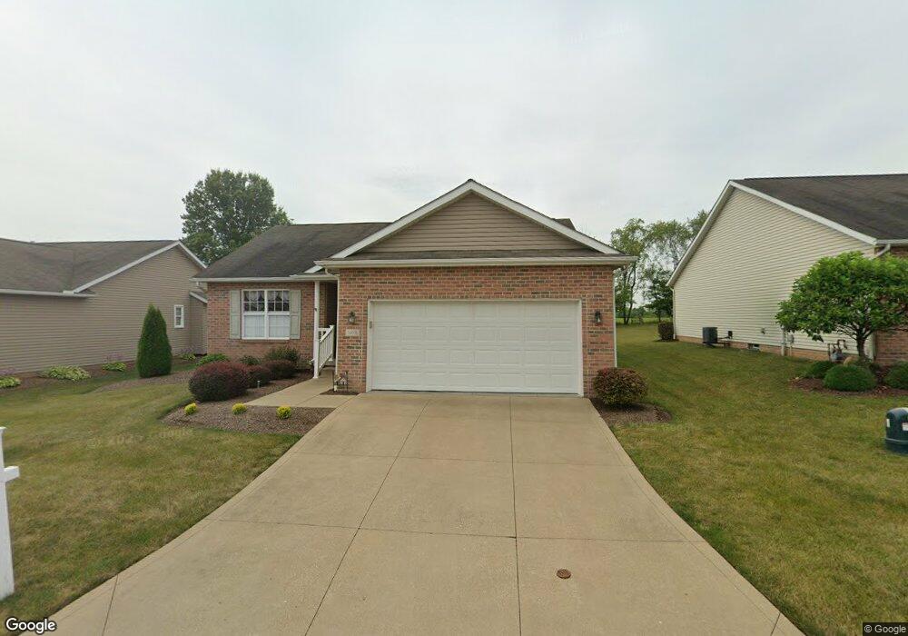
1678 Presidents Cir Unit 34 Louisville, OH 44641
Estimated Value: $288,461 - $291,000
2
Beds
2
Baths
1,560
Sq Ft
$186/Sq Ft
Est. Value
About This Home
This home is located at 1678 Presidents Cir Unit 34, Louisville, OH 44641 and is currently estimated at $289,865, approximately $185 per square foot. 1678 Presidents Cir Unit 34 is a home located in Stark County with nearby schools including Louisville High School and St. Thomas Aquinas High School & Middle School.
Ownership History
Date
Name
Owned For
Owner Type
Purchase Details
Closed on
Feb 7, 2025
Sold by
Lautzenheiser Eric R and Lautzenheiser Todd A
Bought by
Woodard Keith and Woodard Julie
Current Estimated Value
Purchase Details
Closed on
Aug 11, 2010
Sold by
Hudnell Joyce L
Bought by
Lautzenheiser Larry W and Lautzenheiser Eleanor L
Purchase Details
Closed on
Apr 27, 2007
Sold by
Estate Of James Richard Hudnell
Bought by
Hudnell Joyce L
Purchase Details
Closed on
Feb 28, 2005
Sold by
Miranova Inc
Bought by
Hudnell James R and Hudnell Joyce L
Home Financials for this Owner
Home Financials are based on the most recent Mortgage that was taken out on this home.
Original Mortgage
$115,000
Interest Rate
5.8%
Mortgage Type
Construction
Create a Home Valuation Report for This Property
The Home Valuation Report is an in-depth analysis detailing your home's value as well as a comparison with similar homes in the area
Home Values in the Area
Average Home Value in this Area
Purchase History
| Date | Buyer | Sale Price | Title Company |
|---|---|---|---|
| Woodard Keith | $284,900 | None Listed On Document | |
| Lautzenheiser Larry W | $160,000 | Cornerstone Real Estate Titl | |
| Hudnell Joyce L | -- | None Available | |
| Hudnell James R | $169,900 | -- |
Source: Public Records
Mortgage History
| Date | Status | Borrower | Loan Amount |
|---|---|---|---|
| Previous Owner | Hudnell James R | $115,000 |
Source: Public Records
Tax History Compared to Growth
Tax History
| Year | Tax Paid | Tax Assessment Tax Assessment Total Assessment is a certain percentage of the fair market value that is determined by local assessors to be the total taxable value of land and additions on the property. | Land | Improvement |
|---|---|---|---|---|
| 2025 | -- | $94,960 | $16,210 | $78,750 |
| 2024 | -- | $94,960 | $16,210 | $78,750 |
| 2023 | $2,589 | $69,410 | $12,570 | $56,840 |
| 2022 | $2,613 | $69,410 | $12,570 | $56,840 |
| 2021 | $1,441 | $69,410 | $12,570 | $56,840 |
| 2020 | $2,149 | $62,940 | $11,310 | $51,630 |
| 2019 | $2,164 | $62,940 | $11,310 | $51,630 |
| 2018 | $2,156 | $62,940 | $11,310 | $51,630 |
| 2017 | $1,850 | $53,620 | $10,500 | $43,120 |
| 2016 | $1,888 | $53,620 | $10,500 | $43,120 |
| 2015 | $1,894 | $53,620 | $10,500 | $43,120 |
| 2014 | $1,885 | $50,270 | $11,100 | $39,170 |
| 2013 | $946 | $50,270 | $11,100 | $39,170 |
Source: Public Records
Map
Nearby Homes
- 2110 Edmar St
- 1715 High St
- 1812 E Broad St
- 641 S Nickelplate St
- 908 Sand Lot Cir
- 520 S Silver St
- 308 Superior St
- 3390 Meese Rd NE
- 728 E Broad St
- 0 Michigan Blvd
- 2015 E Main St
- 510 S Bauman Ct
- 204 E Broad St
- 107 E Broad St
- 8225 Georgetown St
- 1702 View Pointe Ave
- 1639 Horizon Dr
- 325 Lincoln Ave
- 1170 Winding Ridge Ave
- 910 Crosswyck Cir
- 1684 Presidents Cir Unit 35
- 1672 Presidents Square Unit 33
- 0 Presidents Ave Unit 3629012
- 0 Presidents Ave Unit 3629009
- 0 Presidents Ave Unit 3629001
- 0 Presidents Ave Unit 3628998
- 0 Presidents Ave Unit 3628992
- 0 Presidents Ave Unit 3628986
- 45 Lot Presidents Ave
- 1666 Presidents Square Unit 32
- 1679 Presidents Cir
- 1659 Presidents Square
- 1660 Presidents Square Unit 31
- 1653 Presidents Square Unit 42
- 1634 Presidents Square Unit 30
- 1647 Presidents Square Unit 50
- 1628 Presidents Square Unit 29
- 1611 Presidents Square Unit 43
- 1641 Presidents Square Unit 49
- 1616 Presidents Square Unit 27