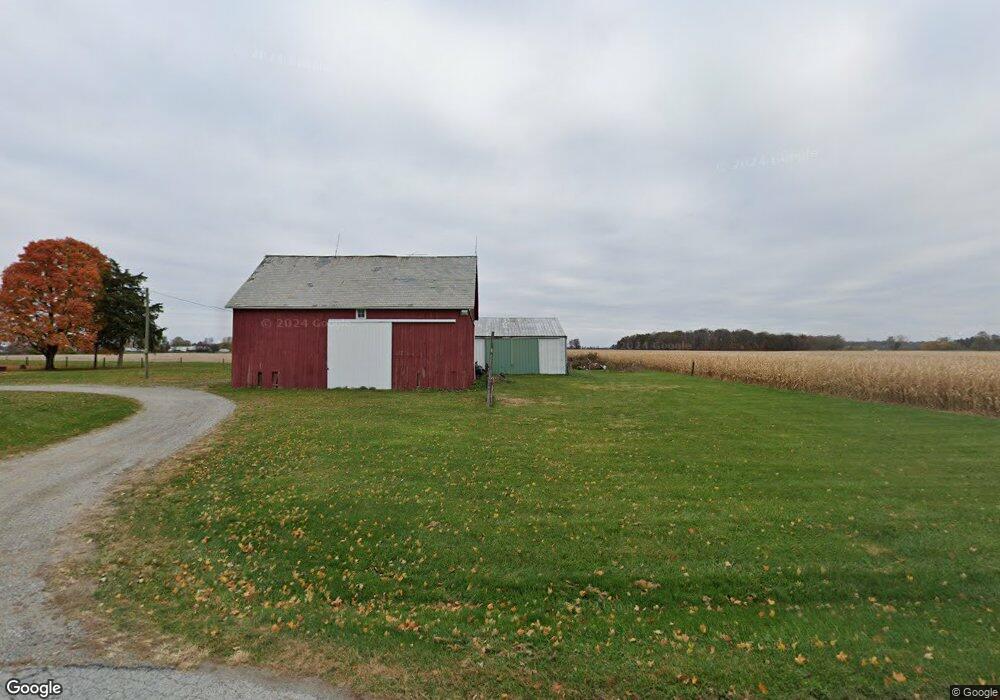
16849 Freymuth Rd Wapakoneta, OH 45895
Estimated Value: $236,763 - $314,000
3
Beds
1
Bath
1,724
Sq Ft
$159/Sq Ft
Est. Value
About This Home
This home is located at 16849 Freymuth Rd, Wapakoneta, OH 45895 and is currently estimated at $274,941, approximately $159 per square foot. 16849 Freymuth Rd is a home located in Auglaize County with nearby schools including Cridersville Elementary School, Wapakoneta High School, and Wapakoneta Middle School.
Ownership History
Date
Name
Owned For
Owner Type
Purchase Details
Closed on
Dec 9, 2016
Sold by
Estate Of Daniel Byron Stauffer
Bought by
Stauffer Tanya D
Current Estimated Value
Purchase Details
Closed on
Feb 6, 2004
Sold by
Mccollum Michael D
Bought by
Stauffer Daniel B
Purchase Details
Closed on
Aug 4, 1995
Sold by
Purdy Lexie Marie
Bought by
Mccollum Michael D
Purchase Details
Closed on
Nov 27, 1991
Sold by
Purdy Lexie
Bought by
Purdy Lexie Marie
Purchase Details
Closed on
Nov 1, 1991
Create a Home Valuation Report for This Property
The Home Valuation Report is an in-depth analysis detailing your home's value as well as a comparison with similar homes in the area
Home Values in the Area
Average Home Value in this Area
Purchase History
| Date | Buyer | Sale Price | Title Company |
|---|---|---|---|
| Stauffer Tanya D | -- | Attorney | |
| Stauffer Daniel B | $144,000 | -- | |
| Mccollum Michael D | $75,000 | -- | |
| Purdy Lexie Marie | -- | -- | |
| -- | $70,500 | -- |
Source: Public Records
Tax History Compared to Growth
Tax History
| Year | Tax Paid | Tax Assessment Tax Assessment Total Assessment is a certain percentage of the fair market value that is determined by local assessors to be the total taxable value of land and additions on the property. | Land | Improvement |
|---|---|---|---|---|
| 2024 | $3,728 | $74,930 | $15,570 | $59,360 |
| 2023 | $2,502 | $74,930 | $15,570 | $59,360 |
| 2022 | $2,026 | $55,610 | $12,980 | $42,630 |
| 2021 | $2,009 | $55,610 | $12,980 | $42,630 |
| 2020 | $1,019 | $55,605 | $12,978 | $42,627 |
| 2019 | $1,713 | $45,578 | $10,637 | $34,941 |
| 2018 | $1,720 | $45,578 | $10,637 | $34,941 |
| 2017 | $1,711 | $45,578 | $10,637 | $34,941 |
| 2016 | $1,604 | $42,837 | $10,129 | $32,708 |
| 2015 | $1,603 | $42,837 | $10,129 | $32,708 |
| 2014 | $1,589 | $42,837 | $10,129 | $32,708 |
| 2013 | $1,638 | $42,837 | $10,129 | $32,708 |
Source: Public Records
Map
Nearby Homes
- 212 S Oak St
- 18609 County Road 25a
- 311 Marcella Ln
- 5290 New Haven Dr
- 310 W Main St
- 17946 National Rd
- 1805 Huntington Dr
- 1835 Huntington Dr
- 2638 Summer Rambo Ct
- 2648 Summer Rambo Ct
- 2613 Jonathon Dr
- 2691 Jonathan Dr
- 17092 Hauss Rd
- 0 Ohio 67
- 301 Muskingum Trail
- 37 N Main St
- 137 Caribou Cir
- 1934 Jo Jean Rd
- 17 E Walnut St
- 1643 W Breese Rd Unit 73
- 0 Seitz Rd
- 17122 Freymuth Rd
- 17198 Freymuth Rd
- 0 Freymuth Rd
- 19566 County Road 25a
- 19409 Mudsock Rd
- 19717 Mudsock Rd
- 19655 Mudsock Rd
- 19500 Mudsock Rd
- 19763 Mudsock Rd
- 19462 Mudsock Rd
- 19404 Mudsock Rd
- 19892 County Road 25a
- 19920 County Road 25a
- 19678 Mudsock Rd
- 19781 Mudsock Rd
- 19265 Mudsock Rd
- 16747 Buckland Holden Rd
- 19334 Mudsock Rd