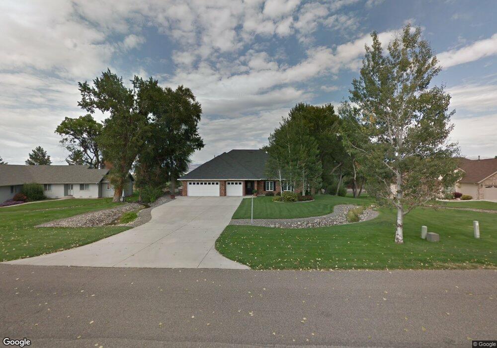
16890 Wildwood Dr Montrose, CO 81403
Estimated Value: $610,386 - $725,000
3
Beds
2
Baths
1,851
Sq Ft
$361/Sq Ft
Est. Value
About This Home
This home is located at 16890 Wildwood Dr, Montrose, CO 81403 and is currently estimated at $667,847, approximately $360 per square foot. 16890 Wildwood Dr is a home located in Montrose County with nearby schools including Cottonwood Elementary School, Columbine Middle School, and Montrose High School.
Ownership History
Date
Name
Owned For
Owner Type
Purchase Details
Closed on
Oct 8, 2008
Sold by
Edith M Cather Revocable Trust
Bought by
Spofford Dana M and Spofford Winifred A
Current Estimated Value
Purchase Details
Closed on
Jan 23, 2007
Sold by
Cather Edith M
Bought by
Edith M Cather Revocable Trust
Purchase Details
Closed on
Feb 13, 2004
Sold by
Kuchynka Gary H and Kuchynka Jeanne T
Bought by
Cather Edith M
Purchase Details
Closed on
Apr 30, 1998
Sold by
Dean Forrest A and Dean Karen Lynn
Bought by
Kuchynka Gary H and Kuchynka Jeanne T
Purchase Details
Closed on
Feb 14, 1997
Sold by
Cobb Daron
Bought by
Kuchynka Gary H and Kuchynka Jeanne T
Purchase Details
Closed on
Oct 22, 1993
Sold by
Kintz Donald J and Kintz Betty S
Bought by
Cobb Daron
Create a Home Valuation Report for This Property
The Home Valuation Report is an in-depth analysis detailing your home's value as well as a comparison with similar homes in the area
Home Values in the Area
Average Home Value in this Area
Purchase History
| Date | Buyer | Sale Price | Title Company |
|---|---|---|---|
| Spofford Dana M | $345,000 | None Available | |
| Edith M Cather Revocable Trust | -- | None Available | |
| Cather Edith M | $359,000 | -- | |
| Kuchynka Gary H | $38,000 | -- | |
| Kuchynka Gary H | $40,500 | -- | |
| Cobb Daron | $31,500 | -- |
Source: Public Records
Tax History Compared to Growth
Tax History
| Year | Tax Paid | Tax Assessment Tax Assessment Total Assessment is a certain percentage of the fair market value that is determined by local assessors to be the total taxable value of land and additions on the property. | Land | Improvement |
|---|---|---|---|---|
| 2024 | $2,252 | $38,330 | $4,580 | $33,750 |
| 2023 | $2,252 | $43,580 | $5,210 | $38,370 |
| 2022 | $1,290 | $25,700 | $3,820 | $21,880 |
| 2021 | $1,330 | $26,440 | $3,930 | $22,510 |
| 2020 | $1,258 | $25,900 | $3,800 | $22,100 |
| 2019 | $1,266 | $25,900 | $3,800 | $22,100 |
| 2018 | $1,691 | $24,420 | $3,190 | $21,230 |
| 2017 | $1,677 | $24,420 | $3,190 | $21,230 |
| 2016 | $1,655 | $24,510 | $3,210 | $21,300 |
| 2015 | $1,626 | $24,510 | $3,210 | $21,300 |
| 2014 | $1,362 | $21,970 | $3,210 | $18,760 |
Source: Public Records
Map
Nearby Homes
- 16885 Wildwood Dr
- TBD Woodgate Rd
- 1728 Keller Ct
- 1712 Keller Ct
- TBD S Hwy 550 & Otter Rd
- TBD Otter Pond Cir
- TBD Lot 1 Woodgate Rd
- TBD Lot 3 Woodgate Rd
- TBD Lot 2-2 Woodgate Rd
- TBD Lot 2 Woodgate Rd
- TBD Lot 2-3 Woodgate Rd
- TBD Lot 2-1 Woodgate Rd
- 4117 Waterfall Dr
- 66182 Crestview Dr
- TBD Oxbow Dr
- 66356 Otter Rd
- 4041 Grand Mesa Dr
- Tbd Grand Mesa Dr
- Lot: 1 Highway 550
- TBD Lot 7 Hawk Pkwy
- 16880 Wildwood Dr
- 16910 Wildwood Dr
- 65836 Otter Rd
- 16895 Wildwood Dr
- 16920 Wildwood Dr
- 16905 Wildwood Dr
- Tbd Aspen Grove Ln
- 1730 Keller Ct
- 16915 Wildwood Dr
- 16875 Wildwood Dr
- 1716 Keller Ct
- 16870 Wildwood Dr
- 16930 Wildwood Dr
- 1723 Keller Ct
- 16925 Wildwood Dr
- 1719 Keller Ct
- 0 Woodgate Rd Unit 629747
- 0 Woodgate Rd Unit 667267
- 0 Woodgate Rd Unit 688887
- 0 Woodgate Rd Unit 692846