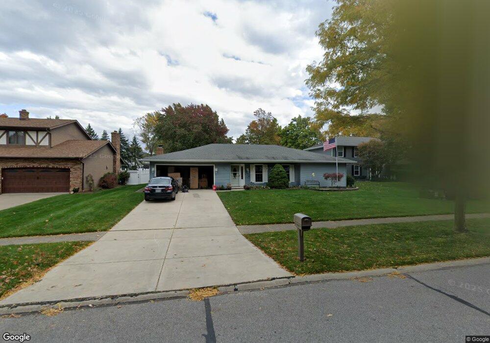
16932 Deer Path Dr Strongsville, OH 44136
Estimated Value: $304,327 - $335,000
3
Beds
2
Baths
1,696
Sq Ft
$188/Sq Ft
Est. Value
About This Home
This home is located at 16932 Deer Path Dr, Strongsville, OH 44136 and is currently estimated at $319,582, approximately $188 per square foot. 16932 Deer Path Dr is a home located in Cuyahoga County with nearby schools including Strongsville High School and Sts Joseph & John Interparochial School.
Ownership History
Date
Name
Owned For
Owner Type
Purchase Details
Closed on
Mar 15, 2021
Sold by
Hudak Daniel and Estate Of Eleanor A Gurchik
Bought by
Karnatz Roger A
Current Estimated Value
Purchase Details
Closed on
May 19, 1988
Sold by
Cornelius J Pearce
Bought by
Gurchik Robert J
Purchase Details
Closed on
Aug 14, 1980
Sold by
Pearce Cornelius J
Bought by
Cornelius J Pearce
Purchase Details
Closed on
Oct 4, 1979
Sold by
Pearce Cornelius J
Bought by
Pearce Cornelius J
Purchase Details
Closed on
Aug 30, 1976
Bought by
Pearce Cornelius J
Purchase Details
Closed on
Feb 9, 1976
Bought by
Brookfield Homes Inc
Purchase Details
Closed on
Jan 1, 1976
Bought by
Erie Shores Dev Co Inc
Create a Home Valuation Report for This Property
The Home Valuation Report is an in-depth analysis detailing your home's value as well as a comparison with similar homes in the area
Home Values in the Area
Average Home Value in this Area
Purchase History
| Date | Buyer | Sale Price | Title Company |
|---|---|---|---|
| Karnatz Roger A | -- | None Available | |
| Gurchik Robert J | $90,000 | -- | |
| Cornelius J Pearce | -- | -- | |
| Pearce Cornelius J | -- | -- | |
| Pearce Cornelius J | $48,800 | -- | |
| Brookfield Homes Inc | -- | -- | |
| Erie Shores Dev Co Inc | -- | -- |
Source: Public Records
Tax History Compared to Growth
Tax History
| Year | Tax Paid | Tax Assessment Tax Assessment Total Assessment is a certain percentage of the fair market value that is determined by local assessors to be the total taxable value of land and additions on the property. | Land | Improvement |
|---|---|---|---|---|
| 2024 | $4,428 | $92,120 | $22,015 | $70,105 |
| 2023 | $4,525 | $70,740 | $18,590 | $52,150 |
| 2022 | $4,493 | $70,740 | $18,590 | $52,150 |
| 2021 | $3,823 | $70,740 | $18,590 | $52,150 |
| 2020 | $3,409 | $57,650 | $15,230 | $42,420 |
| 2019 | $3,309 | $164,700 | $43,500 | $121,200 |
| 2018 | $3,003 | $57,650 | $15,230 | $42,420 |
| 2017 | $2,520 | $46,730 | $12,250 | $34,480 |
| 2016 | $2,499 | $46,730 | $12,250 | $34,480 |
| 2015 | $2,534 | $46,730 | $12,250 | $34,480 |
| 2014 | $2,534 | $46,730 | $12,250 | $34,480 |
Source: Public Records
Map
Nearby Homes
- 18294 Drake Rd
- 17024 Bear Creek Ln
- 17934 Cambridge Oval
- 17682 Drake Rd
- 18162 Fawn Cir
- 18411 Yorktown Oval
- 17259 Woodshire Dr
- 17159 Turkey Meadow Ln
- 19297 Lauren Way
- 19311 Bradford Ct
- 16650 Lanier Ave
- 20393 Wildwood Ln
- 18630 Shurmer Rd
- 18848 Pearl Rd
- 16486 S Red Rock Dr
- 19908 Stoughton Dr
- 20114 Drake Rd
- 20121 Driftwood Ct
- 17130 Golden Star Dr
- 16450 Howe Rd
- 16930 Deer Path Dr
- 16934 Deer Path Dr
- 16928 Deer Path Dr
- 16936 Deer Path Dr
- 16897 Rabbit Run Dr
- 16889 Rabbit Run Dr
- 16905 Rabbit Run Dr
- 16938 Deer Path Dr
- 16926 Deer Path Dr
- 16881 Rabbit Run Dr
- 16939 Deer Path Dr
- 16913 Rabbit Run Dr
- 16937 Deer Path Dr
- 16941 Deer Path Dr
- 16935 Deer Path Dr
- 16921 Rabbit Run Dr
- 16943 Deer Path Dr
- 16873 Rabbit Run Dr
- 16940 Deer Path Dr
- 16933 Deer Path Dr