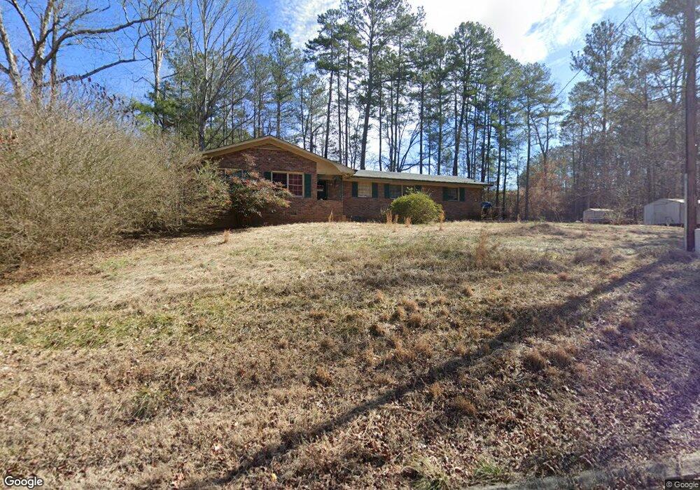
1695 Buchanan Hwy Dallas, GA 30157
Estimated Value: $105,000 - $248,958
2
Beds
2
Baths
1,497
Sq Ft
$138/Sq Ft
Est. Value
About This Home
This home is located at 1695 Buchanan Hwy, Dallas, GA 30157 and is currently estimated at $206,990, approximately $138 per square foot. 1695 Buchanan Hwy is a home located in Paulding County with nearby schools including Lillian C. Poole Elementary School, South Paulding Middle School, and Paulding County High School.
Ownership History
Date
Name
Owned For
Owner Type
Purchase Details
Closed on
Jan 7, 2025
Sold by
Fennell Bruce
Bought by
Maynard Chad
Current Estimated Value
Purchase Details
Closed on
Nov 26, 2024
Sold by
Cash Raven
Bought by
Fennell Angela
Purchase Details
Closed on
Jul 26, 2001
Sold by
Fennell Joyce M
Bought by
Fennell Bruce
Home Financials for this Owner
Home Financials are based on the most recent Mortgage that was taken out on this home.
Original Mortgage
$72,000
Interest Rate
10.25%
Mortgage Type
New Conventional
Create a Home Valuation Report for This Property
The Home Valuation Report is an in-depth analysis detailing your home's value as well as a comparison with similar homes in the area
Home Values in the Area
Average Home Value in this Area
Purchase History
| Date | Buyer | Sale Price | Title Company |
|---|---|---|---|
| Maynard Chad | $103,000 | -- | |
| Fennell Angela | -- | -- | |
| Fennell Bruce | $90,000 | -- |
Source: Public Records
Mortgage History
| Date | Status | Borrower | Loan Amount |
|---|---|---|---|
| Previous Owner | Fennell Bruce | $72,000 |
Source: Public Records
Tax History Compared to Growth
Tax History
| Year | Tax Paid | Tax Assessment Tax Assessment Total Assessment is a certain percentage of the fair market value that is determined by local assessors to be the total taxable value of land and additions on the property. | Land | Improvement |
|---|---|---|---|---|
| 2024 | $2,176 | $90,728 | $9,800 | $80,928 |
| 2023 | $2,227 | $87,960 | $9,480 | $78,480 |
| 2022 | $1,871 | $73,652 | $8,200 | $65,452 |
| 2021 | $1,580 | $56,228 | $6,680 | $49,548 |
| 2020 | $1,464 | $51,136 | $6,920 | $44,216 |
| 2019 | $1,363 | $47,084 | $7,120 | $39,964 |
| 2018 | $1,083 | $37,824 | $8,360 | $29,464 |
| 2017 | $1,013 | $35,024 | $8,360 | $26,664 |
| 2016 | $762 | $27,068 | $7,920 | $19,148 |
| 2015 | $740 | $25,908 | $7,080 | $18,828 |
| 2014 | $673 | $23,188 | $6,760 | $16,428 |
| 2013 | -- | $19,960 | $7,440 | $12,520 |
Source: Public Records
Map
Nearby Homes
- 216 McMichen Rd
- 2240 Buchanan Hwy
- 00 Rock Springs Pass
- 196 Pope Place
- 0 Rock Springs Pass Unit 10640029
- 403 Providence Rd
- 236 E Skyline View
- 233 E Skyline View
- 203 Overlook Ct
- 122 Arena Trail
- 1136 Cole Lake Rd
- 209 Overlook Dr
- 140 Cyrilla Walk
- 128 Cyrilla Walk
- 204 Overlook Dr
- 111 W Skyline View
- 451 Lone Bear Path
- 1745 Buchanan Hwy
- 1732 Buchanan Hwy
- 1674 Buchanan Hwy
- 1714 Buchanan Hwy
- 1598 Buchanan Hwy
- 1769 Buchanan Hwy
- 1784 Buchanan Hwy
- 1801 Buchanan Hwy
- 1806 Buchanan Hwy
- 1564 Buchanan Hwy
- 31 Monroe Dr
- 0 Gann Cemetery Rd Unit 7631966
- 0 Gann Cemetery Rd Unit 8613632
- 0 Gann Cemetery Rd
- 59 Monroe Dr
- 0 Monroe Dr
- 119 Lane Cemetary Rd
- 54 Gann Cemetery Rd
- 00 Gann Cemetery Rd
- 48 Gann Cemetery Rd