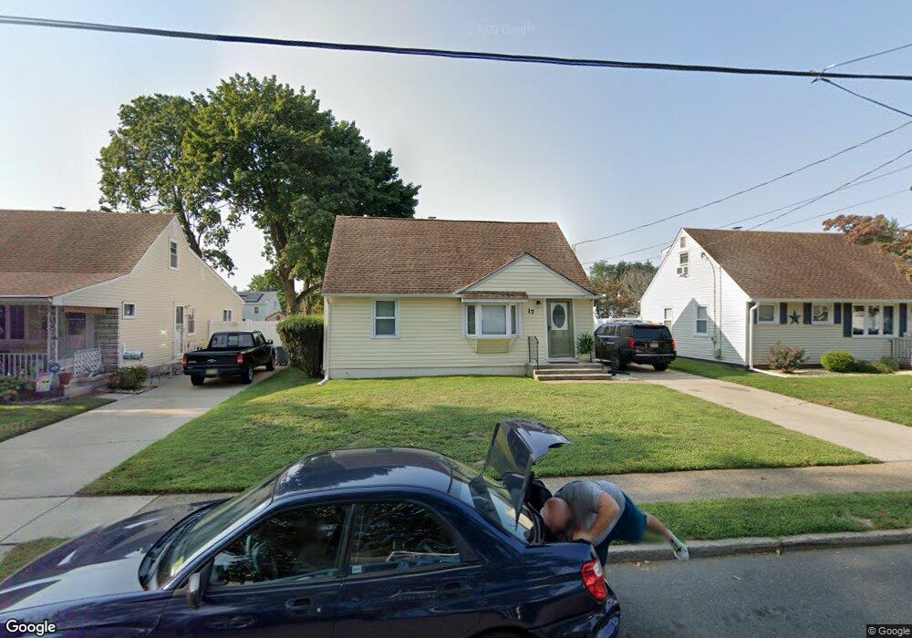
17 Benson Ln Trenton, NJ 08610
Estimated Value: $344,000
3
Beds
1
Bath
1,452
Sq Ft
$237/Sq Ft
Est. Value
About This Home
This home is located at 17 Benson Ln, Trenton, NJ 08610 and is currently estimated at $344,000, approximately $236 per square foot. 17 Benson Ln is a home located in Mercer County with nearby schools including Robinson Elementary School, Albert E. Grice Middle School, and Hamilton West-Watson High School.
Ownership History
Date
Name
Owned For
Owner Type
Purchase Details
Closed on
Nov 30, 2011
Sold by
Semonik Emma I
Current Estimated Value
Home Financials for this Owner
Home Financials are based on the most recent Mortgage that was taken out on this home.
Original Mortgage
$193,955
Outstanding Balance
$132,678
Interest Rate
4.01%
Mortgage Type
FHA
Estimated Equity
$211,322
Purchase Details
Closed on
May 28, 1999
Sold by
Lesage Claude
Bought by
Semonik Emma
Home Financials for this Owner
Home Financials are based on the most recent Mortgage that was taken out on this home.
Original Mortgage
$104,400
Interest Rate
6.9%
Mortgage Type
Purchase Money Mortgage
Create a Home Valuation Report for This Property
The Home Valuation Report is an in-depth analysis detailing your home's value as well as a comparison with similar homes in the area
Home Values in the Area
Average Home Value in this Area
Purchase History
| Date | Buyer | Sale Price | Title Company |
|---|---|---|---|
| -- | $199,000 | Monarch Title Agency Inc | |
| Semonik Emma | $116,000 | -- |
Source: Public Records
Mortgage History
| Date | Status | Borrower | Loan Amount |
|---|---|---|---|
| Open | -- | $193,955 | |
| Previous Owner | Semonik Emma | $104,400 |
Source: Public Records
Tax History Compared to Growth
Tax History
| Year | Tax Paid | Tax Assessment Tax Assessment Total Assessment is a certain percentage of the fair market value that is determined by local assessors to be the total taxable value of land and additions on the property. | Land | Improvement |
|---|---|---|---|---|
| 2025 | $6,682 | $189,600 | $59,700 | $129,900 |
| 2024 | $6,262 | $189,600 | $59,700 | $129,900 |
| 2023 | $6,262 | $189,600 | $59,700 | $129,900 |
| 2022 | $6,164 | $189,600 | $59,700 | $129,900 |
| 2021 | $6,623 | $189,600 | $59,700 | $129,900 |
| 2020 | $5,940 | $189,600 | $59,700 | $129,900 |
| 2019 | $5,811 | $189,600 | $59,700 | $129,900 |
| 2018 | $5,760 | $189,600 | $59,700 | $129,900 |
| 2017 | $5,616 | $189,600 | $59,700 | $129,900 |
| 2016 | $5,127 | $189,600 | $59,700 | $129,900 |
| 2015 | $5,534 | $119,300 | $36,900 | $82,400 |
| 2014 | $5,441 | $119,300 | $36,900 | $82,400 |
Source: Public Records
Map
Nearby Homes
- 376 White Horse Ave
- 153 Knapp Ave
- 6 Wilbert Way
- 2 Godfrey Dr
- 5 Sandy Ln
- 19 Wolf Dr
- 22 Wolf Dr
- 250 Lacy Ave
- 1782 Orchard Ave
- 74 Taft Ave
- 868 White Horse Hamilton Square Rd
- 9 Ann Marie Dr
- 1782 Exton Ave
- 19 Copperfield Dr
- 44 Tantum Dr
- 72 Englewood Blvd
- 27 Olden Terrace
- 45 Kenwood Terrace
- 50 Kenwood Terrace
- 15 Ashwood Rd