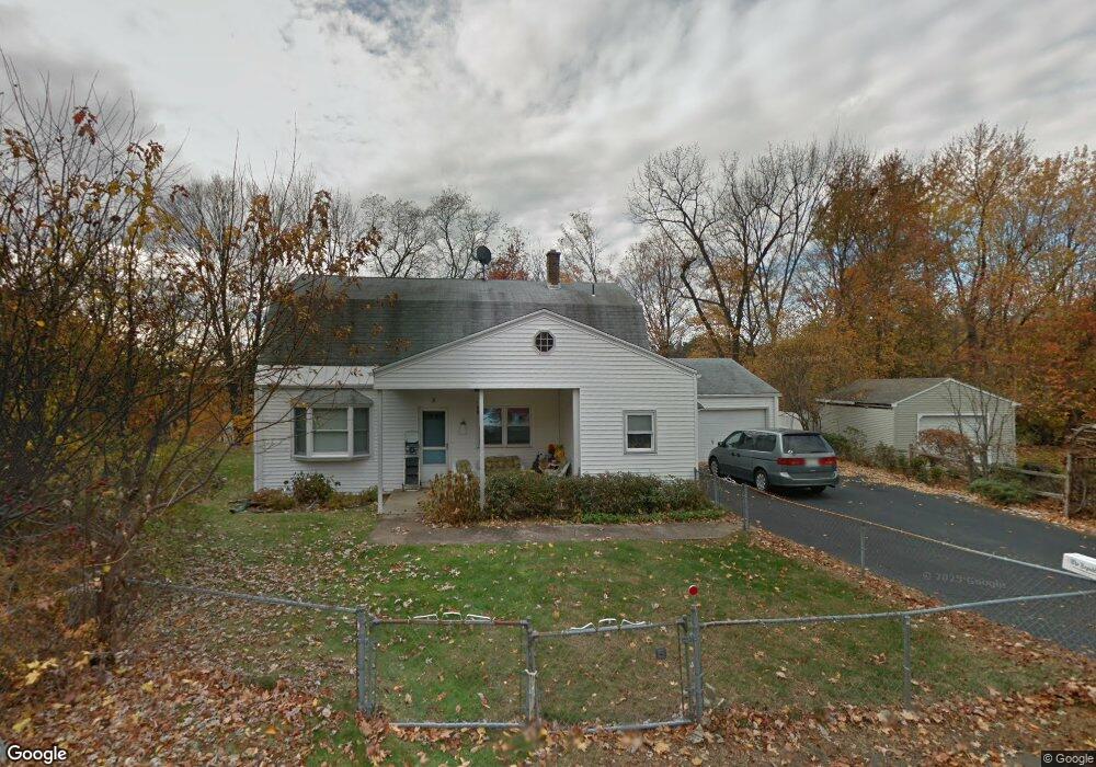
17 Memorial Cir Holyoke, MA 01040
Estimated Value: $361,804 - $390,000
4
Beds
2
Baths
2,254
Sq Ft
$165/Sq Ft
Est. Value
About This Home
This home is located at 17 Memorial Cir, Holyoke, MA 01040 and is currently estimated at $372,701, approximately $165 per square foot. 17 Memorial Cir is a home located in Hampden County with nearby schools including Harriet Bishop Elementary School, Lt. Elmer J. McMahon Elementary School, and Holyoke High School.
Create a Home Valuation Report for This Property
The Home Valuation Report is an in-depth analysis detailing your home's value as well as a comparison with similar homes in the area
Home Values in the Area
Average Home Value in this Area
Tax History Compared to Growth
Tax History
| Year | Tax Paid | Tax Assessment Tax Assessment Total Assessment is a certain percentage of the fair market value that is determined by local assessors to be the total taxable value of land and additions on the property. | Land | Improvement |
|---|---|---|---|---|
| 2025 | $4,779 | $273,700 | $65,000 | $208,700 |
| 2024 | $4,540 | $239,600 | $62,000 | $177,600 |
| 2023 | $4,343 | $231,500 | $62,000 | $169,500 |
| 2022 | $4,208 | $218,500 | $62,000 | $156,500 |
| 2021 | $4,000 | $207,600 | $59,300 | $148,300 |
| 2020 | $3,749 | $196,500 | $59,300 | $137,200 |
| 2019 | $3,790 | $196,500 | $59,300 | $137,200 |
| 2018 | $3,623 | $189,400 | $59,300 | $130,100 |
| 2017 | $3,631 | $189,400 | $59,300 | $130,100 |
| 2016 | $3,608 | $188,700 | $61,200 | $127,500 |
| 2015 | $3,593 | $188,700 | $61,200 | $127,500 |
Source: Public Records
Map
Nearby Homes
- Lot A Homestead Ave
- 794 Homestead Ave
- 84 Woodland St
- 53 Farnum Dr Unit 53
- 34 Maple Crest Cir Unit B
- 33 Maple Crest Cir Unit D
- 15 Maple Crest Cir Unit D
- 43 King St
- 70-72 Westfield Rd
- 42 Arnodale Ave
- 46 Cherry Hill
- 958 Main St
- 13 Willow St
- 78 Calumet Rd
- lot b Homestead Ave
- 934 Main St
- 133-135 Brown Ave
- 12 Temple St
- 1793 Northampton St
- 5 Vernon St