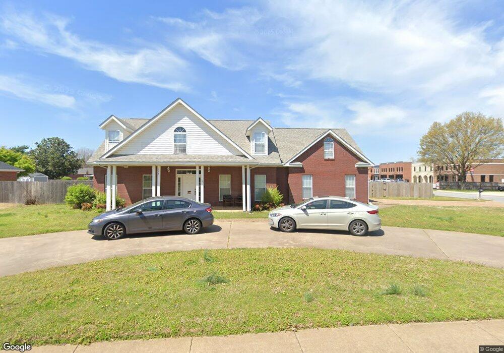
170 Countryside Dr Farmington, AR 72730
Estimated Value: $494,000 - $589,000
5
Beds
3
Baths
4,019
Sq Ft
$134/Sq Ft
Est. Value
About This Home
This home is located at 170 Countryside Dr, Farmington, AR 72730 and is currently estimated at $538,374, approximately $133 per square foot. 170 Countryside Dr is a home located in Washington County with nearby schools including Randall G. Lynch Middle School, Bob Folsom Elementary School, and Farmington Jr. High.
Ownership History
Date
Name
Owned For
Owner Type
Purchase Details
Closed on
Sep 25, 2009
Sold by
Arvest Bank
Bought by
Hampton Beverly J
Current Estimated Value
Purchase Details
Closed on
Apr 15, 2009
Sold by
Naumoff Sergio B and Naumoff Robin M
Bought by
Arvest Bank
Purchase Details
Closed on
Sep 19, 1996
Bought by
Naumoff Sergio B and Naumoff Robin M
Purchase Details
Closed on
Jul 11, 1996
Bought by
Box Lloyd C
Purchase Details
Closed on
Aug 22, 1995
Bought by
Parson Nicky
Purchase Details
Closed on
Jul 28, 1995
Bought by
Box Lloyd C and Box Betty K
Purchase Details
Closed on
Jul 13, 1995
Bought by
Lossing John D
Purchase Details
Closed on
Jan 1, 1994
Bought by
Commercial Properties Inc
Create a Home Valuation Report for This Property
The Home Valuation Report is an in-depth analysis detailing your home's value as well as a comparison with similar homes in the area
Home Values in the Area
Average Home Value in this Area
Purchase History
| Date | Buyer | Sale Price | Title Company |
|---|---|---|---|
| Hampton Beverly J | $210,000 | Waco Title Company | |
| Arvest Bank | $234,891 | None Available | |
| Naumoff Sergio B | $150,000 | -- | |
| Box Lloyd C | $90,000 | -- | |
| Parson Nicky | $20,000 | -- | |
| Box Lloyd C | $20,000 | -- | |
| Lossing John D | -- | -- | |
| Commercial Properties Inc | -- | -- |
Source: Public Records
Tax History Compared to Growth
Tax History
| Year | Tax Paid | Tax Assessment Tax Assessment Total Assessment is a certain percentage of the fair market value that is determined by local assessors to be the total taxable value of land and additions on the property. | Land | Improvement |
|---|---|---|---|---|
| 2025 | $2,180 | $84,700 | $13,500 | $71,200 |
| 2024 | $2,186 | $84,700 | $13,500 | $71,200 |
| 2023 | $2,248 | $84,700 | $13,500 | $71,200 |
| 2022 | $2,171 | $47,500 | $9,000 | $38,500 |
| 2021 | $2,157 | $47,500 | $9,000 | $38,500 |
| 2020 | $2,042 | $47,500 | $9,000 | $38,500 |
| 2019 | $1,935 | $42,700 | $9,000 | $33,700 |
| 2018 | $2,310 | $42,700 | $9,000 | $33,700 |
| 2017 | $2,289 | $42,700 | $9,000 | $33,700 |
| 2016 | $2,289 | $42,700 | $9,000 | $33,700 |
| 2015 | $2,289 | $42,700 | $9,000 | $33,700 |
| 2014 | $2,318 | $43,250 | $9,000 | $34,250 |
Source: Public Records
Map
Nearby Homes
- 201 Countryside Dr
- 237 Briarhill Dr
- 93 Old Depot Rd
- Rye 1903 Plan at The Grove at Engles Mill
- Ouachita 1669 Plan at The Grove at Engles Mill
- Cache 1788 Plan at The Grove at Engles Mill
- Degray 1757 Plan at The Grove at Engles Mill
- Stella 1848 Plan at The Grove at Engles Mill
- Millwood 1862 Plan at The Grove at Engles Mill
- Magnolia 1556 Plan at The Grove at Engles Mill
- Eureka 1536 Plan at The Grove at Engles Mill
- Springs 1445 Plan at The Grove at Engles Mill
- Piper 2064 Plan at The Grove at Engles Mill
- Oak 1463 Plan at The Grove at Engles Mill
- Daisy 2147 Plan at The Grove at Engles Mill
- Ashton 1496 Plan at The Grove at Engles Mill
- Hendrix 1983 Plan at The Grove at Engles Mill
- Osage 1567 Plan at The Grove at Engles Mill
- Maple 1659 Plan at The Grove at Engles Mill
- 285 Briarhill Dr
- 184 Countryside Dr
- 160 Southwinds Rd
- 187 Cedar Brook Place
- 193 Cedar Brook Place
- 166 Southwinds Rd
- 167 Countryside Dr
- 190 Countryside Dr
- 179 Countryside Dr
- 128 Killdeer Dr
- 128 Killdeer Dr Unit 126 & 128
- 126 Killdeer Dr Unit 126-128
- 170 Southwinds Rd
- 140 Southwinds Rd Unit 124
- 140 Southwinds Rd Unit 132
- 140 Southwinds Rd Unit 136
- 140 Southwinds Rd Unit 137
- 140 Southwinds Rd Unit 138
- 140 Southwinds Rd Unit 134
- 140 Southwinds Rd Unit 135
- 140 Southwinds Rd Unit 120