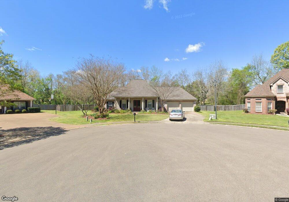
170 Woodsong Way Madison, MS 39110
Estimated Value: $375,000 - $452,000
--
Bed
--
Bath
2,788
Sq Ft
$143/Sq Ft
Est. Value
About This Home
This home is located at 170 Woodsong Way, Madison, MS 39110 and is currently estimated at $399,520, approximately $143 per square foot. 170 Woodsong Way is a home located in Madison County with nearby schools including Madison Avenue Upper Elementary School, Madison Avenue Elementary, and Madison Middle School.
Ownership History
Date
Name
Owned For
Owner Type
Purchase Details
Closed on
Mar 30, 2010
Sold by
Bosarge Joseph R and Bosarge Jerusha L
Bought by
Mcdonald Brian R and Mcdonald Dena T
Current Estimated Value
Home Financials for this Owner
Home Financials are based on the most recent Mortgage that was taken out on this home.
Original Mortgage
$218,000
Outstanding Balance
$144,979
Interest Rate
4.97%
Mortgage Type
New Conventional
Estimated Equity
$254,541
Create a Home Valuation Report for This Property
The Home Valuation Report is an in-depth analysis detailing your home's value as well as a comparison with similar homes in the area
Home Values in the Area
Average Home Value in this Area
Purchase History
| Date | Buyer | Sale Price | Title Company |
|---|---|---|---|
| Mcdonald Brian R | -- | None Available |
Source: Public Records
Mortgage History
| Date | Status | Borrower | Loan Amount |
|---|---|---|---|
| Open | Mcdonald Brian R | $218,000 |
Source: Public Records
Tax History Compared to Growth
Tax History
| Year | Tax Paid | Tax Assessment Tax Assessment Total Assessment is a certain percentage of the fair market value that is determined by local assessors to be the total taxable value of land and additions on the property. | Land | Improvement |
|---|---|---|---|---|
| 2024 | $2,592 | $24,819 | $0 | $0 |
| 2023 | $2,592 | $24,819 | $0 | $0 |
| 2022 | $2,592 | $24,819 | $0 | $0 |
| 2021 | $2,479 | $23,852 | $0 | $0 |
| 2020 | $2,479 | $23,852 | $0 | $0 |
| 2019 | $2,479 | $23,852 | $0 | $0 |
| 2018 | $2,479 | $23,852 | $0 | $0 |
| 2017 | $2,434 | $23,464 | $0 | $0 |
| 2016 | $2,434 | $23,464 | $0 | $0 |
| 2015 | $2,434 | $23,464 | $0 | $0 |
| 2014 | $2,714 | $25,863 | $0 | $0 |
Source: Public Records
Map
Nearby Homes
- 105 Victoria Place
- 1133 Windrose Cir
- 1005 Laramie Ct
- 207 Geneva Blvd
- 149 Stonegate Dr
- 262 Geneva Blvd
- 169 Saint Ives Dr
- 165 Saint Ives Dr
- 865 Wellington Way
- 265 Woodland Brook Dr
- 1133 Highway 51
- 1141 Highway 51
- 234 Brisage Blvd
- 722 Arlington Ct
- 109 Brisage Dr
- 422 Summerville Dr
- 171 E Hill Dr
- 557 Spring Hill Dr
- 418 Wildwood Pointe
- 0 Lansbury Way Unit 4110229
- 174 Woodsong Way
- 166 Woodsong Way
- 900 Keswich Ct
- 904 Keswich Ct
- 130 Victoria Place
- 169 Woodsong Way
- 0 Victoria Place Unit lot 28 1133916
- 0 Victoria Place Unit Lot 2 1135509
- 0 Victoria Place Unit Lot 28 1134066
- 0 Victoria Place Unit lot 1 1134069
- 0 Victoria Place Unit Lot 28 1149189
- 0 Victoria Place Unit lot 31 1133930
- 0 Victoria Place Unit Lot 30 1141149
- 0 Victoria Place Unit LOT 28 1144640
- 0 Victoria Place Unit Lot 17 1138538
- 0 Victoria Place Unit Lot 12 Victoria
- 0 Victoria Place Unit Lot 29 1141148
- 0 Victoria Place Unit Lot 11
- 1164 Windrose Cir
- 117 Victoria Place