Estimated Value: $648,581 - $793,000
3
Beds
2
Baths
1,664
Sq Ft
$425/Sq Ft
Est. Value
About This Home
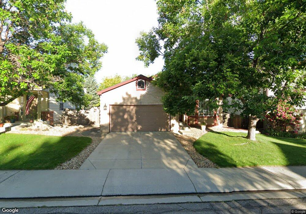
This home is located at 1700 Holeman Dr, Erie, CO 80516 and is currently estimated at $706,645, approximately $424 per square foot. 1700 Holeman Dr is a home located in Boulder County with nearby schools including Meadowlark School, Centaurus High School, and Peak to Peak Charter School.
Ownership History
Date
Name
Owned For
Owner Type
Purchase Details
Closed on
Apr 17, 2007
Sold by
Hallett Sharon L
Bought by
Wiest Sharon L
Current Estimated Value
Purchase Details
Closed on
Jul 15, 1999
Sold by
Carroll Milton C and Carroll Karen C
Bought by
Hallett Sharon L
Home Financials for this Owner
Home Financials are based on the most recent Mortgage that was taken out on this home.
Original Mortgage
$213,655
Interest Rate
7.39%
Purchase Details
Closed on
Jun 22, 1998
Sold by
Kdb Homes Inc
Bought by
Carroll Milton C and Carroll Karen C
Home Financials for this Owner
Home Financials are based on the most recent Mortgage that was taken out on this home.
Original Mortgage
$146,900
Interest Rate
10%
Create a Home Valuation Report for This Property
The Home Valuation Report is an in-depth analysis detailing your home's value as well as a comparison with similar homes in the area
Home Values in the Area
Average Home Value in this Area
Purchase History
| Date | Buyer | Sale Price | Title Company |
|---|---|---|---|
| Wiest Sharon L | -- | None Available | |
| Hallett Sharon L | $224,900 | Land Title | |
| Carroll Milton C | $172,820 | First American Heritage Titl |
Source: Public Records
Mortgage History
| Date | Status | Borrower | Loan Amount |
|---|---|---|---|
| Previous Owner | Hallett Sharon L | $213,655 | |
| Previous Owner | Carroll Milton C | $146,900 |
Source: Public Records
Tax History Compared to Growth
Tax History
| Year | Tax Paid | Tax Assessment Tax Assessment Total Assessment is a certain percentage of the fair market value that is determined by local assessors to be the total taxable value of land and additions on the property. | Land | Improvement |
|---|---|---|---|---|
| 2025 | $3,433 | $38,900 | $10,569 | $28,331 |
| 2024 | $3,433 | $38,900 | $10,569 | $28,331 |
| 2023 | $4,081 | $39,229 | $14,063 | $28,850 |
| 2022 | $3,499 | $31,511 | $8,896 | $22,615 |
| 2021 | $3,491 | $32,418 | $9,152 | $23,266 |
| 2020 | $3,400 | $31,288 | $5,720 | $25,568 |
| 2019 | $3,358 | $31,288 | $5,720 | $25,568 |
| 2018 | $3,041 | $27,821 | $8,064 | $19,757 |
| 2017 | $2,860 | $30,757 | $8,915 | $21,842 |
| 2016 | $2,814 | $26,514 | $11,462 | $15,052 |
| 2015 | $2,690 | $21,587 | $6,527 | $15,060 |
| 2014 | $2,238 | $21,587 | $6,527 | $15,060 |
Source: Public Records
Map
Nearby Homes
- 1842 Southard St
- 1331 Fountain Ln
- 1321 Alexandria St
- 1381 Siltstone St
- 1305 Inverness Dr
- 1305 Balmora St
- 848 Sandstone Cir
- 1195 Fox Hills Ct
- 1920 Marfell St
- 1063 Sandstone Cir
- 309 Baron Ave
- 2326 Carbonate Cir
- 1182 Red Iron Ct
- 1205 Red Iron Ct
- 972 Carbonate Ln
- 908 Dinosaur Dr
- 2268 Front Range Rd
- 1451 Loraine Cir N
- 1441 Loraine Cir N
- 1441 Loraine Cir N
- 1708 Holeman Dr
- 1692 Holeman Dr
- 1716 Holeman Dr
- 2603 Freeman Ct
- 1676 Holeman Dr
- 2589 Freeman Ct
- 1697 Holeman Dr
- 2598 Payne Ct
- 1705 Holeman Dr
- 1691 Holeman Dr
- 2592 Payne Ct
- 1685 Holeman Dr
- 1711 Holeman Dr
- 1732 Holeman Dr
- 2604 Payne Ct
- 1679 Holeman Dr
- 1717 Holeman Dr
- 2590 Freeman Ct
- 2593 Payne Ct
- 1740 Holeman Dr